1970s Maps of Clinton County, Missouri
Explore 6 historic maps of Clinton County from the 1970s. These maps offer a rare glimpse into what life looked like during the 1970s — showing old roads, neighborhoods, homes, and landmarks that have changed or disappeared over time.
Whether you're researching your family's past, planning a metal detecting trip, or studying how Clinton County's landscape evolved across the 1970s, these high-resolution maps are a powerful tool for exploring the history of this region.
- Focus on a specific era: All maps on this page are from the 1970s, giving you a focused view of this time period.
- See what’s changed: Compare century-old streets, trails, and buildings to today's modern landscape using overlays and satellite layers.
- Research with precision: Use these maps for genealogy, historical research, land use analysis, or educational projects.
- View, download, or print: Maps are fully viewable online in high resolution, and can be downloaded or printed for your own records.
Start exploring Clinton County's history through authentic maps from the 1970s. This is your window into the past.
Clinton County, MO maps
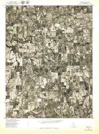
(6)- 1971 Map of Holt, 1973 Print
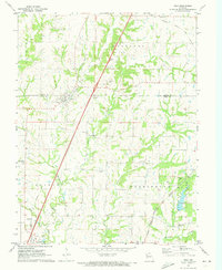 1971 Holt1973 Print · USGSCrossing the Clinton and Clay County border in the early seventies, this area shows a landscape of small farming communities and evolving rail lines. Genealogists can locate numerous family burial sites and rural landmarks like Antioch Cem, New Hope Ch, and Watkins State Park.
 - 1971 Map of Arley, 1973 Print
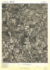
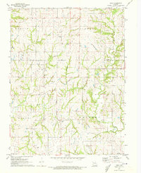 1971 Arley1973 Print · USGSClay and Clinton counties appear in the early 1970s as a landscape of rural hamlets and family farmsteads. Genealogists can trace decades of local history through numerous burial sites including Eberts, Mt Zion, and Fairview cemeteries.
 - 1971 Map of Hemple, 1973 Print
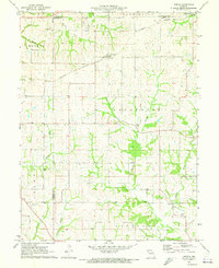 1971 Hemple1973 Print · USGSClinton and Buchanan counties are captured here in the early 1970s, showcasing a landscape of established farmsteads and rural townships. Researchers can trace family roots at Mt Zion Ch, Keller Cem, and along the Burlington Northern line.
 - 1978 Map of Lawson
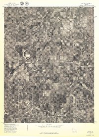 1978 Lawson1978 Print · USGSLawson and Vibbard are shown amidst the Missouri farm country during the late seventies, documented through detailed aerial imagery. Researchers can trace the mid-century layout of Lawson and identify the specific locations of rural homesteads near Vibbard.
 - 1978 Map of Gower
 1978 Gower1978 Print · USGSGower and the surrounding Missouri farmlands are captured in the late seventies, showing the region's agricultural layout and rural road network. Researchers can trace land boundaries near Grayson or follow the meandering course of Castile Creek and the Little Platte.
 - 1978 Map of Arley
 1978 Arley1978 Print · USGSClay County's rural character is captured in the late seventies through this detailed aerial survey of the Missouri landscape. Genealogists and local historians can trace the homesteads around Arley and the natural drainage of Lilly Creek and Clear Creek.
End of results
Showing maps 1-6 of 6
Top cities of Clinton County
- Lathrop historical maps
- Plattsburg historical maps
- Gower historical maps
- Trimble historical maps
- Turney historical maps
- Grayson historical maps
Frequently asked questions
- What are the different types of historical maps available for Clinton County?
- What is the oldest map of Clinton County?
- Where can I purchase historical maps of Clinton County for my home or office?
- Where can I download high-res historical maps of Clinton County?
- Are there historical topographic maps available for Clinton County?
- Is there historical aerial imagery available for Clinton County?
- Where are historical maps of Clinton County sourced from?