2020s Maps of Clinton County, Missouri
Explore 12 historic maps of Clinton County from the 2020s. These maps offer a rare glimpse into what life looked like during the 2020s — showing old roads, neighborhoods, homes, and landmarks that have changed or disappeared over time.
Whether you're researching your family's past, planning a metal detecting trip, or studying how Clinton County's landscape evolved across the 2020s, these high-resolution maps are a powerful tool for exploring the history of this region.
- Focus on a specific era: All maps on this page are from the 2020s, giving you a focused view of this time period.
- See what’s changed: Compare century-old streets, trails, and buildings to today's modern landscape using overlays and satellite layers.
- Research with precision: Use these maps for genealogy, historical research, land use analysis, or educational projects.
- View, download, or print: Maps are fully viewable online in high resolution, and can be downloaded or printed for your own records.
Start exploring Clinton County's history through authentic maps from the 2020s. This is your window into the past.
Clinton County, MO maps
(12)- 2021 Map of Arley, 2021 Print
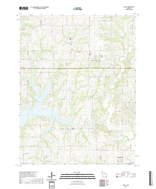 2021 Arley2021 Print · USGSClay County and Clinton County meet at this rural Missouri crossroads during a period of transition near the growing settlement of Kearney. Local historians can trace family roots at Fairview Cemetery and Ecton Cemetery or locate the Block Air Village Airport.
 - 2021 Map of Plattsburg, 2021 Print
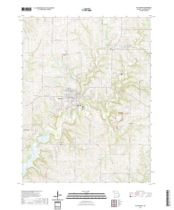 2021 Plattsburg2021 Print · USGSClinton County in the early twenty-first century centers on the hub of Plattsburg, where the Clinton County Courthouse and a dense network of local roads meet. Genealogists can trace several family and community burial sites, from McWilliams Cem to the storied Log Church Cem.
 - 2021 Map of Lathrop, 2021 Print
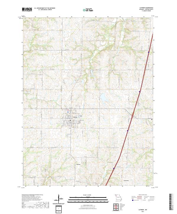 2021 Lathrop2021 Print · USGSClinton County's rolling farmland and stream valleys are captured here in the early 2020s. Researchers can locate family plots at Lathrop Cem or trace the early settlement footprints of Guyton and Converse near the Crooked River.
 - 2021 Map of Cameron East, 2021 Print
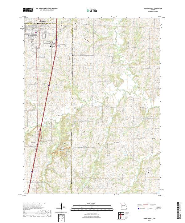 2021 Cameron East2021 Print · USGSCaldwell County and the eastern edges of Cameron are captured here in the early twenty-first century as agricultural lands meet growing town grids. Family historians can locate multiple burial sites like McDaniel Cem and trace old paths such as Rocky Ford Trl near Lake Altaman.
 - 2021 Map of Smithville, 2021 Print
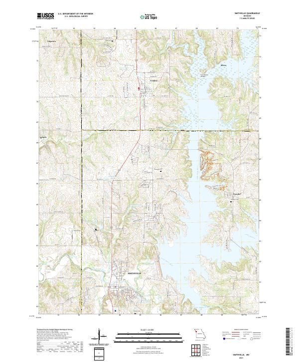 2021 Smithville2021 Print · USGSThe rural landscape of Clay, Platte, and Clinton Counties is shown here in the 2020s as the river valleys surround Smithville. Researchers can locate several family burial grounds like Goss Cem and Brooks Cem or trace the winding Little Platte River.
 - 2021 Map of Perrin, 2021 Print
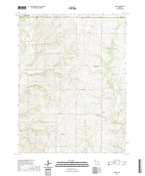 2021 Perrin2021 Print · USGSClinton County and the DeKalb border are captured here in the early twenty-first century, showing a landscape of rural hamlets and family-named roads. Researchers can trace local heritage through sites like Old Presbyterian Cem or the small communities of Perrin and Moors.
 - 2021 Map of Cameron West, 2021 Print
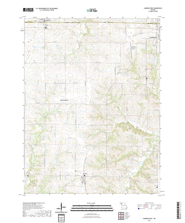 2021 Cameron West2021 Print · USGSThe Clinton County countryside comes into focus at the start of the 2020s, revealing a landscape of rolling drainages and rural settlements. Genealogists can trace family heritage through local landmarks like Turney Cem, Round Prairie Cem, and the quiet community of West Keystone.
 - 2021 Map of Hemple, 2021 Print
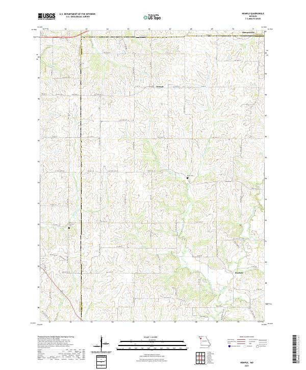 2021 Hemple2021 Print · USGSClinton and Buchanan counties in the early 2020s remain defined by small crossroads like Hemple and Starfield. Genealogists and local historians can trace family roots at New Harmony Cem or follow the waters of Jordan Cr and Castile Cr.
 - 2021 Map of Holt, 2021 Print
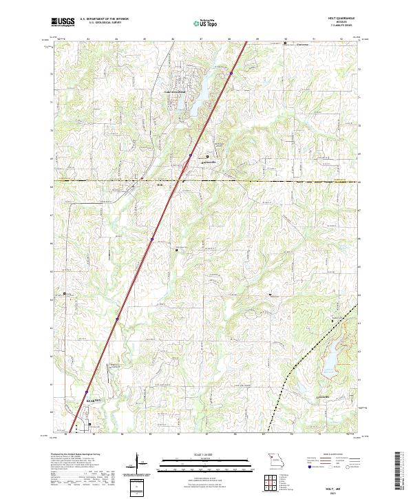 2021 Holt2021 Print · USGSClay and Clinton Counties appear here in the early twenty-first century, showing the northern growth of Kearney toward Holt. Genealogists can locate several burial grounds, including Oakland Cem, or trace local history along Jesse James Farm Rd.
 - 2021 Map of Elmira, 2021 Print
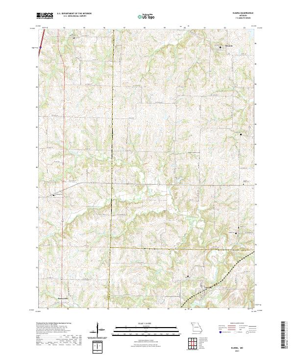 2021 Elmira2021 Print · USGSMissouri's rural tri-county borderlands come to life in this recent survey of the area surrounding Elmira and Mirabile. Researchers can trace old family burial grounds like Zeikle Cem and Brooking Cem along the bends of the Crooked River.
 - 2021 Map of Gower, 2021 Print
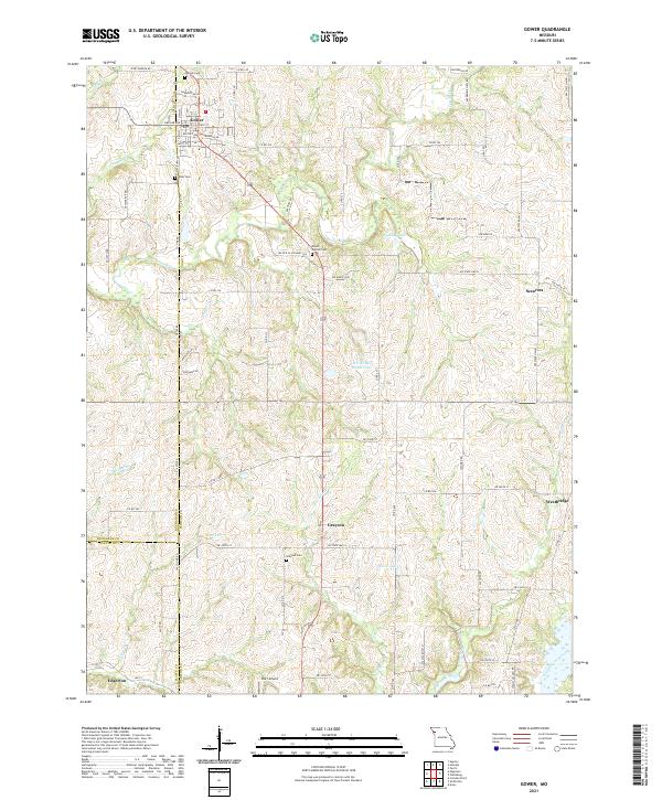 2021 Gower2021 Print · USGSThe rural landscapes of Clinton and Buchanan counties are captured here in the early twenty-first century. Genealogists and local researchers can trace family landmarks and burial grounds such as Grayson Cem, Antioch Cem, and the small settlement of Scearces.
 - 2021 Map of Lawson, 2021 Print
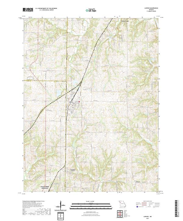 2021 Lawson2021 Print · USGSThe tri-county border of Clinton, Clay, and Ray Counties comes into focus in this early 21st-century study of the Missouri countryside. Researchers can trace the layout of small communities like Lawson and Vibbard or follow the winding courses of the S Fork Fishing River and Rocky Fork.
End of results
Showing maps 1-12 of 12
Top cities of Clinton County
- Lathrop historical maps
- Plattsburg historical maps
- Gower historical maps
- Trimble historical maps
- Turney historical maps
- Grayson historical maps
Frequently asked questions
- What are the different types of historical maps available for Clinton County?
- What is the oldest map of Clinton County?
- Where can I purchase historical maps of Clinton County for my home or office?
- Where can I download high-res historical maps of Clinton County?
- Are there historical topographic maps available for Clinton County?
- Is there historical aerial imagery available for Clinton County?
- Where are historical maps of Clinton County sourced from?