1900s (20th Century) Maps of Crawford County, Missouri
Explore 67 historic maps of Crawford County from the 1900s (20th Century). These maps offer a rare glimpse into what life looked like during the 1900s — showing old roads, neighborhoods, homes, and landmarks that have changed or disappeared over time.
Whether you're researching your family's past, planning a metal detecting trip, or studying how Crawford County's landscape evolved across the 1900s, these high-resolution maps are a powerful tool for exploring the history of this region.
- Focus on a specific era: All maps on this page are from the 1900s, giving you a focused view of this time period.
- See what’s changed: Compare century-old streets, trails, and buildings to today's modern landscape using overlays and satellite layers.
- Research with precision: Use these maps for genealogy, historical research, land use analysis, or educational projects.
- View, download, or print: Maps are fully viewable online in high resolution, and can be downloaded or printed for your own records.
Start exploring Crawford County's history through authentic maps from the 1900s. This is your window into the past.
Crawford County, MO maps
(67)- 1903 Map of Sullivan
 1903 Sullivan1903 Print · USGSFranklin and Gasconade counties are captured here at the close of the nineteenth century, as the St. Louis and San Francisco railroad spurred growth in timber and mining. Genealogists can trace early homesteads and river crossings like Hughes Ford, Spring Bluff, and Anthonies Mill.3 unique versions available
 - 1928 Map of Meramec Spring
 1928 Meramec Spring1928 Print · USGSPhelps and Crawford counties in the late twenties are mapped here as a network of rail-side towns and rural school districts. Genealogists can trace family names through dozens of landmarks like Asher Cemetery, Belview Church, and the Bronson Mine.3 unique versions available
 - 1932 Map of Steelville
 1932 Steelville1932 Print · USGSCrawford County's river valleys and rail junctions are documented here during the early 1930s. Genealogists and historians can locate rural landmarks like Frazier Cem, the St Louis-San Francisco rail line, and numerous schools such as Liberty Sch.
 - 1933 Map of Steelville, 1966 Print
 1933 Steelville1966 Print · USGSCrawford County at the start of the 1930s is a landscape of river-valley settlements and rural industry. Genealogists can trace family lines through dozens of country schools and cemeteries, from Oak Ridge Sch to the Wilkinson Cem near Cherryville.
 - 1934 Map of Meramec State Park, 1962 Print
 1934 Meramec State Park1962 Print · USGSThe Meramec River valley in the mid-1930s reveals a region transitioning from isolated settlements to a destination for early 20th-century tourism. Genealogists and historians can trace defunct school districts like Pea Ridge Sch and Zion Sch, locate the CCC Camp, or find old river crossings at Hamilton Ford.2 unique versions available
 - 1934 Map of Redbird, 1962 Print
 1934 Redbird1962 Print · USGSThe rural landscapes of Phelps, Maries, and Gasconade Counties are captured here in the 1930s, before modern highway expansion altered the backroads. Genealogists can trace family landmarks like Rock Spring Cem, Stockton Mine, and the Soldiers Home.
 - 1937 Map of Steelville
 1937 Steelville1937 Print · USGSCrawford County in the mid-1930s centered on the rail-and-river life of the Steelville area. Researchers can trace early rural life through a detailed network of landmarks like Sligo, Cook Station, and Indian Trail State Park.3 unique versions available
 - 1937 Map of Meramec State Park
 1937 Meramec State Park1937 Print · USGSThe Missouri Ozarks are captured here in the mid-1930s, showing the early infrastructure of Meramec State Park and its surrounding river communities. Genealogists and hikers can trace old homesteads and local landmarks like Reedville Ch, the CCC Camp, and the historic Sappington Bridge river crossing.
 - 1938 Map of Redbird
 1938 Redbird1938 Print · USGSThe Missouri Ozarks during the late 1930s reveal a landscape of river-carved ridges and small agricultural hubs like St James and Highgate. Genealogists and historians can locate dozens of country landmarks, from Stockton Mines to rural schools like Lanes Prairie and the Southard Cem.3 unique versions available
 - 1941 Map of Stone Hill, 1958 Print
 1941 Stone Hill1958 Print · USGSDent County and the Ozark hills are captured here in the early 1940s, just as rural school districts and post-office hamlets still anchored local life. Genealogists and researchers can locate numerous family burial grounds and country schools, including Copeland Cem, Union Ch, and the remote Victory Sch.3 unique versions available
 - 1943 Map of Berryman, 1957 Print
 1943 Berryman1957 Print · USGSCrawford and Washington counties are shown during the mid-twentieth century, capturing the rural character of the Clark National Forest. Genealogists can trace family names at the Cherry Valley Mines, Ozark Gospel Center, and various burial sites like Triswell Cem.4 unique versions available
 - 1943 Map of Boss, 1963 Print
 1943 Boss1963 Print · USGSThe Ozark highlands of the early 1940s are revealed here through a network of small family settlements and mountain schools. Genealogists can trace family footprints at Old Mill Lodge, Moses Store, or rural burial sites like Abbott Cem.2 unique versions available
 - 1945 Map of Stone Hill
 1945 Stone Hill1945 Print · USGSThe Ozark highlands of Dent County are shown here in the mid-1940s, a landscape defined by the upper Meramec River and deep forest preserves. Researchers can trace rural life through dozens of local landmarks, from the Indian Trail Fish Hatchery to remote settlements like Short Bend and Howes Mill PO.2 unique versions available
 - 1945 Map of Berryman
 1945 Berryman1945 Print · USGSIn the mid-1940s, this section of the Missouri Ozarks remained a landscape of timbered hollows and fire lookouts. Researchers can trace rural lineages through numerous community landmarks like Gibbs Cem, Czar Ch, and the remote settlement at Quaker.2 unique versions available
 - 1946 Map of Boss
 1946 Boss1946 Print · USGSThe Missouri Ozarks are captured here just after the war, showing the deep hollows and timberlands of the eastern Courtois Hills. Genealogists and researchers can locate family landmarks like Moses Store, the Webb Cem, and numerous rural schoolhouses such as Barton Sch.2 unique versions available
 - 1947 Map of Sullivan
 1947 Sullivan1947 Print · USGSIn the Missouri Ozarks during the late 1940s, this area shows the growth of river tourism and the railroad corridor. You can trace family roots through numerous local landmarks like Anthonies Mill, Pea Ridge Sch, and Reeds Defeat Cem.3 unique versions available
 - 1948 Map of Cuba
 1948 Cuba1948 Print · USGSCuba and the surrounding Crawford County hills are documented here in the late 1940s as the railroad and Route 66 shaped local life. Genealogists can trace family names through numerous rural landmarks like Zenser Cem, Martin Cem, and Fanning Sch.5 unique versions available
 - 1948 Map of Leasburg
 1948 Leasburg1948 Print · USGSCrawford County's rail-and-river landscape is captured here in the late 1940s, centered on the Leasburg transit corridor. Genealogists can locate numerous country schoolhouses and cemeteries, including Sunnyside Sch, Avery Cem, and Lick Creek Ch.5 unique versions available
 - 1948 Map of Argo
 1948 Argo1948 Print · USGSCrawford and Franklin Counties appear here in the late 1940s, showing a rural landscape of ridge-top farms and river valleys. Genealogists can locate family landmarks like Martin Cemetery and Helms Cemetery or old schools such as Argo School and Delhi School.4 unique versions available
 - 1948 Map of Oak Hill, 1960 Print
 1948 Oak Hill1960 Print · USGSCrawford County was a landscape of small schools and family cemeteries in the late 1940s. Researchers can trace ancestral roots at Ruwwe Cem or Gibson Cem and locate rural landmarks like Oak Hill Sch and the Airway Beacon.3 unique versions available
 - 1949 Map of Saint Louis
 1949 Saint Louis1949 Print · USGSGreater St. Louis and its surrounding river valleys are captured here just after the war, showing the metropolitan core and the rural Ozark fringe. Researchers can trace the sprawling rail network of the Wabash RR or locate landmarks like Meramec Caverns Airport and Scott Air Force Base.2 unique versions available
 - 1949 Map of Oak Hill
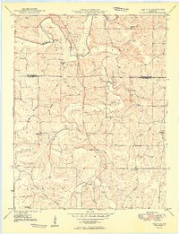 1949 Oak Hill1949 Print · USGSCrawford County's rural uplands are shown in the late 1940s as a landscape of family farms and communal school districts. Researchers can pinpoint early burial sites like Pinnell Cem or trace the old roads connecting High Point Sch and Oak Hill Sch.2 unique versions available
 - 1949 Map of Sullivan
 1949 Sullivan1949 Print · USGSSullivan and Bourbon emerge as key railroad towns in the northern Ozarks during this post-war era. Researchers can locate numerous vanished rural schools like Reeds Defeat Sch and explore the historic cave network including Onondaga Cave and Fisher Cave.
 - 1949 Map of Rolla, 1950 Print
 1949 Rolla1950 Print · USGSThe Missouri Ozarks are captured here just after the war, showing a landscape of deep river valleys and emerging reservoir projects. Genealogists and historians can trace the mining towns of Bonne Terre and Potosi or follow the early route of U.S. Highway 66.
 - 1949 Map of Meramec Spring, 1957 Print
 1949 Meramec Spring1957 Print · USGSPhelps and Dent counties are shown here just after the war, at a time when rural education and mining defined the Missouri Ozarks. Genealogists can locate family landmarks like Wishon Cem, Asher Cemetery, and dozens of district schools such as Roster School.2 unique versions available
Showing maps 1-25 of 67
Top cities of Crawford County
- Cuba historical maps
- Steelville historical maps
- Bourbon historical maps
- Leasburg historical maps
- West Sullivan historical maps
Frequently asked questions
- What are the different types of historical maps available for Crawford County?
- What is the oldest map of Crawford County?
- Where can I purchase historical maps of Crawford County for my home or office?
- Where can I download high-res historical maps of Crawford County?
- Are there historical topographic maps available for Crawford County?
- Is there historical aerial imagery available for Crawford County?
- Where are historical maps of Crawford County sourced from?