Old Maps of Dade County, Missouri for Hiking & Exploration
Hike through history with 96 historic maps of Dade County. Explore old trails, ghost towns, and forgotten backroads — perfect for outdoor adventurers and local explorers.
- Rediscover forgotten places: Map out old mining camps, roads, and footpaths that no longer exist on modern maps.
- Layer with modern tools: Combine with LiDAR or satellite views to plan hikes through historical terrain.
- Made for exploration: Popular among hikers, overlanders, and local history lovers.
Use these maps to find adventure and explore the hidden past of Dade County.
Dade County, MO maps
(96)- 1886 Map of Nevada
 1886 Nevada1886 Print · USGSRailroads and river valleys define southwestern Missouri in the late nineteenth century, as the landscape transitions into a series of organized townships and trade centers. Genealogists and local historians can trace early settlements like Moundville, Montevallo, and El Dorado Springs along the Missouri Pacific Railroad.
 - 1886 Map of Stockton
 1886 Stockton1886 Print · USGSSouthwest Missouri in the mid-1880s was a landscape of river-bottom farms and emerging rail towns along the Kansas City Clinton and Springfield R. R. Trace vanished post offices and local landmarks like Johnson's Mill, Dunnegan Springs, and the early streets of Stockton.3 unique versions available
 - 1886 Map of Greenfield
 1886 Greenfield1886 Print · USGSSouthwest Missouri was undergoing a rail-driven transformation in the 1880s, as new lines connected established county seats to outlying farm towns. Genealogists can trace family roots through numerous small settlements like Paris Springs, Dadeville, and the thriving rail hub at Ash Grove.4 unique versions available
 - 1886 Map of Carthage
 1886 Carthage1886 Print · USGSJasper and Barton Counties thrive during the mid-1880s as the railroad era transforms the Missouri landscape into a bustling corridor of trade and industry. Genealogists and historians can trace the early footprints of Carthage, the mills at Bowers Mill, and the early rail connections through Webb City and Oronogo.
 - 1888 Map of Greenfield, 1898 Print
 1888 Greenfield1898 Print · USGSSouthwest Missouri thrived as a budding rail and agricultural hub in the 1880s. Local researchers can trace the early footprints of Greenfield and Mount Vernon, alongside smaller settlements like Paris Springs and Everton.
 - 1894 Map of Nevada
 1894 Nevada1894 Print · USGSWestern Missouri at the end of the nineteenth century is defined here by its emerging rail towns and expansive prairie townships. Genealogists and local historians can trace the early development of Nevada and Lamar alongside smaller settlements like Montevallo and El Dorado Springs.5 unique versions available
 - 1894 Map of Carthage
 1894 Carthage1894 Print · USGSSouthwest Missouri thrived as a rail and mining hub in the late nineteenth century. Genealogists can trace family roots through old settlements like Diamond City, Dudenville, and Bowers Mill during this period of growth.5 unique versions available
 - 1947 Map of Joplin, 1954 Print
 1947 Joplin1954 Print · USGSThe borderlands of Missouri, Kansas, and Oklahoma are shown here during the late 1940s, a period of heavy industrial and military activity. Researchers can trace the extensive Tri-State Mining District, the layout of Camp Crowder, and local landmarks like Mount Hope Cem.
 - 1949 Map of Joplin
 1949 Joplin1949 Print · USGSThe Kansas-Missouri borderlands thrive in the late 1940s, showing a robust network of railroad towns and river valleys. Researchers can trace historic rail lines like the Missouri Pacific RR and locate rural centers such as Chanute, Iola, and Fort Scott.
 - 1954 Map of Springfield
 1954 Springfield1954 Print · USGSThe Missouri Ozarks are captured here during the post-war era, showing the expansion of Springfield and the surrounding river valleys. Genealogists and historians can trace local landmarks like Mount Comfort Cemetery and the Fort Leonard Wood military grounds.6 unique versions available
 - 1954 Map of Joplin, 1967 Print
 1954 Joplin1967 Print · USGSThe tri-state border region of Kansas, Missouri, and Oklahoma is captured here during a peak era of mid-century industrial and agricultural activity. Researchers can trace family history through dozens of rural cemeteries or locate landmarks like the Kansas Army Ammunition Plant and Pittsburg State University.3 unique versions available
 - 1955 Map of Dadeville, 1957 Print
 1955 Dadeville1957 Print · USGSDade County and Polk County are captured in the mid-1950s as a landscape of river-bottom farms and small rural congregations. Researchers can trace the heritage of Dadeville and locate historic markers like Hulston Mill and Logan Cem.2 unique versions available
 - 1956 Map of Ash Grove, 1957 Print
 1956 Ash Grove1957 Print · USGSWestern Greene County in the mid-1950s is defined by the crossing of the St Louis San Francisco railroad and the winding Sac River. Genealogists can trace family footprints through sites like Hamilton Cem, Johns Chapel, and the established streets of Ash Grove.2 unique versions available
 - 1956 Map of Walnut Grove, 1957 Print
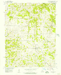 1956 Walnut Grove1957 Print · USGSWalnut Grove and the surrounding Missouri countryside are captured in the mid-fifties, during a time when rural life revolved around local churches and the railroad. Researchers can trace family roots at Green Lawn Cem, explore the old rail stop at Graydon Springs, or locate the Quarries at Phenix.2 unique versions available
 - 1956 Map of Kings Point, 1957 Print
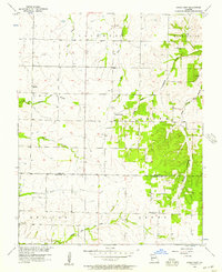 1956 Kings Point1957 Print · USGSThe rural borderlands of Dade and Lawrence counties come into focus during the mid-1950s. Genealogists and local historians can trace the early road networks connecting Meinert, Kings Point, and Round Grove, or locate the rural Salem Ch.
 - 1956 Map of Greenfield, 1957 Print
 1956 Greenfield1957 Print · USGSMid-century Dade County centers on the busy trade hub of Greenfield as the rail-driven economy of South Greenfield takes shape to the south. Genealogists can trace family landmarks like Wetzel Cem, Carr Chapel, and the historic crossing at Fiddlers Ford.3 unique versions available
 - 1956 Map of Lockwood, 1957 Print
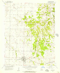 1956 Lockwood1957 Print · USGSThe Dade County prairie of the mid-fifties comes alive in this survey, showing the agricultural town of Lockwood and its rail connections. Genealogists can trace rural family landmarks like Mt Nebo Ch, Immanuel Cem, and the small settlement at Carson.
 - 1956 Map of Bona, 1957 Print
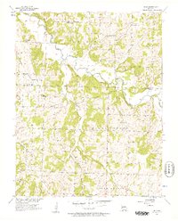 1956 Bona1957 Print · USGSNear the middle of the twentieth century, this portion of Dade County remained a landscape of riverside bluffs and tight-knit rural communities. Genealogists can trace family roots through numerous sites like Mt Carmel Ch, Fullington Cem, and Masters.3 unique versions available
 - 1956 Map of South Greenfield, 1957 Print
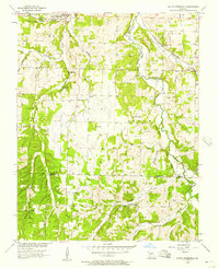 1956 South Greenfield1957 Print · USGSThe rural borderlands of Dade and Lawrence counties are shown here in the mid-fifties, centered on the railroad town of South Greenfield. Researchers can trace old family burial grounds like Daughtrey Cem and Merrick Cem or locate local landmarks like Dilday Mill and Carrico Caves.
 - 1956 Map of Cedarville, 1957 Print
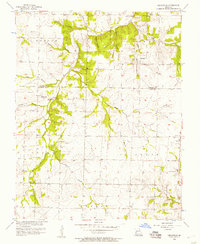 1956 Cedarville1957 Print · USGSThe borderlands of Cedar and Dade counties are captured here in the mid-1950s, showing a landscape defined by small farmsteads and creek-side settlements. Local historians can trace family locations near Cedarville, Omer, and several rural burial grounds like Hickory Grove Cem.
 - 1956 Map of Crisp, 1957 Print
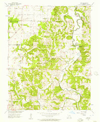 1956 Crisp1957 Print · USGSAcross the Cedar and Dade county line in the mid-fifties, this landscape reveals a network of river-bottom farms and rural crossroads. Researchers can locate remote burial sites like Ball Mound Cem and early community centers such as Crisp and Seybert.3 unique versions available
 - 1956 Map of Aldrich, 1957 Print
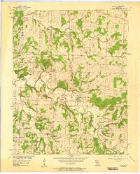 1956 Aldrich1957 Print · USGSThe river valleys of Polk and Dade Counties are shown here in the mid-1950s, centered on the Little Sac River. Local historians can trace a dense network of family landmarks and rural institutions, from Hubbard Cem to the Bear Creek Quarry.3 unique versions available
 - 1956 Map of Everton, 1957 Print
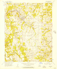 1956 Everton1957 Print · USGSEverton and the surrounding Rock Prairie uplands are captured here in the mid-fifties, showing the vital link between the St Louis San Francisco railroad and local agriculture. Researchers can trace rural life through sites like Hopewell Sch, Liberty Ch, and the Hood Cem.2 unique versions available
 - 1958 Map of Springfield
 1958 Springfield1958 Print · USGSThe Missouri Ozarks are captured during the mid-century era of growth, centered on the bustling hub of Springfield. Genealogists and historians can trace family roots through numerous landmarks like Ebenezer Church, Stockton Cem, and the various county courthouses.
 - 1958 Map of Joplin
 1958 Joplin1958 Print · USGSThe tri-state border region of Missouri, Kansas, and Oklahoma is shown during the late fifties, a time of heavy rail traffic and mining activity. Local historians can trace the industrial landscape through the Joplin & Pittsburg Ry or locate family sites like Zion Ch and Bender Mounds.
Showing maps 1-25 of 96
Top cities of Dade County
- Greenfield historical maps
- Lockwood historical maps
- Everton historical maps
- Dadeville historical maps
- Pilgrim historical maps
- South Greenfield historical maps
See more
Frequently asked questions
- What are the different types of historical maps available for Dade County?
- What is the oldest map of Dade County?
- Where can I purchase historical maps of Dade County for my home or office?
- Where can I download high-res historical maps of Dade County?
- Are there historical topographic maps available for Dade County?
- Is there historical aerial imagery available for Dade County?
- Where are historical maps of Dade County sourced from?