2020s Maps of Dade County, Missouri
Explore 15 historic maps of Dade County from the 2020s. These maps offer a rare glimpse into what life looked like during the 2020s — showing old roads, neighborhoods, homes, and landmarks that have changed or disappeared over time.
Whether you're researching your family's past, planning a metal detecting trip, or studying how Dade County's landscape evolved across the 2020s, these high-resolution maps are a powerful tool for exploring the history of this region.
- Focus on a specific era: All maps on this page are from the 2020s, giving you a focused view of this time period.
- See what’s changed: Compare century-old streets, trails, and buildings to today's modern landscape using overlays and satellite layers.
- Research with precision: Use these maps for genealogy, historical research, land use analysis, or educational projects.
- View, download, or print: Maps are fully viewable online in high resolution, and can be downloaded or printed for your own records.
Start exploring Dade County's history through authentic maps from the 2020s. This is your window into the past.
Dade County, MO maps
(15)- 2021 Map of Golden City, 2021 Print
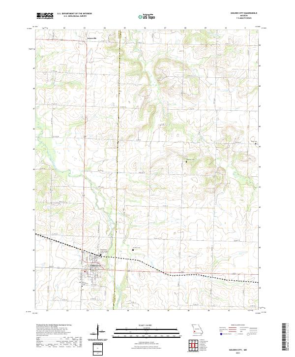 2021 Golden City2021 Print · USGSThe town of Golden City and the nearby settlement of Layneville appear as they were in the early 2020s amidst the Barton and Dade county lines. Genealogists can trace family landmarks like the Independent Order of Odd Fellows Cem, Worthen Cem, and the Harlow-Wright Cem.
 - 2021 Map of Dudenville, 2021 Print
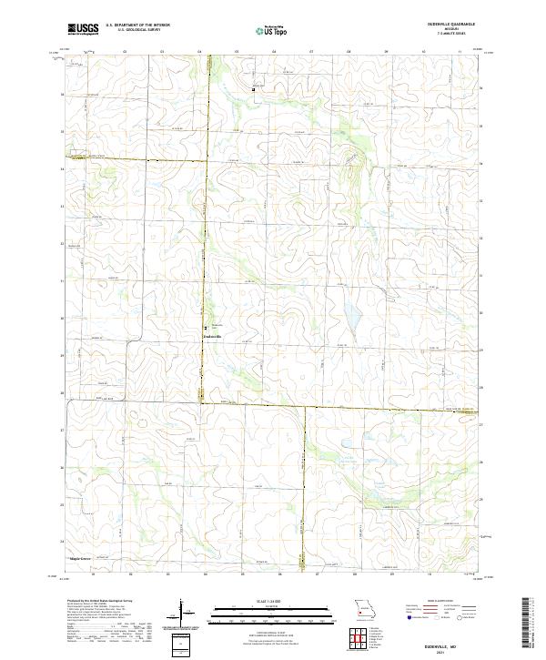 2021 Dudenville2021 Print · USGSThe rural crossroads where Dade, Barton, Jasper, and Lawrence counties meet are captured here in the modern era. Genealogists can locate family sites near Dudenville Cem or trace the winding course of the N Fork Spring River and Deer Cr.
 - 2021 Map of Jerico Springs, 2021 Print
 2021 Jerico Springs2021 Print · USGSJerico Springs and its surrounding tri-county borderlands are detailed here in this contemporary look at Cedar, Barton, and Dade counties. Researchers can trace local lineage through numerous sites like Round Prairie Cem, Newport, and Bethlehem Cem.
 - 2021 Map of Kings Point, 2021 Print
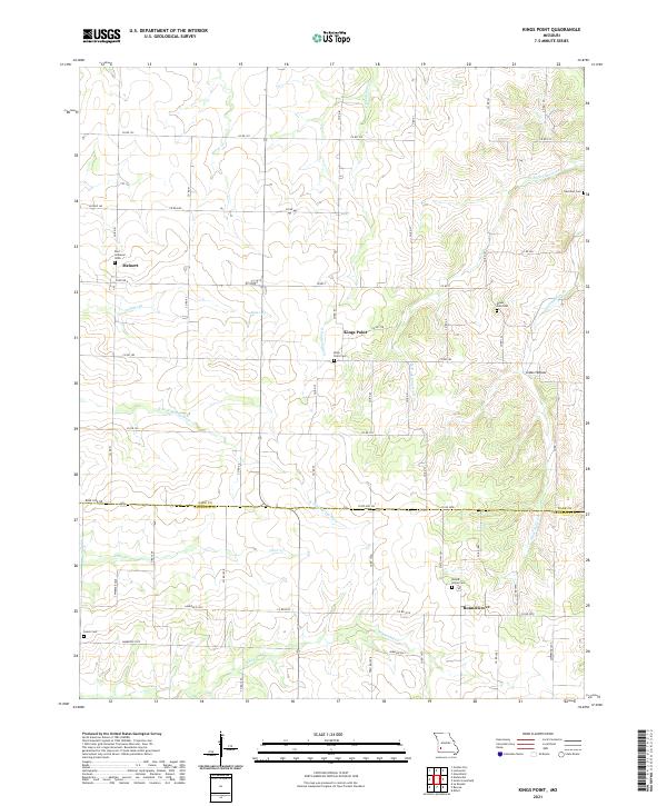 2021 Kings Point2021 Print · USGSThe Dade and Lawrence county line in Southwest Missouri comes alive in this contemporary survey of its rural settlements and cemeteries. Researchers can locate community centers like Meinert and Round Grove or trace family history at Kings Point Cem and Mount Zion Cem.
 - 2021 Map of Aldrich, 2021 Print
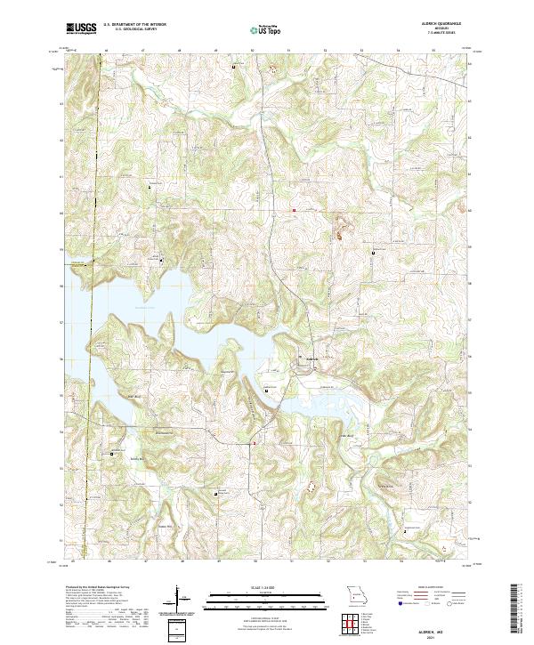 2021 Aldrich2021 Print · USGSThe community of Aldrich and the sprawling waters of Stockton Lake define this part of the Missouri Ozarks in the early 2020s. Genealogists can trace family heritage through numerous rural burial sites like Pleasant Ridge Cem, Trimble Cem, and Henderson Cem.
 - 2021 Map of Everton, 2021 Print
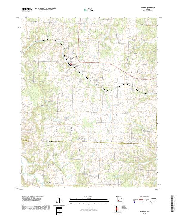 2021 Everton2021 Print · USGSEverton and the surrounding farmsteads of Dade County are documented here in the early twenty-first century. Genealogists can trace family heritage at Morrison - Richardson Cem and Hood Cem or locate the rural Ellingsen Field.
 - 2021 Map of Lockwood, 2021 Print
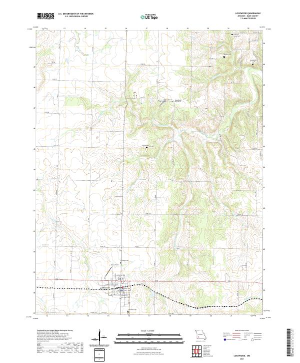 2021 Lockwood2021 Print · USGSLockwood and the surrounding Dade County countryside are shown here in the early 2020s, highlighting the area's deep-rooted cemetery and road network. Genealogists can locate family landmarks like Montgomery Cem, Messick Cem, and Collins Cem alongside Sons Creek.
 - 2021 Map of Cedarville, 2021 Print
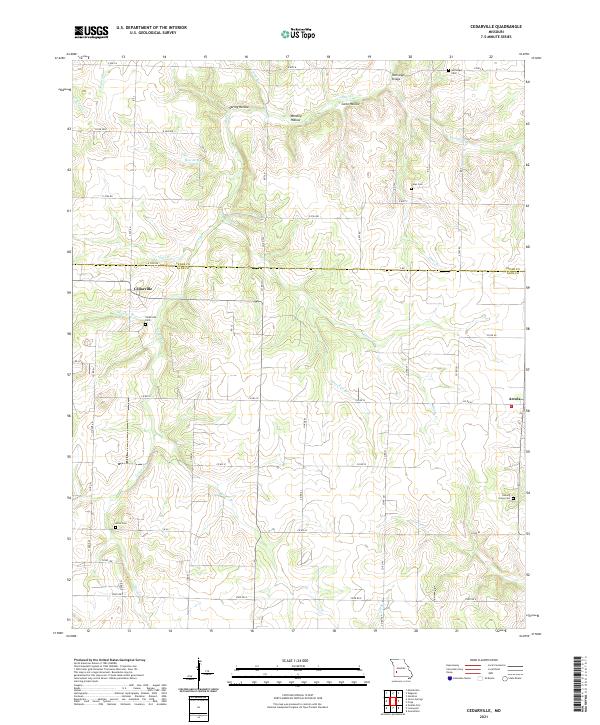 2021 Cedarville2021 Print · USGSThe rural border of Dade and Cedar counties is documented here as it appeared in the early 2020s, centered on the settlements of Cedarville and Arcola. Local historians can trace family roots through numerous sites including Noffsinger Cem, Amos Cem, and the crossing at Noffsinger Bridge.
 - 2021 Map of Ash Grove, 2021 Print
 2021 Ash Grove2021 Print · USGSGreene County and the town of Ash Grove are shown here in the modern era, where traditional farm life meets recreational trail systems. Genealogists and local historians can locate several rural burying grounds including Johns Chapel Cem and Hamilton Cem, or trace the path of the Frisco Highline Trl.
 - 2021 Map of Dadeville, 2021 Print
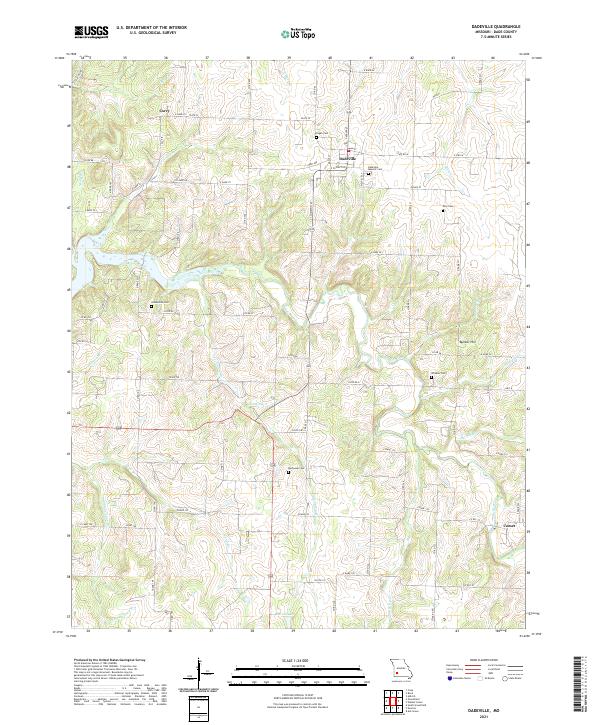 2021 Dadeville2021 Print · USGSDadeville and the surrounding rural Dade County countryside are captured here in the early twenty-first century as the landscape remains tied to its agricultural roots. Genealogists and local historians can trace family locations through numerous sites like Dadeville Masonic Cem, Corry, and Buchanan Cem.
 - 2021 Map of South Greenfield, 2021 Print
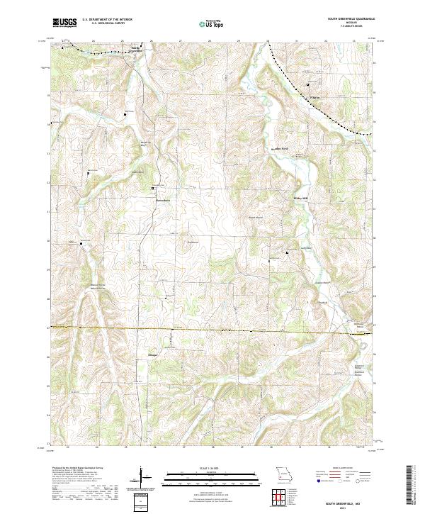 2021 South Greenfield2021 Print · USGSSouthwestern Missouri's rural interior comes into focus here at the start of the 2020s, documenting the creek-carved hillsides of Dade and Lawrence Counties. Researchers can locate local landmarks like Dilday Mill, Snadon Ford, and numerous family burial grounds including Friend Cem.
 - 2021 Map of Crisp, 2021 Print
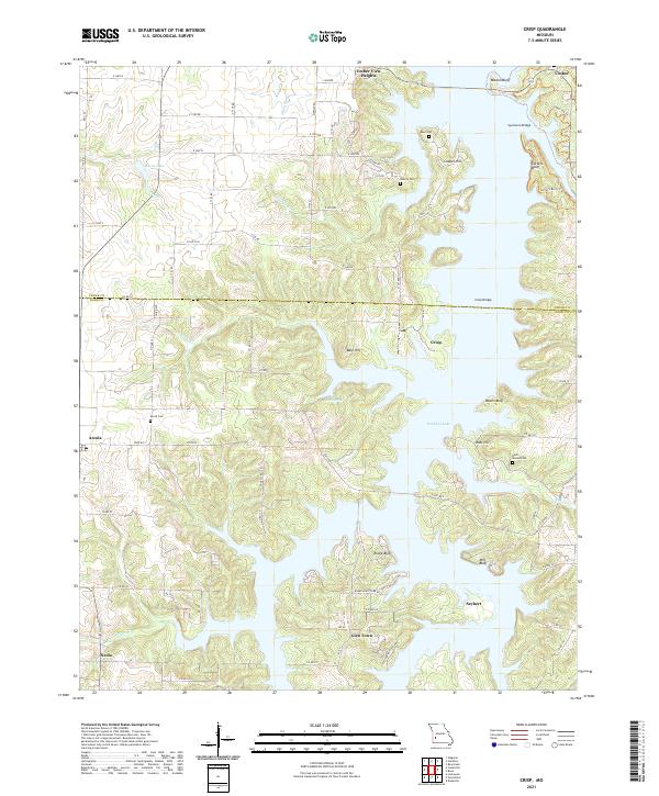 2021 Crisp2021 Print · USGSMissouri's lake country in the Ozark foothills is shown here as it appeared in recent years, where modern water management meets old settlements. Genealogists can locate several family burial grounds, including Acord Cem and Bald Mound Cem, alongside the communities of Arcola and Seybert.
 - 2021 Map of Greenfield, 2021 Print
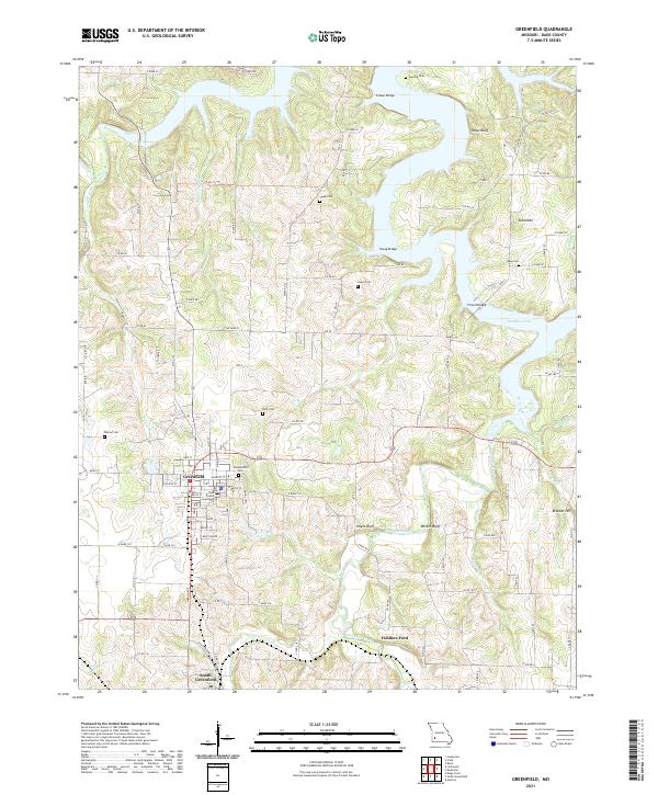 2021 Greenfield2021 Print · USGSGreenfield and Dade County come into focus in this contemporary study of southwest Missouri. Researchers can trace family history through local sites like the Dade County Courthouse, Fiddlers Ford, and the Rose Cem near Stockton Lake.
 - 2021 Map of Walnut Grove, 2021 Print
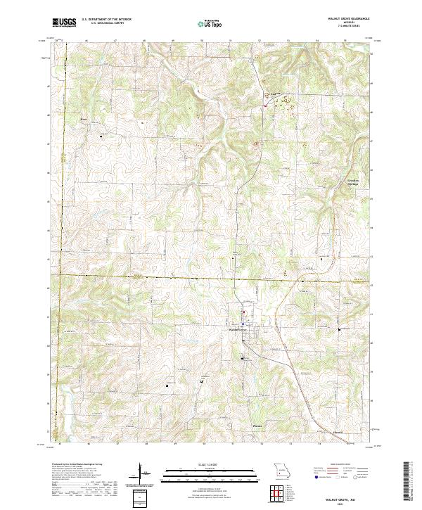 2021 Walnut Grove2021 Print · USGSThis southwestern Missouri corner where three counties converge shows the rural landscape as it appeared in the early 2020s. Researchers can trace the path of the Frisco Highline Trail through Phenix or locate family sites at Green Lawn Cemetery and Turkey Creek Cemetery.
 - 2021 Map of Bona, 2021 Print
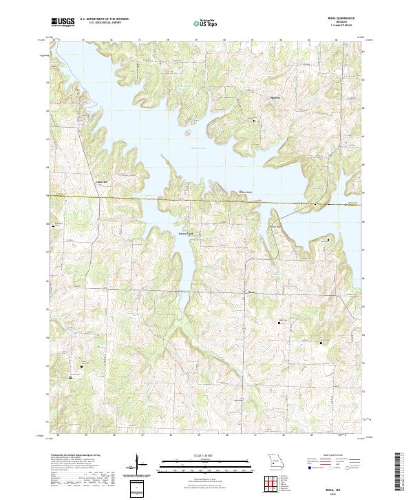 2021 Bona2021 Print · USGSThe northern Ozarks landscape around the Stockton Lake reservoir appears here in the early twenty-first century. Genealogists can trace family footprints across several rural cemeteries including Asbell Cem, Mount Zion Cem, and Devine Cem.
End of results
Showing maps 1-15 of 15
Top cities of Dade County
- Greenfield historical maps
- Lockwood historical maps
- Everton historical maps
- Dadeville historical maps
- Pilgrim historical maps
- South Greenfield historical maps
See more
Frequently asked questions
- What are the different types of historical maps available for Dade County?
- What is the oldest map of Dade County?
- Where can I purchase historical maps of Dade County for my home or office?
- Where can I download high-res historical maps of Dade County?
- Are there historical topographic maps available for Dade County?
- Is there historical aerial imagery available for Dade County?
- Where are historical maps of Dade County sourced from?