1960s Maps of Grundy County, Missouri
Explore 3 historic maps of Grundy County from the 1960s. These maps offer a rare glimpse into what life looked like during the 1960s — showing old roads, neighborhoods, homes, and landmarks that have changed or disappeared over time.
Whether you're researching your family's past, planning a metal detecting trip, or studying how Grundy County's landscape evolved across the 1960s, these high-resolution maps are a powerful tool for exploring the history of this region.
- Focus on a specific era: All maps on this page are from the 1960s, giving you a focused view of this time period.
- See what’s changed: Compare century-old streets, trails, and buildings to today's modern landscape using overlays and satellite layers.
- Research with precision: Use these maps for genealogy, historical research, land use analysis, or educational projects.
- View, download, or print: Maps are fully viewable online in high resolution, and can be downloaded or printed for your own records.
Start exploring Grundy County's history through authentic maps from the 1960s. This is your window into the past.
Grundy County, MO maps
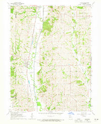
(3)- 1960 Map of Moberly
 1960 Moberly1960 Print · USGSCentral Missouri comes alive in the mid-twentieth century as a bustling network of river towns and significant rail corridors. Genealogists and historians can trace the paths of the Wabash RR through Moberly or explore the riverfronts of Lexington and Brunswick.
 - 1964 Map of Harris, 1965 Print
 1964 Harris1965 Print · USGSSullivan County's rural townships are documented in the mid-sixties, showing the agricultural landscape and rail corridors near the Mercer and Grundy borders. Researchers can trace family roots at Harris Cem and Center Grove Ch or follow the Chicago Milwaukee St Paul and Pacific rail line.2 unique versions available
 - 1964 Map of Half Rock, 1965 Print
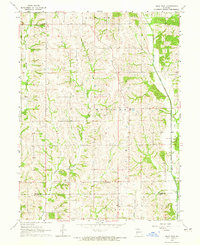 1964 Half Rock1965 Print · USGSNorthern Missouri farmland near the Mercer and Grundy county line comes into focus in the mid-1960s. Genealogists and local historians can trace family roots around Half Rock, Brantley Cem, and country churches like Hunter Ch.
End of results
Showing maps 1-3 of 3
Top cities of Grundy County
- Trenton historical maps
- Spickard historical maps
- Galt historical maps
- Laredo historical maps
- Tindall historical maps
- Brimson historical maps
Frequently asked questions
- What are the different types of historical maps available for Grundy County?
- What is the oldest map of Grundy County?
- Where can I purchase historical maps of Grundy County for my home or office?
- Where can I download high-res historical maps of Grundy County?
- Are there historical topographic maps available for Grundy County?
- Is there historical aerial imagery available for Grundy County?
- Where are historical maps of Grundy County sourced from?