1900s (20th Century) Maps of Grundy County, Missouri
Explore 43 historic maps of Grundy County from the 1900s (20th Century). These maps offer a rare glimpse into what life looked like during the 1900s — showing old roads, neighborhoods, homes, and landmarks that have changed or disappeared over time.
Whether you're researching your family's past, planning a metal detecting trip, or studying how Grundy County's landscape evolved across the 1900s, these high-resolution maps are a powerful tool for exploring the history of this region.
- Focus on a specific era: All maps on this page are from the 1900s, giving you a focused view of this time period.
- See what’s changed: Compare century-old streets, trails, and buildings to today's modern landscape using overlays and satellite layers.
- Research with precision: Use these maps for genealogy, historical research, land use analysis, or educational projects.
- View, download, or print: Maps are fully viewable online in high resolution, and can be downloaded or printed for your own records.
Start exploring Grundy County's history through authentic maps from the 1900s. This is your window into the past.
Grundy County, MO maps
(43)- 1921 Map of Chillicothe, 1958 Print
 1921 Chillicothe1958 Print · USGSNorth-central Missouri at the start of the 1920s is a landscape of river-bottom farms and a bustling rail hub at the intersection of four major lines. Genealogists and researchers can trace dozens of country schoolhouses and early post offices like Hickory Creek P O, Lily Grove Church, and the Graham Mill Bridge.2 unique versions available
 - 1922 Map of Gallatin
 1922 Gallatin1922 Print · USGSDaviess and Caldwell Counties are shown here during the early twenties, when the Grand River and major railroads drove the local economy. Genealogists can trace hundreds of rural family sites anchored by Everly Cemetery, Centenary Church, and schools like Calfpen School.2 unique versions available
 - 1923 Map of Chillicothe
 1923 Chillicothe1923 Print · USGSThe Livingston County rail hub of Chillicothe is shown here in the early twenties at the height of its regional importance. Genealogists can trace dozens of rural school districts like Happy Hollow School and early centers like Hickory P O.2 unique versions available
 - 1924 Map of Chula
 1924 Chula1924 Print · USGSNorth-central Missouri thrived as a rail-connected farming region in the early twentieth century. Researchers can trace dozens of rural schoolhouses and family plots, from Brush College School to the Plainview Cemetery near Chula.3 unique versions available
 - 1925 Map of Gilman
 1925 Gilman1925 Print · USGSDaviess County was a landscape of tightly-knit rural school districts and parish churches in the mid-1920s. Genealogists can trace family footprints at Bancroft, the Quincy Omaha and Kansas City rail line, and numerous sites like Prairie City Church.3 unique versions available
 - 1946 Map of Gilman
 1946 Gilman1946 Print · USGSMid-century Daviess and Harrison Counties are captured here during a period of transition for rural Missouri's rail and school networks. Researchers can trace the legacy of local education through nearly twenty named school sites like Liberty Sch and Red Sch, or locate family sites near Bancroft and the Wabash line.
 - 1946 Map of Princeton, 1976 Print
 1946 Princeton1976 Print · USGSMercer County during the mid-forties reveals a rural landscape anchored by the Princeton rail corridor and the Weldon River valley. Researchers can trace family history through dozens of country schools and churches, such as Early Sch, Coon Ch, and the Mercer Cem.
 - 1946 Map of Galt, 1981 Print
 1946 Galt1981 Print · USGSMid-century Missouri agriculture and rail life are preserved here, showing the region at the height of its rural school and church network. Genealogists can locate specific family landmarks like Sandefur Cem or trace the early paths to Mud College Sch and Camp Ground Ch.
 - 1947 Map of Blythedale
 1947 Blythedale1947 Print · USGSNorthern Missouri's agricultural heartland is documented here in the late 1940s, showing a landscape densely dotted with local schoolhouses and family cemeteries. Genealogists can trace roots through the Chicago Burlington and Quincy rail line and sites like Yankee Ridge Cem or Green Castle Sch.2 unique versions available
 - 1947 Map of Chula
 1947 Chula1947 Print · USGSNorth-central Missouri in the late 1940s is defined here by its rail-linked prairie towns and an incredible density of small country schoolhouses. Genealogists can trace family footprints across dozens of landmarks like Stucker Cemetery, Mt Gilead Church, and Jacksnipe School.3 unique versions available
 - 1948 Map of Gilman
 1948 Gilman1948 Print · USGSDaviess and Harrison counties are shown in the late 1940s, capturing a detailed landscape of rural Missouri crossroads and small-town commerce. Genealogists can trace family roots through the numerous named landmarks like Gilman City P O, Bancroft, and the Wabash railroad line.2 unique versions available
 - 1948 Map of Princeton
 1948 Princeton1948 Print · USGSNorthern Missouri's agricultural heartland is documented here during the late 1940s, centered on the river valley and rail corridor. Researchers can trace the layout of Princeton and locate vanished rural landmarks like Modena, Hamblin School, and the Salem Cemetery.2 unique versions available
 - 1948 Map of Trenton
 1948 Trenton1948 Print · USGSGrundy County in the late 1940s shows a landscape of tight-knit rural communities and bustling rail corridors. Researchers can trace dozens of local schoolhouses and country churches, from Paint Lick Ch to the Big Oak Sch near Edinburg.2 unique versions available
 - 1949 Map of Galt
 1949 Galt1949 Print · USGSMid-century Missouri farm life is captured here near the Grundy and Sullivan county lines as the rail network still linked small towns. Trace family roots through numerous local schools and churches like Mud College Sch, Starlight Ch, and Richardson Cem.2 unique versions available
 - 1953 Map of Moberly
 1953 Moberly1953 Print · USGSMid-century north-central Missouri is documented here as a bustling intersection of river commerce and heavy rail. Researchers can trace historic family-named landmarks and transport hubs from the Missouri River corridor to the rail yards of Moberly, Chillicothe, and Macon.
 - 1954 Map of Centerville, 1967 Print
 1954 Centerville1967 Print · USGSThe Iowa-Missouri borderlands at mid-century reveal a landscape shaped by river valleys and the height of the regional rail network. Genealogists and historians can trace the paths of the Wabash railroad and locate old townsites like Mystic, Moulton, and Greentop.3 unique versions available
 - 1954 Map of Moberly, 1969 Print
 1954 Moberly1969 Print · USGSMid-century Missouri is captured here during a period of transition for its river towns and rail hubs. Genealogists and historians can trace the paths of the Wabash railroad through Moberly or explore the riverside layout of Lexington and Brunswick.3 unique versions available
 - 1957 Map of Moberly
 1957 Moberly1957 Print · USGSNorth-central Missouri in the late nineteen-forties and fifties remains a landscape defined by its great rivers and a dense network of steam and diesel rail lines. Genealogists and historians can trace the paths of the Wabash RR and Santa Fe RR through historic junctions like Moberly, Brookfield, and Macon.
 - 1957 Map of Centerville
 1957 Centerville1957 Print · USGSThe Iowa-Missouri borderlands in the mid-fifties reveal a landscape of river-valley agriculture and vital rail corridors. Genealogists and historians can trace family-named landmarks and small-town growth in Centerville, Kirksville, and along the Wabash railroad line.
 - 1958 Map of Centerville
 1958 Centerville1958 Print · USGSThe Iowa-Missouri borderlands come into focus during the mid-fifties, showing a landscape defined by river valleys and intersecting rail lines. Genealogists and local historians can trace family roots through dozens of rural hubs like Bloomfield, Unionville, and Corydon.
 - 1960 Map of Moberly
 1960 Moberly1960 Print · USGSCentral Missouri comes alive in the mid-twentieth century as a bustling network of river towns and significant rail corridors. Genealogists and historians can trace the paths of the Wabash RR through Moberly or explore the riverfronts of Lexington and Brunswick.
 - 1964 Map of Harris, 1965 Print
 1964 Harris1965 Print · USGSSullivan County's rural townships are documented in the mid-sixties, showing the agricultural landscape and rail corridors near the Mercer and Grundy borders. Researchers can trace family roots at Harris Cem and Center Grove Ch or follow the Chicago Milwaukee St Paul and Pacific rail line.2 unique versions available
 - 1964 Map of Half Rock, 1965 Print
 1964 Half Rock1965 Print · USGSNorthern Missouri farmland near the Mercer and Grundy county line comes into focus in the mid-1960s. Genealogists and local historians can trace family roots around Half Rock, Brantley Cem, and country churches like Hunter Ch.
 - 1981 Map of Chillicothe
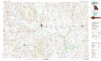 1981 Chillicothe1981 Print · USGSNorth Missouri's Grand River basin comes into focus during the early 1980s, showcasing a network of vital rail lines and river settlements. Genealogists and historians can trace rail-town development from Gallatin to Brookfield and explore extensive conservation lands like Swan Lake National Wildlife Refuge.
 - 1981 Map of Trenton
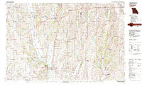 1981 Trenton1981 Print · USGSNorthern Missouri in the early eighties remains a landscape defined by its river valleys and intersecting rail lines. Genealogists and local historians can trace the development of riverside towns like Trenton and Princeton or locate smaller rural junctions such as Humphreys and Brimson.
Showing maps 1-25 of 43
Top cities of Grundy County
- Trenton historical maps
- Spickard historical maps
- Galt historical maps
- Laredo historical maps
- Tindall historical maps
- Brimson historical maps
Frequently asked questions
- What are the different types of historical maps available for Grundy County?
- What is the oldest map of Grundy County?
- Where can I purchase historical maps of Grundy County for my home or office?
- Where can I download high-res historical maps of Grundy County?
- Are there historical topographic maps available for Grundy County?
- Is there historical aerial imagery available for Grundy County?
- Where are historical maps of Grundy County sourced from?