1980s Maps of Grundy County, Missouri
Explore 20 historic maps of Grundy County from the 1980s. These maps offer a rare glimpse into what life looked like during the 1980s — showing old roads, neighborhoods, homes, and landmarks that have changed or disappeared over time.
Whether you're researching your family's past, planning a metal detecting trip, or studying how Grundy County's landscape evolved across the 1980s, these high-resolution maps are a powerful tool for exploring the history of this region.
- Focus on a specific era: All maps on this page are from the 1980s, giving you a focused view of this time period.
- See what’s changed: Compare century-old streets, trails, and buildings to today's modern landscape using overlays and satellite layers.
- Research with precision: Use these maps for genealogy, historical research, land use analysis, or educational projects.
- View, download, or print: Maps are fully viewable online in high resolution, and can be downloaded or printed for your own records.
Start exploring Grundy County's history through authentic maps from the 1980s. This is your window into the past.
Grundy County, MO maps
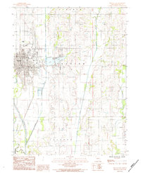
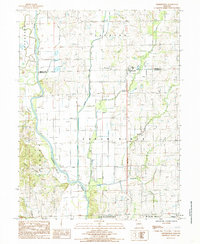
(20)- 1981 Map of Chillicothe
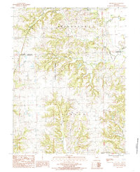
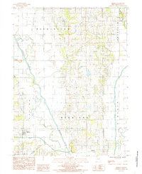
 1981 Chillicothe1981 Print · USGSNorth Missouri's Grand River basin comes into focus during the early 1980s, showcasing a network of vital rail lines and river settlements. Genealogists and historians can trace rail-town development from Gallatin to Brookfield and explore extensive conservation lands like Swan Lake National Wildlife Refuge.
 - 1981 Map of Trenton
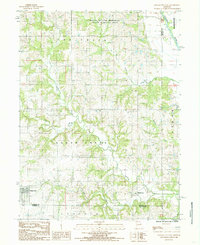
 1981 Trenton1981 Print · USGSNorthern Missouri in the early eighties remains a landscape defined by its river valleys and intersecting rail lines. Genealogists and local historians can trace the development of riverside towns like Trenton and Princeton or locate smaller rural junctions such as Humphreys and Brimson.
 - 1983 Map of Chula, 1985 Print
 1983 Chula1985 Print · USGSNorthwestern Missouri's agricultural heartland is documented here in the early 1980s, centered on the railroad town of Chula. Researchers can trace the path of the Chicago Milwaukee St Paul and Pacific rail line and locate old settlements like Alpha and Sturges.
 - 1984 Map of Trenton West
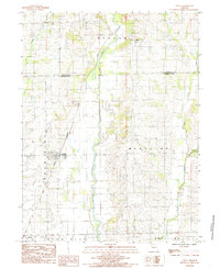
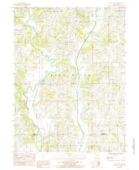
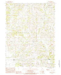
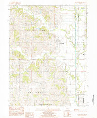
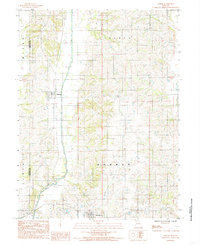
 1984 Trenton West1984 Print · USGSGrundy County in the mid-1980s shows the suburban and recreational growth west of the Thompson River. Researchers can trace the development of Leisure Lake, the boundaries of Crowder State Park, and the quiet rural character of Edinburg.
 - 1984 Map of Laredo
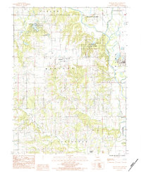
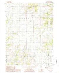
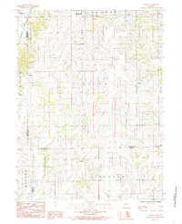
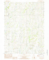
 1984 Laredo1984 Print · USGSGrundy County's rural townships are shown here in the mid-1980s, revealing the agricultural landscape and small-town footprints of the era. Researchers can trace the street grids of Laredo and Galt or locate homesteads near Medicine Creek and Dunlap.
 - 1984 Map of Trenton East
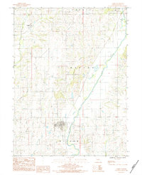
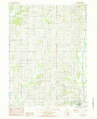
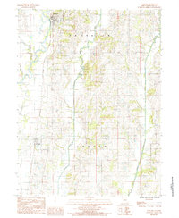
 1984 Trenton East1984 Print · USGSThe eastern reaches of Grundy County come into focus in the mid-eighties as the city of Trenton expands toward the prairie creeks. Local researchers can trace family landmarks and civic infrastructure from Trenton Lake to the rural Cem and Airport.
 - 1984 Map of Shearwood, 1985 Print
 1984 Shearwood1985 Print · USGSNorthwest of Chillicothe in the mid-1980s, this area of Missouri is characterized by the expansive Poosey State Forest and its creek-carved hills. Genealogists and researchers can locate old rural settlements like Shearwood and Springhill or find unnamed cemeteries tucked away in Jackson Township.
 - 1984 Map of Gilman City East, 1985 Print
 1984 Gilman City East1985 Print · USGSNorthwest Missouri in the early 1980s reveals a rural landscape defined by the branching tributaries of Sugar Creek and the Thompson River. Researchers can trace the borders of Gilman City and Melbourne or explore the Wayne Helton Memorial State Wildlife Area.
 - 1984 Map of Mill Grove, 1985 Print
 1984 Mill Grove1985 Print · USGSNorth central Missouri is captured here in the mid-eighties as a landscape of river bends and rural townships. Researchers can trace family roots near Mill Grove or locate several local Cemeteries tucked between Muddy Creek and the Weldon River.
 - 1984 Map of Bancroft, 1985 Print
 1984 Bancroft1985 Print · USGSDaviess and Grundy counties appear in the mid-1980s as a landscape of rural townships and winding creek valleys. Researchers can trace family history through several Cem locations and small settlements like Bancroft and Jamesport Community Lake.
 - 1984 Map of Farmersville, 1985 Print
 1984 Farmersville1985 Print · USGSThe Missouri-Grundy county line comes alive in the mid-1980s, showing a river valley heavily shaped by agricultural management. Trace family roots and rural homesteads near Farmersville, Sturges, and several remote Cem sites along the Thompson River.
 - 1984 Map of Modena, 1985 Print
 1984 Modena1985 Print · USGSNorth-central Missouri farming country is documented here in the early 1980s, centered on the community of Modena. Genealogists and local historians can trace property lines across the Mercer and Grundy County border near Sandy Creek and Peleet Creek.
 - 1984 Map of Lindley, 1985 Print
 1984 Lindley1985 Print · USGSSullivan County and the surrounding tri-county borderlands are captured here in the early eighties as a network of rural townships and winding creeks. Genealogists and local researchers can trace family lands near Humphreys, Lindley, and the small settlement of Haseville.
 - 1984 Map of Galt, 1985 Print
 1984 Galt1985 Print · USGSNorthern Missouri farmland in the early eighties centers on the village of Galt and its surrounding townships. Researchers can trace rural cemeteries labeled Cem and the intricate drainage of Medicine Creek and East Honey Creek.
 - 1984 Map of Jamesport, 1985 Print
 1984 Jamesport1985 Print · USGSDaviess County farmland in the early 1980s centers on the town of Jamesport and its surrounding rural townships. Genealogists and local historians can trace the Old Railroad Grade and find family-named landmarks like Gees Creek or the small settlement of Blake.
 - 1984 Map of Brimson, 1985 Print
 1984 Brimson1985 Print · USGSGrundy County in the early 1980s is defined by the meandering basins of the Thompson River and Weldon River. Researchers can trace old watercourses like the Old Channel and locate the rural centers of Brimson and Parkerton.
 - 1984 Map of Mount Moriah, 1985 Print
 1984 Mount Moriah1985 Print · USGSHarrison County in the early eighties is captured here in a moment of rural continuity and conservation. Researchers can trace property lines near Mount Moriah or locate the Wayne Helton Memorial State Wildlife Area and the winding Thompson River.
 - 1984 Map of Spickard, 1985 Print
 1984 Spickard1985 Print · USGSNorth-central Missouri's rural townships are captured here in the mid-1980s, centered on the river-fed agricultural lands of Grundy County. Genealogists and local historians can trace property locations near Spickard, Tindall, and the Chicago Rock Island and Pacific railroad.
 - 1984 Map of Eversonville, 1985 Print
 1984 Eversonville1985 Print · USGSNorthern Missouri farm country and small crossroads communities are preserved here in the mid-1980s. Researchers can trace the rural landscape around Eversonville, Shafter, and Hecla, alongside the winding banks of Muddy Creek and Smokey Creek.
 - 1984 Map of Osgood, 1985 Print
 1984 Osgood1985 Print · USGSSullivan County agriculture and the watercourse of Medicine Creek define this region in the early 1980s. Genealogists can trace the rural layouts of Osgood and Humphreys or explore the boundaries of Liberty and Bowman townships.
End of results
Showing maps 1-20 of 20
Top cities of Grundy County
- Trenton historical maps
- Spickard historical maps
- Galt historical maps
- Laredo historical maps
- Tindall historical maps
- Brimson historical maps
Frequently asked questions
- What are the different types of historical maps available for Grundy County?
- What is the oldest map of Grundy County?
- Where can I purchase historical maps of Grundy County for my home or office?
- Where can I download high-res historical maps of Grundy County?
- Are there historical topographic maps available for Grundy County?
- Is there historical aerial imagery available for Grundy County?
- Where are historical maps of Grundy County sourced from?