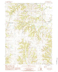
1984 Map of Shearwood
USGS Topo · Published 1985About this map
Poosey State Forest dominates the central terrain of this quadrangle, covering a significant portion of the land between Jefferson and Jackson townships. The landscape is defined by the drainage systems of Gees Creek and its South Fork, alongside the winding path of Clear Creek near the Grundy and Livingston County line. Small rural settlements and geographic markers like Shearwood, Coburn, and Springhill provide points of interest for local history and genealogy.
Find a feature on this map
19 named features on this map. Tap any name to fly to it.
Don’t see what you’re looking for? This feature index may not catch every label — zoom into the map to look around manually.
Map Details
Editions of this 1984 Shearwood Map
This is the sole edition of this map. No revisions or reprints were ever made.
Other maps of this area

1921 · Chillicothe
USGS Topo · 1:62,500

1922 · Gallatin
USGS Topo · 1:62,500

1923 · Chillicothe
USGS Topo · 1:62,500

1925 · Gilman
USGS Topo · 1:62,500

1946 · Gilman
USGS Topo · 1:48,000

1948 · Gilman
USGS Topo · 1:62,500

1948 · Trenton
USGS Topo · 1:62,500

1953 · Moberly
USGS Topo · 1:250,000

1954 · Centerville
USGS Topo · 1:250,000

1954 · Moberly
USGS Topo · 1:250,000