1980s Maps of Harrison County, Missouri
Explore 20 historic maps of Harrison County from the 1980s. These maps offer a rare glimpse into what life looked like during the 1980s — showing old roads, neighborhoods, homes, and landmarks that have changed or disappeared over time.
Whether you're researching your family's past, planning a metal detecting trip, or studying how Harrison County's landscape evolved across the 1980s, these high-resolution maps are a powerful tool for exploring the history of this region.
- Focus on a specific era: All maps on this page are from the 1980s, giving you a focused view of this time period.
- See what’s changed: Compare century-old streets, trails, and buildings to today's modern landscape using overlays and satellite layers.
- Research with precision: Use these maps for genealogy, historical research, land use analysis, or educational projects.
- View, download, or print: Maps are fully viewable online in high resolution, and can be downloaded or printed for your own records.
Start exploring Harrison County's history through authentic maps from the 1980s. This is your window into the past.
Harrison County, MO maps
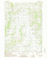
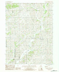
(20)- 1981 Map of Lamoni South
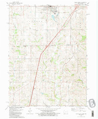 1981 Lamoni South1981 Print · USGSSouthern Iowa and northern Missouri are captured here in the early eighties, centered on the growing community of Lamoni. Genealogists and local historians can trace rural roots through Rose Hill Cem, Sweet Home Cem, and the old Andover townsite.2 unique versions available
 - 1981 Map of Akron
 1981 Akron1981 Print · USGSThe Missouri-Iowa state line was a landscape of quiet river valleys and scattered farmsteads in the early eighties. Researchers can trace rural lineages through the many family-named burial grounds like Miller Cem or explore the Akron Townhall and the grounds of Nine Eagles State Park.
 - 1981 Map of Pawnee
 1981 Pawnee1981 Print · USGSThe rural borderlands between Iowa and Missouri come into focus in the early eighties. Genealogists and local historians can trace family roots through several landmarks including Mt Zion Cem, Lone Rock Ch, and the settlement of Pawnee.
 - 1981 Map of Trenton
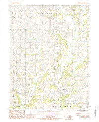
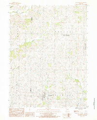
 1981 Trenton1981 Print · USGSNorthern Missouri in the early eighties remains a landscape defined by its river valleys and intersecting rail lines. Genealogists and local historians can trace the development of riverside towns like Trenton and Princeton or locate smaller rural junctions such as Humphreys and Brimson.
 - 1981 Map of Leon, 1982 Print
 1981 Leon1982 Print · USGSSouthern Iowa and northern Missouri are captured here in the early eighties as the rural landscape balances traditional agriculture with large-scale water management. Researchers can trace the path of the Burlington Northern through Leon or locate early settlements like Decatur City and New Buda.
 - 1981 Map of Hatfield, 1982 Print
 1981 Hatfield1982 Print · USGSThe Missouri-Iowa borderlands near Hatfield were still deeply rural in the early eighties, characterized by small settlements and family farms. Genealogists can locate several remote burial sites such as Lincoln Center Cem and Petty Cem, or trace the winding course of the East Fork Grand River.
 - 1984 Map of Gardner, 1985 Print
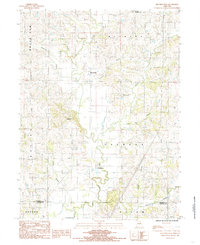
 1984 Gardner1985 Print · USGSNorthern Missouri farmland is captured here in the mid-1980s, showcasing the rural crossroads of Gardner and the surrounding townships. Researchers can trace the path of the Old Railroad and locate local landmarks like Polecat Creek and the Cem sites.
 - 1984 Map of Brooklyn, 1985 Print
 1984 Brooklyn1985 Print · USGSHarrison County's rural landscape is captured here in the mid-1980s, centered on the small community of Brooklyn. Family historians can trace the meandering West Fork Big Creek and locate a local Cem and Pumping Station along the township lines.
 - 1984 Map of Matkins, 1985 Print
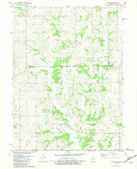
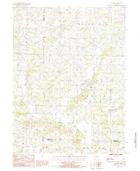 1984 Matkins1985 Print · USGSHarrison County in the early eighties is captured here in a time of established rural life and family farming. Genealogists can trace property locations near Matkins or follow family landmarks along Sampson Creek, Goose Creek, and White Oak Creek.
 - 1984 Map of Gilman City East, 1985 Print
 1984 Gilman City East1985 Print · USGSNorthwest Missouri in the early 1980s reveals a rural landscape defined by the branching tributaries of Sugar Creek and the Thompson River. Researchers can trace the borders of Gilman City and Melbourne or explore the Wayne Helton Memorial State Wildlife Area.
 - 1984 Map of Bethany, 1985 Print
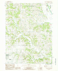
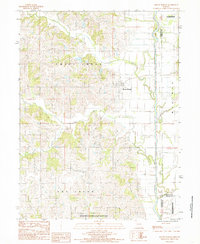
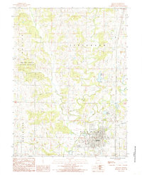 1984 Bethany1985 Print · USGSBethany and its surrounding Harrison County landscape are captured here in the early eighties as the town grew along its historic waterways. Researchers can trace the paths of Big Creek and Little Creek or locate local Cem sites and the Sewage Disposal Plant.
 - 1984 Map of Mitchellville, 1985 Print
 1984 Mitchellville1985 Print · USGSHarrison and Daviess Counties appear in the early eighties as a network of small settlements and winding creek branches. Researchers can trace the rural landscape around Mitchellville and Bridgeport, locating sites like the local Cemetery and Wildwood.
 - 1984 Map of Eagleville, 1985 Print
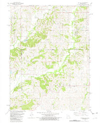
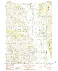
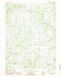
 1984 Eagleville1985 Print · USGSHarrison County in the early eighties shows a landscape of established farmsteads and creek-carved hillsides. Genealogists and historians can trace the early layout of Eagleville, Blythedale, and Ridgeway or locate rural landmarks like Rock House Lake and several local Cem sites.
 - 1984 Map of Cainsville, 1985 Print
 1984 Cainsville1985 Print · USGSCainsville and the river valleys of northern Missouri are captured here in the early 1980s. Researchers can trace the path of the Thompson River, locate a local Cem, and explore the rural townships of Madison and Trail Creek.
 - 1984 Map of Washington Center, 1985 Print
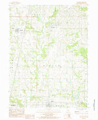
 1984 Washington Center1985 Print · USGSHarrison County farmland and conservation areas are captured here in the mid-eighties as a network of creek-fed townships. Local researchers can trace the rural layout of Washington Center or the boundaries of the Emmett and Leah Seat Memorial Wildlife Area.
 - 1984 Map of New Hampton, 1985 Print
 1984 New Hampton1985 Print · USGSNorthwest Missouri's rolling farm country is captured here in the early 1980s, centering on the rural crossroads and drainage basins of Harrison and Gentry counties. Researchers can trace the boundaries of Grand Trace State Forest or locate properties near New Hampton and Martinsville.
 - 1984 Map of Mount Moriah, 1985 Print
 1984 Mount Moriah1985 Print · USGSHarrison County in the early eighties is captured here in a moment of rural continuity and conservation. Researchers can trace property lines near Mount Moriah or locate the Wayne Helton Memorial State Wildlife Area and the winding Thompson River.
 - 1984 Map of Gilman City West, 1985 Print
 1984 Gilman City West1985 Print · USGSHarrison County farmland in the early 1980s is defined by its winding creek valleys and quiet rural crossroads. Genealogists and researchers can trace the landscape between Blue Ridge and Gilman City, crossing through Sherman and Adams townships.
 - 1985 Map of Mount Ayr
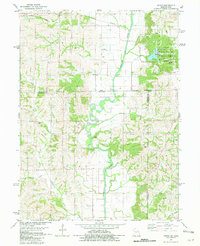
 1985 Mount Ayr1985 Print · USGSThe Iowa-Missouri borderlands are captured here in the mid-eighties, showing a landscape defined by the branching forks of the Platte River and Grand River. Researchers can trace the heritage of rural communities and conservation sites like Lake of Three Fires State Park and Rose Hill Cemetery.2 unique versions available
 - 1986 Map of Maryville
 1986 Maryville1986 Print · USGSNorthwest Missouri's agricultural heartland is documented here in the mid-1980s, from the campus at Northwest Missouri State University to the Grand River valley. Genealogists can trace family footprints across dozens of local burial grounds like Alanthus Grove Cem and Brooklyn Cem.2 unique versions available
End of results
Showing maps 1-20 of 20
Top cities of Harrison County
- Bethany historical maps
- Ridgeway historical maps
- Cainsville historical maps
- New Hampton historical maps
- Eagleville historical maps
- Blythedale historical maps
See more
Frequently asked questions
- What are the different types of historical maps available for Harrison County?
- What is the oldest map of Harrison County?
- Where can I purchase historical maps of Harrison County for my home or office?
- Where can I download high-res historical maps of Harrison County?
- Are there historical topographic maps available for Harrison County?
- Is there historical aerial imagery available for Harrison County?
- Where are historical maps of Harrison County sourced from?