Old Maps of Harrison County, Missouri for Hiking & Exploration
Hike through history with 107 historic maps of Harrison County. Explore old trails, ghost towns, and forgotten backroads — perfect for outdoor adventurers and local explorers.
- Rediscover forgotten places: Map out old mining camps, roads, and footpaths that no longer exist on modern maps.
- Layer with modern tools: Combine with LiDAR or satellite views to plan hikes through historical terrain.
- Made for exploration: Popular among hikers, overlanders, and local history lovers.
Use these maps to find adventure and explore the hidden past of Harrison County.
Harrison County, MO maps
(107)- 1925 Map of Pattonsburg
 1925 Pattonsburg1925 Print · USGSDaviess and Gentry counties are shown here in the mid-1920s as a thriving rail and river landscape. Researchers can trace the paths of the Wabash railroad through Pattonsburg or locate rural landmarks like Wesley Chapel and the Everly School.3 unique versions available
 - 1925 Map of Gilman
 1925 Gilman1925 Print · USGSDaviess County was a landscape of tightly-knit rural school districts and parish churches in the mid-1920s. Genealogists can trace family footprints at Bancroft, the Quincy Omaha and Kansas City rail line, and numerous sites like Prairie City Church.3 unique versions available
 - 1944 Map of Pattonsburg, 1977 Print
 1944 Pattonsburg1977 Print · USGSNorthwest Missouri in the 1940s is defined here by the winding Grand River and the busy WABASH rail line. Genealogists can locate family landmarks like Savage Cem, the Coffey P O and Sta, and rural centers such as Mitchellville.2 unique versions available
 - 1945 Map of Mount Ayr, 1954 Print
 1945 Mount Ayr1954 Print · USGSThe Iowa-Missouri borderlands come into focus at the end of the war, showing a landscape of small townships and family farms. Genealogists can trace local roots through landmarks like Petry Cem, Friendship Ch, and the many rural schools including Lone Rock Sch.2 unique versions available
 - 1945 Map of Lamoni, 1957 Print
 1945 Lamoni1957 Print · USGSThe Iowa and Missouri borderlands come to life in this mid-century survey of the rural corridor between Harrison and Decatur counties. Researchers can trace the tracks of the Chicago Burlington and Quincy railroad and find local landmarks like Andover, Riverview Ch, and Akron Cem.
 - 1946 Map of Gilman
 1946 Gilman1946 Print · USGSMid-century Daviess and Harrison Counties are captured here during a period of transition for rural Missouri's rail and school networks. Researchers can trace the legacy of local education through nearly twenty named school sites like Liberty Sch and Red Sch, or locate family sites near Bancroft and the Wabash line.
 - 1946 Map of Pattonsburg
 1946 Pattonsburg1946 Print · USGSNorthwest Missouri's river valleys and rail lines are captured here in the mid-1940s, showing a landscape defined by small-scale agriculture and close-knit rural communities. Genealogists can locate numerous local institutions like Virginia Ridge Sch, Pattonsburg, and the Crab Orchard Cem.
 - 1947 Map of Lamoni
 1947 Lamoni1947 Print · USGSThe rural borderlands of Iowa and Missouri are captured here just after the war, showing a dense network of country schools and churches. Genealogists can trace family roots through landmarks like Andover Cem, Lone Star Sch, and the Riverview Ch along the Thompson River.2 unique versions available
 - 1947 Map of Blythedale
 1947 Blythedale1947 Print · USGSNorthern Missouri's agricultural heartland is documented here in the late 1940s, showing a landscape densely dotted with local schoolhouses and family cemeteries. Genealogists can trace roots through the Chicago Burlington and Quincy rail line and sites like Yankee Ridge Cem or Green Castle Sch.2 unique versions available
 - 1947 Map of Mount Ayr
 1947 Mount Ayr1947 Print · USGSThe Missouri-Iowa border comes into focus in the mid-1940s, capturing the rural townships of Lincoln and Hamilton at a peak of local community density. Researchers can trace the exact locations of family homesteads near Hatfield or find the remote Turkey Grove Cem and Arrington Sch.2 unique versions available
 - 1948 Map of Gilman
 1948 Gilman1948 Print · USGSDaviess and Harrison counties are shown in the late 1940s, capturing a detailed landscape of rural Missouri crossroads and small-town commerce. Genealogists can trace family roots through the numerous named landmarks like Gilman City P O, Bancroft, and the Wabash railroad line.2 unique versions available
 - 1948 Map of Bethany
 1948 Bethany1948 Print · USGSNorthwestern Missouri's agricultural heartland is captured here in the years following the war, centered on the hub of Bethany. Researchers can trace rural genealogy through family-named sites like Magee Cem and dozens of local schools including Glendenning Sch and Solomon Sch.4 unique versions available
 - 1948 Map of Pattonsburg
 1948 Pattonsburg1948 Print · USGSDaviess and Gentry counties are shown here just after the war, featuring the winding Grand River and the Wabash rail line. Researchers can locate many former rural landmarks, including Rice Town Sch, Mooney Bridge, and Salem Coffey P O and Sta.2 unique versions available
 - 1954 Map of Centerville, 1967 Print
 1954 Centerville1967 Print · USGSThe Iowa-Missouri borderlands at mid-century reveal a landscape shaped by river valleys and the height of the regional rail network. Genealogists and historians can trace the paths of the Wabash railroad and locate old townsites like Mystic, Moulton, and Greentop.3 unique versions available
 - 1955 Map of Nebraska City, 1967 Print
 1955 Nebraska City1967 Print · USGSThe four-state region surrounding the Missouri River valley appears here in the mid-1950s, a landscape of rail-dependent market towns and rural school districts. Genealogists can locate family landmarks like the Rock Bluff School, St Oswald Church, and the Clarinda State Hospital.3 unique versions available
 - 1957 Map of Nebraska City
 1957 Nebraska City1957 Print · USGSThe four-state junction of Nebraska, Iowa, Missouri, and Kansas comes alive in this mid-fifties survey of the Missouri River valley. Genealogists and historians can trace the rail-and-road networks connecting Nebraska City, Maryville, and the Squaw Creek National Wildlife Refuge.
 - 1957 Map of Centerville
 1957 Centerville1957 Print · USGSThe Iowa-Missouri borderlands in the mid-fifties reveal a landscape of river-valley agriculture and vital rail corridors. Genealogists and historians can trace family-named landmarks and small-town growth in Centerville, Kirksville, and along the Wabash railroad line.
 - 1958 Map of Centerville
 1958 Centerville1958 Print · USGSThe Iowa-Missouri borderlands come into focus during the mid-fifties, showing a landscape defined by river valleys and intersecting rail lines. Genealogists and local historians can trace family roots through dozens of rural hubs like Bloomfield, Unionville, and Corydon.
 - 1958 Map of Nebraska City
 1958 Nebraska City1958 Print · USGSThe Missouri River Valley and its fertile four-state borderlands are captured here during the mid-century expansion of the regional highway and rail networks. Genealogists can trace family roots through numerous rural landmarks like Moulton School, Shady Grove Church, and the Clarinda State Hospital.
 - 1981 Map of Lamoni South
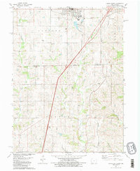 1981 Lamoni South1981 Print · USGSSouthern Iowa and northern Missouri are captured here in the early eighties, centered on the growing community of Lamoni. Genealogists and local historians can trace rural roots through Rose Hill Cem, Sweet Home Cem, and the old Andover townsite.2 unique versions available
 - 1981 Map of Akron
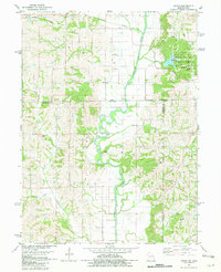 1981 Akron1981 Print · USGSThe Missouri-Iowa state line was a landscape of quiet river valleys and scattered farmsteads in the early eighties. Researchers can trace rural lineages through the many family-named burial grounds like Miller Cem or explore the Akron Townhall and the grounds of Nine Eagles State Park.
 - 1981 Map of Pawnee
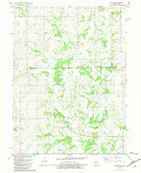 1981 Pawnee1981 Print · USGSThe rural borderlands between Iowa and Missouri come into focus in the early eighties. Genealogists and local historians can trace family roots through several landmarks including Mt Zion Cem, Lone Rock Ch, and the settlement of Pawnee.
 - 1981 Map of Trenton
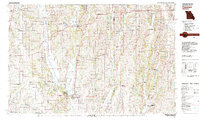 1981 Trenton1981 Print · USGSNorthern Missouri in the early eighties remains a landscape defined by its river valleys and intersecting rail lines. Genealogists and local historians can trace the development of riverside towns like Trenton and Princeton or locate smaller rural junctions such as Humphreys and Brimson.
 - 1981 Map of Leon, 1982 Print
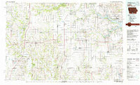 1981 Leon1982 Print · USGSSouthern Iowa and northern Missouri are captured here in the early eighties as the rural landscape balances traditional agriculture with large-scale water management. Researchers can trace the path of the Burlington Northern through Leon or locate early settlements like Decatur City and New Buda.
 - 1981 Map of Hatfield, 1982 Print
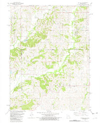 1981 Hatfield1982 Print · USGSThe Missouri-Iowa borderlands near Hatfield were still deeply rural in the early eighties, characterized by small settlements and family farms. Genealogists can locate several remote burial sites such as Lincoln Center Cem and Petty Cem, or trace the winding course of the East Fork Grand River.
Showing maps 1-25 of 107
Top cities of Harrison County
- Bethany historical maps
- Ridgeway historical maps
- Cainsville historical maps
- New Hampton historical maps
- Eagleville historical maps
- Blythedale historical maps
See more
Frequently asked questions
- What are the different types of historical maps available for Harrison County?
- What is the oldest map of Harrison County?
- Where can I purchase historical maps of Harrison County for my home or office?
- Where can I download high-res historical maps of Harrison County?
- Are there historical topographic maps available for Harrison County?
- Is there historical aerial imagery available for Harrison County?
- Where are historical maps of Harrison County sourced from?