Old Maps of Knox County, Missouri for Academic Research
Study the evolution of Knox County with 103 high-resolution historic maps. Whether you're teaching, researching, or modeling changes in land use, these maps provide essential visual documentation of urban, environmental, and geographic change.
- Analyze long-term change: Track patterns in development, transportation, and natural features.
- Ideal for environmental or urban studies: Support academic projects with primary historical map data.
- Use in the classroom or lab: Educators and researchers rely on these maps to bring historical context to life.
These maps are a powerful tool for teaching, research, and visualizing how Knox County has changed over the decades.
Knox County, MO maps
(103)- 1903 Map of Kahoka
 1903 Kahoka1903 Print · USGSNortheast Missouri at the turn of the century shows a landscape defined by the convergence of major rivers and competing rail lines. Genealogists can trace family roots in early centers like Kahoka and Monticello, or locate riverfront crossings at St. Francisville and Canton.3 unique versions available
 - 1903 Map of Palmyra
 1903 Palmyra1903 Print · USGSNortheast Missouri at the start of the twentieth century was a landscape of river-valley farming and critical rail junctions. Researchers can trace early rural life through features like Sharp Mills, St. Pauls Ch., and the crossing of the Hannibal and St. Joseph R. R.2 unique versions available
 - 1903 Map of Edina
 1903 Edina1903 Print · USGSNortheast Missouri at the turn of the century shows a bustling landscape of rail-fed market towns and river valley townships. Researchers can trace the path of the Santa Fe Railroad through Baring or locate early settlements like Pleasant Retreat and Bible Grove.2 unique versions available
 - 1908 Map of Atlanta
 1908 Atlanta1908 Print · USGSMacon County is characterized by its early twentieth-century rail and river networks, anchored by the WABASH RR. Genealogists can trace family roots through numerous rural landmarks like Sue City, Mt Tabor Church, and La Porte School.2 unique versions available
 - 1948 Map of Quincy
 1948 Quincy1948 Print · USGSThe Mississippi and Illinois River valleys are captured at a post-war crossroads as rail and river travel met the expanding highway system. Genealogists can trace family settlements from Quincy to Hannibal and smaller towns like Vandalia and Jerseyville.2 unique versions available
 - 1950 Map of Colony, 1976 Print
 1950 Colony1976 Print · USGSNortheast Missouri at the mid-century mark reveals a rural landscape defined by independent school districts and quiet creek valleys. Genealogists and historians can trace the foundations of local life at Sutter Cem, Fairmont, and the Arkansas Sch.
 - 1950 Map of La Belle, 1977 Print
 1950 La Belle1977 Print · USGSThe town of La Belle and the surrounding Lewis County countryside are shown here at mid-century, just as the local rural school system was beginning to consolidate. Researchers can trace family sites near Washburn Cem or locate former schoolhouses like Sweet Oak Sch and Salem Sch.
 - 1951 Map of La Belle
 1951 La Belle1951 Print · USGSLa Belle and the surrounding Missouri countryside are captured here in the early fifties, just as the local rural school system was undergoing significant change. Genealogists and historians can trace family locations near the Chicago Burlington and Quincy tracks or locate family plots at Washburn Cem and Glover Cem.2 unique versions available
 - 1951 Map of Colony
 1951 Colony1951 Print · USGSNortheast Missouri agriculture and small-town life are captured here at mid-century, where the four corners of Clark, Scotland, Knox, and Lewis counties converge. Researchers can trace family roots through sites like Sutter Cem, Bear Creek Ch, and schools such as Price Sch.2 unique versions available
 - 1951 Map of Deer Ridge
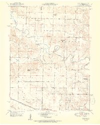 1951 Deer Ridge1951 Print · USGSLewis County was transitioning away from its one-room schoolhouse era during the mid-century as seen in this detailed map. Researchers can trace the decline of rural districts through Union Sch and Banner Sch, or locate family sites near Forest Springs and Bondurant Cem.3 unique versions available
 - 1953 Map of Moberly
 1953 Moberly1953 Print · USGSMid-century north-central Missouri is documented here as a bustling intersection of river commerce and heavy rail. Researchers can trace historic family-named landmarks and transport hubs from the Missouri River corridor to the rail yards of Moberly, Chillicothe, and Macon.
 - 1954 Map of Centerville, 1967 Print
 1954 Centerville1967 Print · USGSThe Iowa-Missouri borderlands at mid-century reveal a landscape shaped by river valleys and the height of the regional rail network. Genealogists and historians can trace the paths of the Wabash railroad and locate old townsites like Mystic, Moulton, and Greentop.3 unique versions available
 - 1954 Map of Moberly, 1969 Print
 1954 Moberly1969 Print · USGSMid-century Missouri is captured here during a period of transition for its river towns and rail hubs. Genealogists and historians can trace the paths of the Wabash railroad through Moberly or explore the riverside layout of Lexington and Brunswick.3 unique versions available
 - 1956 Map of Quincy, 1967 Print
 1956 Quincy1967 Print · USGSThe river and rail corridors of the Illinois-Missouri border are documented here during the mid-1950s. Researchers can trace historic river landings and regional transit hubs from Quincy and Hannibal to smaller settlements like Meredosia and Roodhouse.3 unique versions available
 - 1957 Map of Moberly
 1957 Moberly1957 Print · USGSNorth-central Missouri in the late nineteen-forties and fifties remains a landscape defined by its great rivers and a dense network of steam and diesel rail lines. Genealogists and historians can trace the paths of the Wabash RR and Santa Fe RR through historic junctions like Moberly, Brookfield, and Macon.
 - 1957 Map of Centerville
 1957 Centerville1957 Print · USGSThe Iowa-Missouri borderlands in the mid-fifties reveal a landscape of river-valley agriculture and vital rail corridors. Genealogists and historians can trace family-named landmarks and small-town growth in Centerville, Kirksville, and along the Wabash railroad line.
 - 1958 Map of Centerville
 1958 Centerville1958 Print · USGSThe Iowa-Missouri borderlands come into focus during the mid-fifties, showing a landscape defined by river valleys and intersecting rail lines. Genealogists and local historians can trace family roots through dozens of rural hubs like Bloomfield, Unionville, and Corydon.
 - 1958 Map of Burlington, 1968 Print
 1958 Burlington1968 Print · USGSThe tri-state river country of Iowa, Illinois, and Missouri is captured here in the mid-fifties, dominated by the Mississippi River and major rail lines. Genealogists and historians can trace the development of river towns like Keokuk or locate the sprawling Iowa Army Ammunition Plant.4 unique versions available
 - 1960 Map of Moberly
 1960 Moberly1960 Print · USGSCentral Missouri comes alive in the mid-twentieth century as a bustling network of river towns and significant rail corridors. Genealogists and historians can trace the paths of the Wabash RR through Moberly or explore the riverfronts of Lexington and Brunswick.
 - 1961 Map of Burlington
 1961 Burlington1961 Print · USGSThe tri-state borderlands along the Mississippi River are captured here during the late fifties and early sixties, showing the vital river-and-rail economy of Iowa, Illinois, and Missouri. Genealogists and historians can trace the development of major hubs like Galesburg and Macomb alongside landmark sites such as the Iowa Ordnance Plant and the historic river town of Nauvoo.
 - 1963 Map of Burlington
 1963 Burlington1963 Print · USGSThe tri-state river country of the Mississippi and Illinois valleys comes alive in this mid-century survey. Genealogists and historians can trace the industrial and academic growth of the region, from the Iowa Ordnance Plant to campuses like Knox College and Western Illinois University.
 - 1963 Map of Leonard, 1965 Print
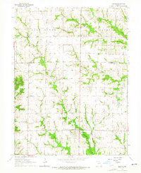 1963 Leonard1965 Print · USGSNortheast Missouri farm life is preserved here during the early sixties, showing the rural communities along the Salt River. Genealogists can locate several family burial sites like Antioch Cemetery and trace the road network around Leonard and Cherry Box.
 - 1964 Map of Newark, 1965 Print
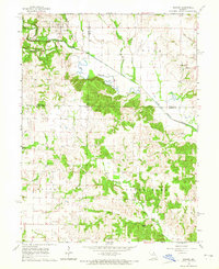 1964 Newark1965 Print · USGSNorthern Missouri farm country and the winding South Fabius River define this area in the mid-1960s. Genealogists can locate family landmarks like the Nelson Cem, Shilo Ch, and the small settlement of Steffenville.
 - 1964 Map of Bethel, 1965 Print
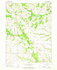 1964 Bethel1965 Print · USGSNorthern Shelby County is documented here in the mid-1960s, showing the agricultural landscape around the Little Fabius River. Genealogists can locate several family cemeteries and churches, including Hebron Cem and Mount Salem Ch.2 unique versions available
 - 1965 Map of Edina SE, 1966 Print
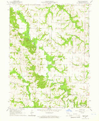 1965 Edina SE1966 Print · USGSKnox County farmland and river bottoms are preserved here as they appeared in the mid-1960s. Genealogists and local historians can trace family land across Bee Ridge, locating the Bee Ridge Ch, Coe Cem, and numerous creek crossings.2 unique versions available
Showing maps 1-25 of 103
Top cities of Knox County
- Edina historical maps
- Hurdland historical maps
- Knox City historical maps
- Baring historical maps
- Novelty historical maps
- Newark historical maps
Frequently asked questions
- What are the different types of historical maps available for Knox County?
- What is the oldest map of Knox County?
- Where can I purchase historical maps of Knox County for my home or office?
- Where can I download high-res historical maps of Knox County?
- Are there historical topographic maps available for Knox County?
- Is there historical aerial imagery available for Knox County?
- Where are historical maps of Knox County sourced from?