
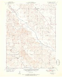
1950 Map of Colony
USGS Topo · Published 1976About this map
The borderlands of Clark, Scotland, Knox, and Lewis Counties are defined by a network of rural schools and family cemeteries that anchored mid-century Missouri life. Small settlements like Fairmont and Colony serve as local hubs, while the landscape is dotted with educational history, including the Narrow Grove Sch, Price Sch, and the marked Arkansas Sch (Abandoned). The topography is shaped by the meandering Little Wyaconda River and the complex waterways of Bear Creek and Shaffer Creek.
Find a feature on this map
23 named features on this map. Tap any name to fly to it.
Don’t see what you’re looking for? This feature index may not catch every label — zoom into the map to look around manually.
Map Details
Editions of this 1950 Colony Map
This is the sole edition of this map. No revisions or reprints were ever made.
Other maps of this area

1903 · Kahoka
USGS Topo · 1:125,000

1903 · Edina
USGS Topo · 1:125,000

1950 · Neeper
USGS Topo · 1:24,000

1950 · Williamstown
USGS Topo · 1:24,000

1950 · Medill
USGS Topo · 1:24,000

1951 · Colony
USGS Topo · 1:24,000

1951 · Neeper
USGS Topo · 1:24,000

1951 · Medill
USGS Topo · 1:24,000
1951 · Williamstown
USGS Topo · 1:24,000

1951 · Wyaconda
USGS Topo · 1:24,000