2020s Maps of Bates City, Missouri
Explore 2 historic maps of Bates City from the 2020s. These maps offer a rare glimpse into what life looked like during the 2020s — showing old roads, neighborhoods, homes, and landmarks that have changed or disappeared over time.
Whether you're researching your family's past, planning a metal detecting trip, or studying how Bates City's landscape evolved across the 2020s, these high-resolution maps are a powerful tool for exploring the history of this region.
- Focus on a specific era: All maps on this page are from the 2020s, giving you a focused view of this time period.
- See what’s changed: Compare century-old streets, trails, and buildings to today's modern landscape using overlays and satellite layers.
- Research with precision: Use these maps for genealogy, historical research, land use analysis, or educational projects.
- View, download, or print: Maps are fully viewable online in high resolution, and can be downloaded or printed for your own records.
Start exploring Bates City's history through authentic maps from the 2020s. This is your window into the past.
Bates City, MO maps
(2)- 2021 Map of Chapel Hill, 2021 Print
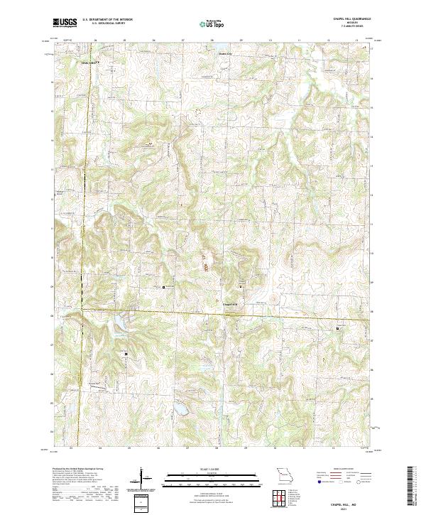 2021 Chapel Hill2021 Print · USGSThe tri-county border of Jackson, Lafayette, and Johnson counties comes together in this 2021 landscape of high ridges and winding headwaters. Genealogists and researchers can trace old family burial grounds at Chapel Hill Cem and Shore Cem near the historic crossroads of Chapel Hill.
 - 2021 Map of Bates City, 2021 Print
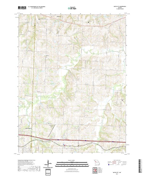 2021 Bates City2021 Print · USGSLafayette and Jackson Counties are shown here during a period of modern regional growth and infrastructure development. Researchers can trace ancestral sites at Anderson Cemetery and Campbell Cemetery or explore the waterways of Sni-A-Bar Creek.
End of results
Showing maps 1-2 of 2
Top cities near Bates City
- Independence historical maps
- Lee's Summit historical maps
- Blue Springs historical maps
- Grain Valley historical maps
- Pleasant Hill historical maps
- Oak Grove historical maps
See more
Frequently asked questions
- What are the different types of historical maps available for Bates City?
- What is the oldest map of Bates City?
- Where can I purchase historical maps of Bates City for my home or office?
- Where can I download high-res historical maps of Bates City?
- Are there historical topographic maps available for Bates City?
- Is there historical aerial imagery available for Bates City?
- Where are historical maps of Bates City sourced from?