Old Maps of Lincoln County, Missouri for Academic Research
Study the evolution of Lincoln County with 139 high-resolution historic maps. Whether you're teaching, researching, or modeling changes in land use, these maps provide essential visual documentation of urban, environmental, and geographic change.
- Analyze long-term change: Track patterns in development, transportation, and natural features.
- Ideal for environmental or urban studies: Support academic projects with primary historical map data.
- Use in the classroom or lab: Educators and researchers rely on these maps to bring historical context to life.
These maps are a powerful tool for teaching, research, and visualizing how Lincoln County has changed over the decades.
Lincoln County, MO maps
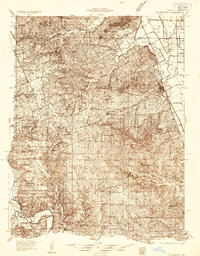
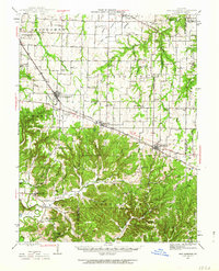
(139)- 1890 Map of Louisiana
 1890 Louisiana1890 Print · USGSUpper Missouri and Illinois river country in the 1890s is captured here at the height of the steam-rail era. Genealogists can trace family roots through old rural outposts like New Harmony, Prairieville, and the transit hub at Bowling Green.5 unique versions available
 - 1890 Map of Hermann
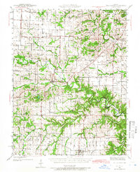
 1890 Hermann1890 Print · USGSMid-Missouri river life and rail commerce define this late-century landscape during a period of steady expansion. Genealogists and historians can trace family roots through old post offices like Hopewell Academy P.O. and Swiss P.O. or the early street grids of Hermann and Warrenton.5 unique versions available
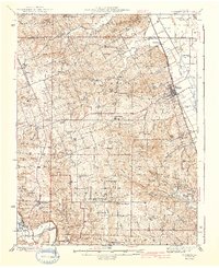
 - 1903 Map of O'Fallon
 1903 O'Fallon1903 Print · USGSSt. Charles County at the turn of the century is a labyrinth of river islands and rail lines at the confluence of the Missouri and Mississippi. Researchers can trace old river landings like Cap Au Gris Landing and family-named settlements from Moscow Mills to New Melle.5 unique versions available
 - 1930 Map of Hardin
 1930 Hardin1930 Print · USGSCalhoun County's narrow peninsula is captured here between the two great rivers during the late Prohibition era. Genealogists and local researchers can locate numerous rural landmarks like Indian Creek Ch, Oases Ch, and a high concentration of schoolhouses including South Lincoln Sch.2 unique versions available
 - 1931 Map of Brussels
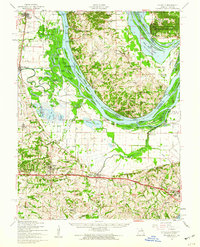
 1931 Brussels1931 Print · USGSThe peninsula between the Illinois and Mississippi Rivers is captured here in the early 1930s, showcasing a network of river landings and ridge-top settlements. Genealogists can trace family roots through numerous local landmarks like Golden Eagle, Point Pleasant, and Nichols Sch.2 unique versions available
 - 1934 Map of Elsberry
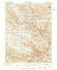
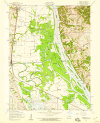
 1934 Elsberry1934 Print · USGSLincoln County in the mid-1930s shows a landscape of ridge-top farms and river valley settlements along the Chicago Burlington and Quincy rail line. Genealogists can trace early rural life through numerous sites like Old Alexandria, Ashbury Chapel, and the Boyles Cem.2 unique versions available
 - 1934 Map of Hardin, 1956 Print
 1934 Hardin1956 Print · USGSThe river bluffs of Calhoun and Greene counties come alive in this mid-1930s survey of the Mississippi River and Illinois River valleys. Genealogists can trace family roots through numerous rural landmarks like Indian Creek Ch, St Andrew Ch, and the Pecan Grove Sch.2 unique versions available
 - 1937 Map of Silex, 1955 Print
 1937 Silex1955 Print · USGSLincoln and Pike counties are shown here in the mid-1930s, when the agricultural economy was centered on the banks of the Cuivre River. Genealogists and local historians can trace rural school districts and old fords, such as Abe Duff Sch, Silex, and Richardson Mill Ford.
 - 1938 Map of Hardin
 1938 Hardin1938 Print · USGSThe river-bound peninsula of Calhoun County is shown here in the 1930s, caught between the shifting chutes of the Mississippi and the Illinois rivers. Genealogists can trace family roots through numerous rural landmarks like Gilead Cemetery, the Poor Farm, and small communities such as Batchtown and Hamburg.2 unique versions available
 - 1939 Map of Silex
 1939 Silex1939 Print · USGSLincoln and Pike Counties are shown in the late 1930s, featuring a landscape defined by the winding Cuivre River and its many forks. Researchers can trace rural life through dozens of local landmarks like Forest Cem Sch, Fairview Ch, and the St Louis and Hannibal RR.
 - 1939 Map of Brussels, 1955 Print
 1939 Brussels1955 Print · USGSThe confluence of the Illinois and Mississippi rivers defines this pre-war era, where river landings and ferries still anchored local life. Genealogists can trace family footprints at Old Rock Ch, numerous rural schools like Black Jack Sch, and the West Point Ferry.
 - 1941 Map of Troy, 1964 Print
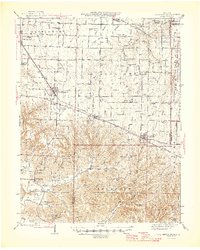
 1941 Troy1964 Print · USGSLincoln and St. Charles Counties are captured here in the early 1940s as the rail-and-river economy shaped local life. Researchers can trace dozens of rural schoolhouses and family landmarks like Pond Fort Sch, Shiloh Ch, and the Wabash RR junction at Wentzville.2 unique versions available
 - 1942 Map of Elsberry
 1942 Elsberry1942 Print · USGSNortheastern Missouri's river bluffs and rail corridors are captured here during the early 1940s. Genealogists and historians can locate vanished landmarks like Brussels Sch, Penn Cave, and the rural Old Alexandria Ch.2 unique versions available
 - 1942 Map of New Florence, 1963 Print
 1942 New Florence1963 Print · USGSMontgomery County in the early 1940s reveals a landscape of dispersed farmsteads and rail-dependent towns like New Florence and High Hill. You can trace rural education through vanished schoolhouses like Orange Blossom Sch or locate family sites near Wright Cem.2 unique versions available
 - 1942 Map of Bellflower, 1966 Print
 1942 Bellflower1966 Print · USGSEastern Missouri farm country is captured here during the early years of the war, revealing a landscape defined by the Cuivre River and the Chicago Burlington and Quincy rail line. Genealogists can locate family-named landmarks and rural hubs like Middletown, Smyrna Ch, and the Prairie Flower Sch.
 - 1943 Map of Brussels
 1943 Brussels1943 Print · USGSThe river bottomlands near the Missouri and Illinois border come alive in the 1940s, showing a network of ferries, landings, and rail lines. Trace family history through local landmarks like Lone Tree Indian Mound, Boones Lick Road, and St Peters.2 unique versions available
 - 1943 Map of Warrenton, 1962 Print
 1943 Warrenton1962 Print · USGSMissouri's rural heartland is meticulously detailed in the early 1940s, showing the vital rail corridors and crossroads communities of Warren and Lincoln counties. Genealogists and historians can locate dozens of small schoolhouses like Weeks Sch and Moore Sch alongside the tracks of the Wabash RR.2 unique versions available
 - 1945 Map of Troy
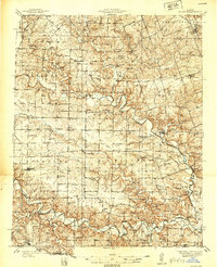
 1945 Troy1945 Print · USGSLincoln and St. Charles counties are shown in the 1940s, revealing a landscape of small farming hamlets and a high density of rural schoolhouses. Researchers can trace the paths of the Wabash RR and locate ancestral landmarks like Owen Station Sch or Oak Grove Cem.2 unique versions available
 - 1945 Map of Bellflower
 1945 Bellflower1945 Print · USGSThe rural borderlands of Montgomery, Audrain, and Pike counties are captured here in the mid-1940s as a network of tightly-knit farming communities. Genealogists can trace family footprints through dozens of local landmarks, including Payne Cem, Smyrna Ch, and the many namesake schoolhouses like Mudd Sch.2 unique versions available
 - 1945 Map of Warrenton
 1945 Warrenton1945 Print · USGSWarrenton and Wright City thrive along the Wabash rail line in the mid-1940s, surrounded by a dense network of Missouri country schools and rural churches. Genealogists can trace family landmarks like Camp Branch Cem, Zion Ch, and the Goat Spring Sch.2 unique versions available
 - 1946 Map of New Florence
 1946 New Florence1946 Print · USGSMid-century Montgomery and Warren counties are captured here just as the rural school system and steam-era rail lines remained central to life. Genealogists can locate family landmarks like Wright Cem and dozens of vanished schoolhouses including Crabapple Sch and Me Kittrick Sch.2 unique versions available
 - 1948 Map of Quincy
 1948 Quincy1948 Print · USGSThe Mississippi and Illinois River valleys are captured at a post-war crossroads as rail and river travel met the expanding highway system. Genealogists can trace family settlements from Quincy to Hannibal and smaller towns like Vandalia and Jerseyville.2 unique versions available
 - 1949 Map of Saint Louis
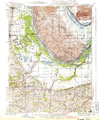
 1949 Saint Louis1949 Print · USGSGreater St. Louis and its surrounding river valleys are captured here just after the war, showing the metropolitan core and the rural Ozark fringe. Researchers can trace the sprawling rail network of the Wabash RR or locate landmarks like Meramec Caverns Airport and Scott Air Force Base.2 unique versions available
 - 1954 Map of Winfield, 1959 Print
 1954 Winfield1959 Print · USGSThe confluence of the Mississippi and Cuivre Rivers is captured in the mid-1950s, showing a landscape defined by levees and rail. Trace family roots at Hayden Sch or Winfield, and locate old river landings like Beech Landing.3 unique versions available
 - 1954 Map of Brussels, 1960 Print
 1954 Brussels1960 Print · USGSThe confluence of the Mississippi and Illinois Rivers comes alive in the mid-1950s, showing a landscape shaped by river transport and rail. Trace the routes of the Wabash Railroad or find family history at All Saints Village and Dardenne Cem.2 unique versions available
Showing maps 1-25 of 139
Top cities of Lincoln County
- Troy historical maps
- Elsberry historical maps
- Moscow Mills historical maps
- Winfield historical maps
- Hawk Point historical maps
- Old Monroe historical maps
See more
Frequently asked questions
- What are the different types of historical maps available for Lincoln County?
- What is the oldest map of Lincoln County?
- Where can I purchase historical maps of Lincoln County for my home or office?
- Where can I download high-res historical maps of Lincoln County?
- Are there historical topographic maps available for Lincoln County?
- Is there historical aerial imagery available for Lincoln County?
- Where are historical maps of Lincoln County sourced from?