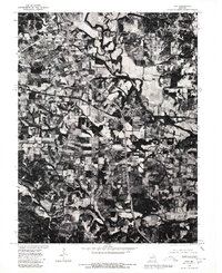
1970s Maps of Lincoln County, Missouri
Explore 22 historic maps of Lincoln County from the 1970s. These maps offer a rare glimpse into what life looked like during the 1970s — showing old roads, neighborhoods, homes, and landmarks that have changed or disappeared over time.
Whether you're researching your family's past, planning a metal detecting trip, or studying how Lincoln County's landscape evolved across the 1970s, these high-resolution maps are a powerful tool for exploring the history of this region.
- Focus on a specific era: All maps on this page are from the 1970s, giving you a focused view of this time period.
- See what’s changed: Compare century-old streets, trails, and buildings to today's modern landscape using overlays and satellite layers.
- Research with precision: Use these maps for genealogy, historical research, land use analysis, or educational projects.
- View, download, or print: Maps are fully viewable online in high resolution, and can be downloaded or printed for your own records.
Start exploring Lincoln County's history through authentic maps from the 1970s. This is your window into the past.
Lincoln County, MO maps
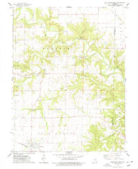
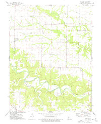
(22)- 1972 Map of Foristell, 1973 Print
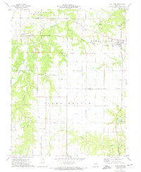
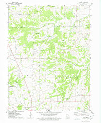
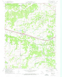 1972 Foristell1973 Print · USGSForistell and the surrounding tri-county rural landscape appear here in the early seventies, caught between its rail-town roots and growing industrial utility. Researchers can locate family landmarks along Stringtown Road or trace sites like Smith Chapel and the Mid America Raceway.3 unique versions available
 - 1972 Map of Troy, 1973 Print
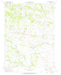
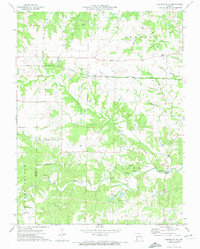
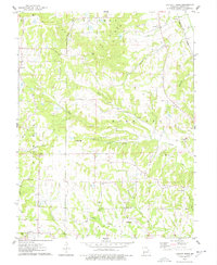
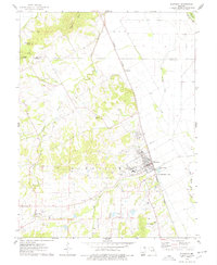
 1972 Troy1973 Print · USGSLincoln County in the early 1970s reveals a landscape where modern development met historic rail and river corridors. Researchers can trace family roots at Sand Run Ch or Bray Cem, and explore the path of the Old Railroad Grade near Moscow Mills.3 unique versions available
 - 1972 Map of Maryknoll, 1973 Print
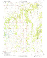
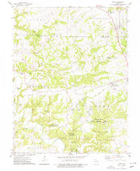
 1972 Maryknoll1973 Print · USGSLincoln and St. Charles counties meet along the winding river valley in the early seventies, a landscape shaped by rail and water. Genealogists can locate family landmarks such as Highland Prairie Ch and St Pauls Ch or trace the early paths of Ethlyn and Old Monroe.
 - 1972 Map of Wright City, 1974 Print
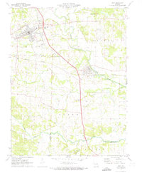
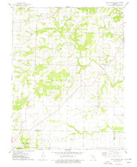
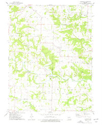
 1972 Wright City1974 Print · USGSWright City and Truesdale are shown at a crossroads of rail and regional industry in the early seventies. Trace the Norfolk and Western line or locate local landmarks like Passionist Fathers Seminary and Harmonie Ch.2 unique versions available
 - 1973 Map of Hawk Point, 1974 Print
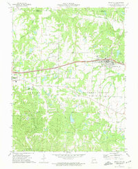
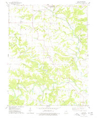
 1973 Hawk Point1974 Print · USGSHawk Point and the surrounding Lincoln and Warren County borderlands are shown in the early seventies during a period of steady rural development. Researchers can trace family sites at Hawk Point Cem, follow the Burlington Northern rail line, or locate the Weeks Community Center.2 unique versions available
 - 1973 Map of Warrenton NE, 1974 Print
 1973 Warrenton NE1974 Print · USGSThe rural borderlands of Lincoln and Warren counties come into focus during the early seventies, showcasing a landscape of family farms and creek valleys. Genealogists and local historians can trace legacy sites like the Old Davis Cem, Big Creek Community Center, and the Burlington Northern rail line.
 - 1973 Map of Bellflower South, 1975 Print
 1973 Bellflower South1975 Print · USGSEastern Missouri's rural landscape is captured here in the early seventies, showing a network of small settlements and creek-bottom farms. Researchers can trace family history through sites like St Paul Cem, the Baptist Cem of Bellflower, and the old rail line of the Burlington Northern.
 - 1973 Map of New Hartford, 1977 Print
 1973 New Hartford1977 Print · USGSPike and Montgomery counties are captured in the early seventies, showcasing a rural landscape defined by its many family cemeteries and country churches. Genealogists can locate sites like Harelson Cemetery, Siloam Church, and the settlement of New Hartford.
 - 1973 Map of Bellflower North, 1977 Print
 1973 Bellflower North1977 Print · USGSMontgomery County was a landscape of small rural settlements and river-valley farms in the early 1970s. Researchers can trace family history through numerous landmarks like Union Chapel, Mabry Cem, and the old crossing at Stillhouse Ford.
 - 1975 Map of Luckett Ridge, 1977 Print
 1975 Luckett Ridge1977 Print · USGSLincoln County in the mid-seventies is a landscape of high ridges and winding creek bottoms west of the Mississippi. Genealogists can trace family names through several rural burial grounds like Luckett Cem and Taylor Cem or locate the quiet crossroads of Argentville.
 - 1975 Map of Eolia, 1977 Print
 1975 Eolia1977 Print · USGSThe Pike and Lincoln county line comes alive in the mid-seventies, showing a landscape of small towns and conservation lands. Genealogists and historians can trace family markers at Tinsley Cem and Copenhagen Cem or locate the Old Railroad Grade near Whiteside.2 unique versions available
 - 1975 Map of Louisville, 1977 Print
 1975 Louisville1977 Print · USGSThe rural border of Pike and Lincoln counties is meticulously detailed in the mid-seventies, showing the agricultural heart of the Cuivre River valley. Researchers can trace numerous family burial grounds and early local landmarks like Grimmett Bridge, Old Ashley Cem, and Louisville Ch.
 - 1975 Map of Truxton, 1977 Print
 1975 Truxton1977 Print · USGSLincoln County in the 1970s reveals a quiet landscape of prairie rivers and established crossroads like Truxton and Olney. Genealogists and historians can locate rural burial grounds including Old Liberty Cem and trace early resource sites such as the Claypits.2 unique versions available
 - 1975 Map of Silex, 1977 Print
 1975 Silex1977 Print · USGSLincoln County farmland and river bottoms are captured here in the mid-seventies, showing the intersection of several rural townships. Genealogists can trace numerous burial sites like Sitton Cem and St Marys Cem or locate the Old Railroad Grade and Stepanek Crossing.2 unique versions available
 - 1975 Map of Foley, 1978 Print
 1975 Foley1978 Print · USGSThe riverfront communities of Missouri and Illinois are captured here in the mid-seventies, centered on the crossing between Foley and Batchtown. Genealogists can locate family burial sites at Stonebraker Cem and Plummer Cem or trace the old Burlington Northern rail line.
 - 1975 Map of Okete, 1978 Print
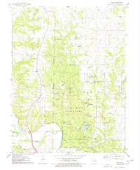 1975 Okete1978 Print · USGSLincoln County in the mid-seventies shows a landscape of conservation and quiet rural life. Genealogists can locate numerous family burial grounds like Gladney Cem and Reid Cem or trace the early community centers of Okete and Brussels.2 unique versions available
 - 1975 Map of Auburn, 1978 Print
 1975 Auburn1978 Print · USGSThe rural landscape of Lincoln and Pike counties is captured here in the mid-1970s, showcasing a network of family farmsteads and creek valleys. Researchers can locate numerous family burial sites like Mitchell Cem and Nelson-Cannon Cem, or trace the path of the Old RR Grade.2 unique versions available
 - 1975 Map of Elsberry, 1978 Print
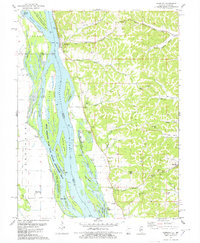
 1975 Elsberry1978 Print · USGSThe Missouri river bluffs and the Burlington Northern line define the landscape around Elsberry in the mid-seventies. Local historians can trace old homesteads and family roots through the Vance-Seaman Cem, the U S Experimental Farm, and the hilltop Oak Ridge Cem.
 - 1978 Map of Hamburg
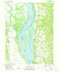
 1978 Hamburg1978 Print · USGSThe Illinois-Missouri borderlands along the Mississippi come into focus during the late seventies, showing the river’s complex channel and the steep bluff country. Trace historical river crossings at Hamburg Ferry and explore local landmarks like Indian Creek Ch and Sugar Loaf.
 - 1979 Map of Foristell, 1980 Print
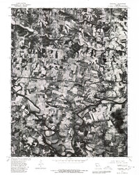
 1979 Foristell1980 Print · USGSThe Missouri countryside around Foristell is captured in late 1979 through high-resolution aerial imagery rather than traditional line drawing. Researchers can trace the exact 1970s land use patterns along Peruque Creek and the Fifth Principal Meridian.
 - 1979 Map of Maryknoll, 1980 Print
 1979 Maryknoll1980 Print · USGSLincoln County farmland and river bends appear in sharp detail just before the 1980s. Genealogists and historians can trace the rural layouts of Old Monroe and Chain of Rocks along the banks of the Cuivre River.
 - 1979 Map of Troy, 1980 Print
 1979 Troy1980 Print · USGSLincoln County comes into sharp focus in the late seventies as the expansion of Troy meets the agricultural traditions of the Cuivre River valley. Researchers can trace land divisions along the Fifth Principal Meridian or explore the mid-century layout of Moscow Mills.
End of results
Showing maps 1-22 of 22
Top cities of Lincoln County
- Troy historical maps
- Elsberry historical maps
- Moscow Mills historical maps
- Winfield historical maps
- Hawk Point historical maps
- Old Monroe historical maps
See more
Frequently asked questions
- What are the different types of historical maps available for Lincoln County?
- What is the oldest map of Lincoln County?
- Where can I purchase historical maps of Lincoln County for my home or office?
- Where can I download high-res historical maps of Lincoln County?
- Are there historical topographic maps available for Lincoln County?
- Is there historical aerial imagery available for Lincoln County?
- Where are historical maps of Lincoln County sourced from?