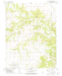
1973 Map of Bellflower North
USGS Topo · Published 1977About this map
Bellflower anchors the southwestern portion of this Montgomery County landscape, situated along the Burlington Northern railroad corridor. The area is defined by the winding course of the Cuivre River and its multiple tributaries, including the Fork Cuivre River and Elkhorn Creek, which carve through the Prairie and Bear Creek townships. Local industry and land use are evident through several Claypit excavations scattered across the terrain.
Find a feature on this map
30 named features on this map. Tap any name to fly to it.
Don’t see what you’re looking for? This feature index may not catch every label — zoom into the map to look around manually.
Map Details
Editions of this 1973 Bellflower North Map
This is the sole edition of this map. No revisions or reprints were ever made.
Other maps of this area

1890 · Louisiana
USGS Topo · 1:125,000

1890 · Hermann
USGS Topo · 1:125,000

1937 · Silex
USGS Topo · 1:62,500

1939 · Silex
USGS Topo · 1:48,000

1942 · New Florence
USGS Topo · 1:62,500

1942 · Bellflower
USGS Topo · 1:62,500

1943 · Warrenton
USGS Topo · 1:62,500

1945 · Bellflower
USGS Topo · 1:62,500

1945 · Warrenton
USGS Topo · 1:62,500

1946 · New Florence
USGS Topo · 1:62,500