1950s Maps of Livingston County, Missouri
Explore 10 historic maps of Livingston County from the 1950s. These maps offer a rare glimpse into what life looked like during the 1950s — showing old roads, neighborhoods, homes, and landmarks that have changed or disappeared over time.
Whether you're researching your family's past, planning a metal detecting trip, or studying how Livingston County's landscape evolved across the 1950s, these high-resolution maps are a powerful tool for exploring the history of this region.
- Focus on a specific era: All maps on this page are from the 1950s, giving you a focused view of this time period.
- See what’s changed: Compare century-old streets, trails, and buildings to today's modern landscape using overlays and satellite layers.
- Research with precision: Use these maps for genealogy, historical research, land use analysis, or educational projects.
- View, download, or print: Maps are fully viewable online in high resolution, and can be downloaded or printed for your own records.
Start exploring Livingston County's history through authentic maps from the 1950s. This is your window into the past.
Livingston County, MO maps
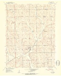
(10)- 1950 Map of Coloma, 1952 Print
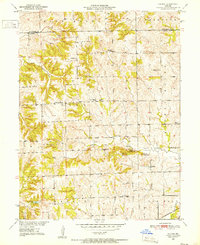 1950 Coloma1952 Print · USGSThe rural landscape of Carroll County is captured here in the early fifties, showing a community structured around small schools and high prairie mounds. Researchers can find old landmarks like Coloma, the Locust Sch, and the unique triplet of Tater Hill, Long Tater Hill, and Round Tater Hill.3 unique versions available
 - 1950 Map of Plymouth, 1952 Print
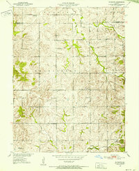 1950 Plymouth1952 Print · USGSNorthwestern Missouri was a landscape of small school districts and country churches at the mid-century. Genealogists can locate family-named landmarks like Rea Sch and Hanks Sch, or trace the community centers of Plymouth and Mt Tabor Ch.3 unique versions available
 - 1950 Map of Hale, 1956 Print
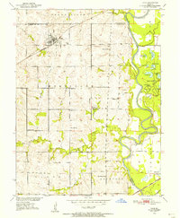 1950 Hale1956 Print · USGSCarroll County was a landscape of river-bend lakes and rural schoolhouses in the mid-twentieth century. Genealogists can trace family footprints through sites like Elizabeth Cemetery or Hazel Hill School, while exploring the oxbows of the Grand River.2 unique versions available
 - 1951 Map of Hale
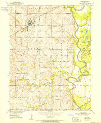 1951 Hale1951 Print · USGSNorthwestern Missouri farming life and river management are preserved here in the early fifties. Genealogists can locate family landmarks like Elizabeth Cem, Winfrey Cem, and numerous rural schools including Battsville Sch.
 - 1951 Map of Utica, 1952 Print
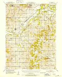 1951 Utica1952 Print · USGSLivingston and Carroll counties are mapped here in the early fifties, showing a landscape defined by the Grand River and thriving rail corridors. Researchers can trace dozens of rural school sites like McCleary Sch and family-named landmarks from Bunch Hollow to Tater Hill.
 - 1951 Map of Hale, 1952 Print
 1951 Hale1952 Print · USGSNorth-central Missouri's river lowlands are captured here in the early fifties, showing the area around Hale and the Grand River floodplain. Researchers can trace defunct rural infrastructure like Hazel Green Sch and the Sumner Bridge crossing.3 unique versions available
 - 1952 Map of Tina
 1952 Tina1952 Print · USGSCarroll County rural life in the early fifties is centered on the railroad village of Tina. Researchers can trace old family footprints through numerous country schoolhouses like Ironclad Sch and Round Grove Sch, or locate ancestral sites at Macklin Cem.3 unique versions available
 - 1953 Map of Moberly
 1953 Moberly1953 Print · USGSMid-century north-central Missouri is documented here as a bustling intersection of river commerce and heavy rail. Researchers can trace historic family-named landmarks and transport hubs from the Missouri River corridor to the rail yards of Moberly, Chillicothe, and Macon.
 - 1954 Map of Moberly, 1969 Print
 1954 Moberly1969 Print · USGSMid-century Missouri is captured here during a period of transition for its river towns and rail hubs. Genealogists and historians can trace the paths of the Wabash railroad through Moberly or explore the riverside layout of Lexington and Brunswick.3 unique versions available
 - 1957 Map of Moberly
 1957 Moberly1957 Print · USGSNorth-central Missouri in the late nineteen-forties and fifties remains a landscape defined by its great rivers and a dense network of steam and diesel rail lines. Genealogists and historians can trace the paths of the Wabash RR and Santa Fe RR through historic junctions like Moberly, Brookfield, and Macon.
End of results
Showing maps 1-10 of 10
Top cities of Livingston County
- Chillicothe historical maps
- Blue Mound historical maps
- Utica historical maps
- Wheeling historical maps
- Sampsel historical maps
- Ludlow historical maps
See more
Frequently asked questions
- What are the different types of historical maps available for Livingston County?
- What is the oldest map of Livingston County?
- Where can I purchase historical maps of Livingston County for my home or office?
- Where can I download high-res historical maps of Livingston County?
- Are there historical topographic maps available for Livingston County?
- Is there historical aerial imagery available for Livingston County?
- Where are historical maps of Livingston County sourced from?