2020s Maps of Utica, Missouri
Explore 4 historic maps of Utica from the 2020s. These maps offer a rare glimpse into what life looked like during the 2020s — showing old roads, neighborhoods, homes, and landmarks that have changed or disappeared over time.
Whether you're researching your family's past, planning a metal detecting trip, or studying how Utica's landscape evolved across the 2020s, these high-resolution maps are a powerful tool for exploring the history of this region.
- Focus on a specific era: All maps on this page are from the 2020s, giving you a focused view of this time period.
- See what’s changed: Compare century-old streets, trails, and buildings to today's modern landscape using overlays and satellite layers.
- Research with precision: Use these maps for genealogy, historical research, land use analysis, or educational projects.
- View, download, or print: Maps are fully viewable online in high resolution, and can be downloaded or printed for your own records.
Start exploring Utica's history through authentic maps from the 2020s. This is your window into the past.
Utica, MO maps
(4)- 2021 Map of Utica East, 2021 Print
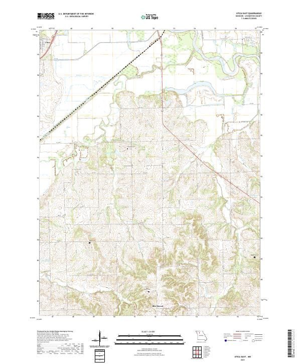 2021 Utica East2021 Print · USGSLivingston County in the early 2020s shows a landscape of river bottoms and high prairie ridges south of Utica. Genealogists can trace family sites at Welsh Cem and Blue Mound Cem or follow the winding course of the Grand River.
 - 2021 Map of Sampsel, 2021 Print
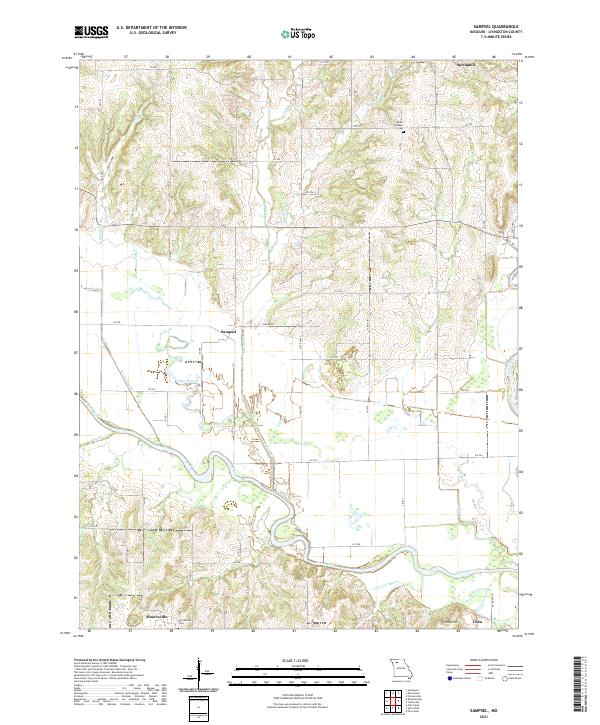 2021 Sampsel2021 Print · USGSLivingston County settlements and river valleys are captured here as they appeared in the early twenty-first century. Researchers can trace the winding Grand River and locate family landmarks like Mooresville Cem, Mount Pleasant Cem, and Sampsel.
 - 2021 Map of Utica West, 2021 Print
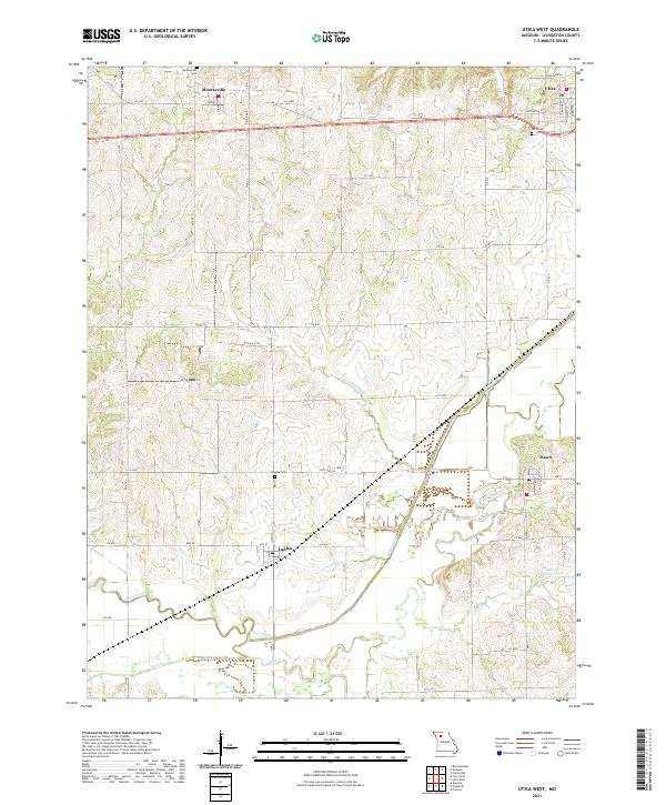 2021 Utica West2021 Print · USGSLivingston County communities and family-named cemeteries are documented here as they appeared in the early 2020s. Genealogists can locate ancestors at Mooresville Cem or Utica Cem and trace the rural reaches of Shoal Creek near Ludlow.
 - 2021 Map of Chillicothe, 2021 Print
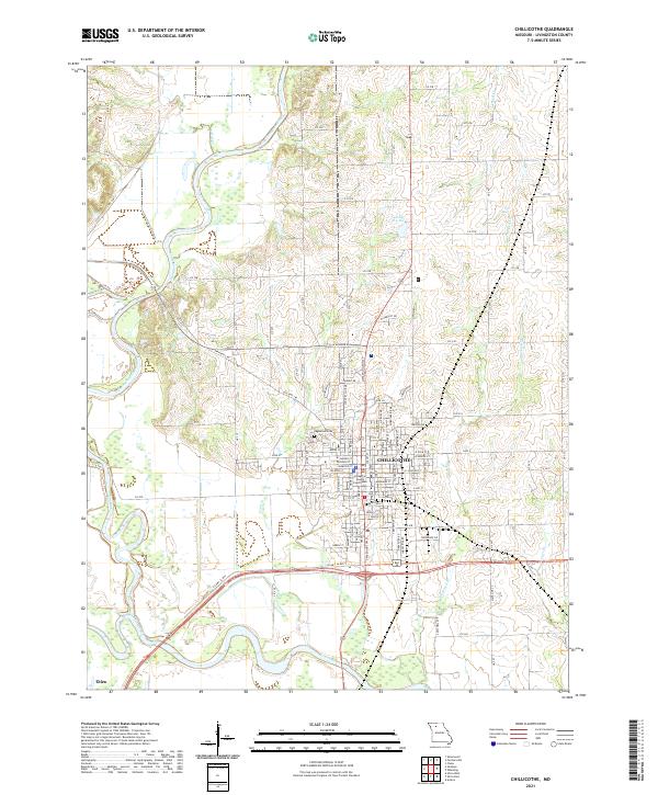 2021 Chillicothe2021 Print · USGSChillicothe and the surrounding river bottomlands are captured here in the early twenty-first century, showing the town's expansion between the rivers. Genealogists and local researchers can locate the Livingston County Courthouse, Edgewood Cem, and the nearby settlement of Utica.
End of results
Showing maps 1-4 of 4
Top cities near Utica
- Chillicothe historical maps
- Braymer historical maps
- Jamesport historical maps
- Breckenridge historical maps
- Blue Mound historical maps
- Sampsel historical maps
See more
Frequently asked questions
- What are the different types of historical maps available for Utica?
- What is the oldest map of Utica?
- Where can I purchase historical maps of Utica for my home or office?
- Where can I download high-res historical maps of Utica?
- Are there historical topographic maps available for Utica?
- Is there historical aerial imagery available for Utica?
- Where are historical maps of Utica sourced from?