1900s (20th Century) Maps of Macon County, Missouri
Explore 41 historic maps of Macon County from the 1900s (20th Century). These maps offer a rare glimpse into what life looked like during the 1900s — showing old roads, neighborhoods, homes, and landmarks that have changed or disappeared over time.
Whether you're researching your family's past, planning a metal detecting trip, or studying how Macon County's landscape evolved across the 1900s, these high-resolution maps are a powerful tool for exploring the history of this region.
- Focus on a specific era: All maps on this page are from the 1900s, giving you a focused view of this time period.
- See what’s changed: Compare century-old streets, trails, and buildings to today's modern landscape using overlays and satellite layers.
- Research with precision: Use these maps for genealogy, historical research, land use analysis, or educational projects.
- View, download, or print: Maps are fully viewable online in high resolution, and can be downloaded or printed for your own records.
Start exploring Macon County's history through authentic maps from the 1900s. This is your window into the past.
Macon County, MO maps
(41)- 1903 Map of Edina
 1903 Edina1903 Print · USGSNortheast Missouri at the turn of the century shows a bustling landscape of rail-fed market towns and river valley townships. Researchers can trace the path of the Santa Fe Railroad through Baring or locate early settlements like Pleasant Retreat and Bible Grove.2 unique versions available
 - 1908 Map of Atlanta
 1908 Atlanta1908 Print · USGSMacon County is characterized by its early twentieth-century rail and river networks, anchored by the WABASH RR. Genealogists can trace family roots through numerous rural landmarks like Sue City, Mt Tabor Church, and La Porte School.2 unique versions available
 - 1908 Map of Macon, 1965 Print
 1908 Macon1965 Print · USGSMacon County and its neighbors are seen here in the early twentieth century, as rail lines and river forks defined the local economy. Genealogists can locate family landmarks among dozens of rural schoolhouses and churches like Bethlehem Church and Prairie Dale School.
 - 1910 Map of Macon
 1910 Macon1910 Print · USGSMacon County's rural landscape is captured here in the decade before the Great War, showing a territory defined by railroad towns and isolated river mills. Genealogists can trace family roots through numerous country landmarks like Blees Military Academy, Levick Mill, and the Bear Thicket School.
 - 1937 Map of Elmer
 1937 Elmer1937 Print · USGSMacon County's rural heartland is meticulously documented in the late 1930s, showing a landscape defined by the winding Chariton River and its multiple rail lines. Genealogists can locate dozens of country schools and churches like Hopewell Sch & Ch or trace family plots at Shirley Cem and Sibel Cem.
 - 1938 Map of Kirksville
 1938 Kirksville1938 Print · USGSAdair and Macon Counties are captured here in the late 1930s, showing a landscape defined by the Chariton River and a dense network of rural schools. Trace family roots at the Grosse P.O. or through numerous landmarks like Sloans Point Sch and Novinger Cem.2 unique versions available
 - 1940 Map of Kirksville
 1940 Kirksville1940 Print · USGSAdair County and the city of Kirksville are captured just before the 1940s, showing a landscape defined by crossing railroads and numerous small townships. Genealogists can locate dozens of rural landmarks, from Union Temple Ch to long-gone schoolhouses like Troy Mills Sch and Danforth Sch.
 - 1942 Map of Elmer
 1942 Elmer1942 Print · USGSMacon County in the late thirties and early forties was a landscape of rail-connected towns and rural township schools. Researchers can trace family roots through numerous burial grounds like Shirley Cem or locate former community hubs such as Milam Chapel, Bloomington, and Kern Sch.3 unique versions available
 - 1950 Map of New Cambria West
 1950 New Cambria West1950 Print · USGSNorthwestern Macon County was a landscape of small schools and dual rail lines at mid-century. Genealogists can trace family footprints across several rural burial grounds and school districts, including St Mary Cem, Jobson Sch, and the community of Lingo.2 unique versions available
 - 1951 Map of New Boston
 1951 New Boston1951 Print · USGSNorth-central Missouri farming life is captured here in the early fifties, spanning the Linn and Macon county line. Genealogists can locate numerous rural schools and churches, including Maple Grove Sch, Union Chapel, and the North Swede Ch near the banks of Mussel Fork.2 unique versions available
 - 1953 Map of Moberly
 1953 Moberly1953 Print · USGSMid-century north-central Missouri is documented here as a bustling intersection of river commerce and heavy rail. Researchers can trace historic family-named landmarks and transport hubs from the Missouri River corridor to the rail yards of Moberly, Chillicothe, and Macon.
 - 1953 Map of Bevier South, 1955 Print
 1953 Bevier South1955 Print · USGSMacon County coal country is captured here in the mid-1950s, showing a landscape shaped by industrial mining and the rail lines that served it. Genealogists can trace family roots through rural landmarks like Keota, Ardmore, and New Salem Ch.2 unique versions available
 - 1953 Map of College Mound, 1955 Print
 1953 College Mound1955 Print · USGSRandolph and Macon Counties appear here during the mid-fifties, showing a landscape defined by coal mining and rural tradition. Researchers can trace the Bevier and Southern railroad through a massive strip mine and locate Barnhart Cem or the Crisman Sch.2 unique versions available
 - 1953 Map of Prairie Hill, 1955 Print
 1953 Prairie Hill1955 Print · USGSNorth-central Missouri farming and mining communities come into focus in the mid-1950s. Genealogists and local historians can trace family locations near Prairie Hill, Cumberland Chapel, and the now-abandoned Old Grove Ch (Abandoned).2 unique versions available
 - 1953 Map of Lagonda, 1955 Print
 1953 Lagonda1955 Print · USGSThe border of Macon and Chariton Counties in the early fifties shows a landscape of small farming communities defined by the winding paths of the Old Channel Chariton River. Researchers can trace rural school locations like Minefree School and find family burial sites at Rice Cemetery or Dodson Cemetery.2 unique versions available
 - 1953 Map of Wien, 1955 Print
 1953 Wien1955 Print · USGSChariton and Macon counties are shown in the early 1950s, a period when rural schoolhouses and country churches still anchored the Missouri landscape. Genealogists can trace family footprints at St Marys Cem or locate former local landmarks like Raub Sch and Plainview Ch.2 unique versions available
 - 1954 Map of Centerville, 1967 Print
 1954 Centerville1967 Print · USGSThe Iowa-Missouri borderlands at mid-century reveal a landscape shaped by river valleys and the height of the regional rail network. Genealogists and historians can trace the paths of the Wabash railroad and locate old townsites like Mystic, Moulton, and Greentop.3 unique versions available
 - 1954 Map of Moberly, 1969 Print
 1954 Moberly1969 Print · USGSMid-century Missouri is captured here during a period of transition for its river towns and rail hubs. Genealogists and historians can trace the paths of the Wabash railroad through Moberly or explore the riverside layout of Lexington and Brunswick.3 unique versions available
 - 1957 Map of Moberly
 1957 Moberly1957 Print · USGSNorth-central Missouri in the late nineteen-forties and fifties remains a landscape defined by its great rivers and a dense network of steam and diesel rail lines. Genealogists and historians can trace the paths of the Wabash RR and Santa Fe RR through historic junctions like Moberly, Brookfield, and Macon.
 - 1957 Map of Centerville
 1957 Centerville1957 Print · USGSThe Iowa-Missouri borderlands in the mid-fifties reveal a landscape of river-valley agriculture and vital rail corridors. Genealogists and historians can trace family-named landmarks and small-town growth in Centerville, Kirksville, and along the Wabash railroad line.
 - 1958 Map of Centerville
 1958 Centerville1958 Print · USGSThe Iowa-Missouri borderlands come into focus during the mid-fifties, showing a landscape defined by river valleys and intersecting rail lines. Genealogists and local historians can trace family roots through dozens of rural hubs like Bloomfield, Unionville, and Corydon.
 - 1960 Map of Moberly
 1960 Moberly1960 Print · USGSCentral Missouri comes alive in the mid-twentieth century as a bustling network of river towns and significant rail corridors. Genealogists and historians can trace the paths of the Wabash RR through Moberly or explore the riverfronts of Lexington and Brunswick.
 - 1963 Map of Nind, 1965 Print
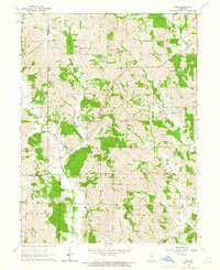 1963 Nind1965 Print · USGSNorth central Missouri agriculture and small-town life are documented here during the early sixties. Genealogists can locate family landmarks like Hall Cem, Mt Carmel Ch, and the rural Willow Branch Sch near the county lines.
 - 1965 Map of Locust Hill, 1967 Print
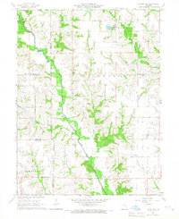 1965 Locust Hill1967 Print · USGSNortheast Missouri farmland meets the winding North Fork Salt River in this mid-sixties survey of the Knox County border. Genealogists and local historians can trace family ties at Locust Hill Cem or follow the path of the Old Railroad Grade.
 - 1966 Map of La Plata, 1967 Print
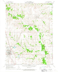 1966 La Plata1967 Print · USGSLa Plata and the surrounding Missouri countryside are captured in the mid-1960s at the height of its dual-railroad era. Researchers can trace the junction of the Atchison Topeka and Santa Fe and Norfolk and Western, alongside local landmarks like Santa Fe Lake and Gibbs Union Cem.
Showing maps 1-25 of 41
Top cities of Macon County
- Macon historical maps
- La Plata historical maps
- Bevier historical maps
- Callao historical maps
- New Cambria historical maps
- Ethel historical maps
See more
Frequently asked questions
- What are the different types of historical maps available for Macon County?
- What is the oldest map of Macon County?
- Where can I purchase historical maps of Macon County for my home or office?
- Where can I download high-res historical maps of Macon County?
- Are there historical topographic maps available for Macon County?
- Is there historical aerial imagery available for Macon County?
- Where are historical maps of Macon County sourced from?