1900s (20th Century) Maps of New Cambria, Missouri
Explore 9 historic maps of New Cambria from the 1900s (20th Century). These maps offer a rare glimpse into what life looked like during the 1900s — showing old roads, neighborhoods, homes, and landmarks that have changed or disappeared over time.
Whether you're researching your family's past, planning a metal detecting trip, or studying how New Cambria's landscape evolved across the 1900s, these high-resolution maps are a powerful tool for exploring the history of this region.
- Focus on a specific era: All maps on this page are from the 1900s, giving you a focused view of this time period.
- See what’s changed: Compare century-old streets, trails, and buildings to today's modern landscape using overlays and satellite layers.
- Research with precision: Use these maps for genealogy, historical research, land use analysis, or educational projects.
- View, download, or print: Maps are fully viewable online in high resolution, and can be downloaded or printed for your own records.
Start exploring New Cambria's history through authentic maps from the 1900s. This is your window into the past.
New Cambria, MO maps
(9)- 1937 Map of Elmer
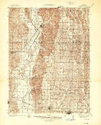 1937 Elmer1937 Print · USGSMacon County's rural heartland is meticulously documented in the late 1930s, showing a landscape defined by the winding Chariton River and its multiple rail lines. Genealogists can locate dozens of country schools and churches like Hopewell Sch & Ch or trace family plots at Shirley Cem and Sibel Cem.
 - 1942 Map of Elmer
 1942 Elmer1942 Print · USGSMacon County in the late thirties and early forties was a landscape of rail-connected towns and rural township schools. Researchers can trace family roots through numerous burial grounds like Shirley Cem or locate former community hubs such as Milam Chapel, Bloomington, and Kern Sch.3 unique versions available
 - 1950 Map of New Cambria West
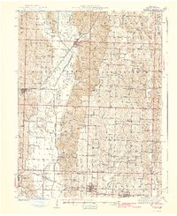
 1950 New Cambria West1950 Print · USGSNorthwestern Macon County was a landscape of small schools and dual rail lines at mid-century. Genealogists can trace family footprints across several rural burial grounds and school districts, including St Mary Cem, Jobson Sch, and the community of Lingo.2 unique versions available
 - 1953 Map of Moberly
 1953 Moberly1953 Print · USGSMid-century north-central Missouri is documented here as a bustling intersection of river commerce and heavy rail. Researchers can trace historic family-named landmarks and transport hubs from the Missouri River corridor to the rail yards of Moberly, Chillicothe, and Macon.
 - 1954 Map of Moberly, 1969 Print
 1954 Moberly1969 Print · USGSMid-century Missouri is captured here during a period of transition for its river towns and rail hubs. Genealogists and historians can trace the paths of the Wabash railroad through Moberly or explore the riverside layout of Lexington and Brunswick.3 unique versions available
 - 1957 Map of Moberly
 1957 Moberly1957 Print · USGSNorth-central Missouri in the late nineteen-forties and fifties remains a landscape defined by its great rivers and a dense network of steam and diesel rail lines. Genealogists and historians can trace the paths of the Wabash RR and Santa Fe RR through historic junctions like Moberly, Brookfield, and Macon.
 - 1960 Map of Moberly
 1960 Moberly1960 Print · USGSCentral Missouri comes alive in the mid-twentieth century as a bustling network of river towns and significant rail corridors. Genealogists and historians can trace the paths of the Wabash RR through Moberly or explore the riverfronts of Lexington and Brunswick.
 - 1979 Map of New Cambria East
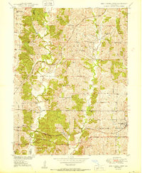
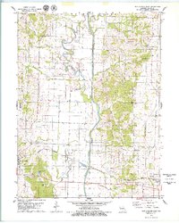 1979 New Cambria East1979 Print · USGSMacon County in the late seventies is marked by the transformation of the Chariton River and its floodplains. Researchers can find old rural landmarks like Chariton Ch, Mt Zion Cem, and the path of the Burlington Northern railroad through Callao.
 - 1981 Map of Macon
 1981 Macon1981 Print · USGSNorthern Missouri's rail-and-river landscape is captured here in the early eighties, centered on the crossroads of Macon. Researchers can trace old cemetery sites like St Marys Cem, local landmarks such as College Mound, and the routes of the Burlington Northern railroad.
End of results
Showing maps 1-9 of 9
Top cities near New Cambria
- Marceline historical maps
- Bevier historical maps
- Bucklin historical maps
- Callao historical maps
- Ethel historical maps
- Elmer historical maps
Frequently asked questions
- What are the different types of historical maps available for New Cambria?
- What is the oldest map of New Cambria?
- Where can I purchase historical maps of New Cambria for my home or office?
- Where can I download high-res historical maps of New Cambria?
- Are there historical topographic maps available for New Cambria?
- Is there historical aerial imagery available for New Cambria?
- Where are historical maps of New Cambria sourced from?