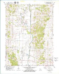
1979 Map of New Cambria East
USGS Topo · Published 1979About this map
New Cambria and Callao anchor this mid-1970s landscape, which is defined by the engineered transition of the Chariton River. The map clearly illustrates the contrast between the natural, meandering loops of the Old Channel and the modern, straightened river course that now bisects the Chariton Valley. This change in hydrology altered the surrounding bottomlands, though numerous tributary streams like White Oak Creek, Painter Creek, and Stinking Creek still drain the undulating uplands.
Find a feature on this map
39 named features on this map. Tap any name to fly to it.
Don’t see what you’re looking for? This feature index may not catch every label — zoom into the map to look around manually.
Map Details
Editions of this 1979 New Cambria East Map
This is the sole edition of this map. No revisions or reprints were ever made.
Other maps of this area

1937 · Elmer
USGS Topo · 1:48,000

1942 · Elmer
USGS Topo · 1:62,500

1950 · New Cambria West
USGS Topo · 1:24,000

1951 · New Boston
USGS Topo · 1:24,000

1953 · Moberly
USGS Topo · 1:250,000

1953 · Bevier South
USGS Topo · 1:24,000

1953 · Lagonda
USGS Topo · 1:24,000

1953 · Wien
USGS Topo · 1:24,000

1954 · Moberly
USGS Topo · 1:250,000

1957 · Moberly
USGS Topo · 1:250,000