
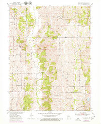
1951 Map of New Boston
USGS Topo · Published 1951About this map
Mussel Fork meanders through this portion of north-central Missouri, marking a landscape defined by small-scale farming and rural education at the start of the 1950s. The region is densely populated with community landmarks, particularly country schools like Nagel Sch and People Sch that served the dispersed agricultural families of Macon Co and Linn Co. The settlement of New Boston and the village of Goldsberry serve as local hubs, while the Atchison Topeka and Santa Fe railroad cuts across the southeastern corner near Ethel Lake. This survey illustrates the intricate social geography of the era, where family and faith were anchored by sites such as Union Chapel, North Swede Ch, and White Cem, most of which were accessible only by the network of unimproved roads that crisscross the drainage of Little Brush Creek.
Find a feature on this map
30 named features on this map. Tap any name to fly to it.
Don’t see what you’re looking for? This feature index may not catch every label — zoom into the map to look around manually.
Map Details
Editions of this 1951 New Boston Map
2 editions found
Other maps of this area

1937 · Elmer
USGS Topo · 1:48,000

1938 · Kirksville
USGS Topo · 1:62,500

1940 · Kirksville
USGS Topo · 1:62,500

1942 · Elmer
USGS Topo · 1:62,500

1949 · Bucklin
USGS Topo · 1:24,000

1949 · Bucklin NW
USGS Topo · 1:24,000

1950 · Bucklin
USGS Topo · 1:24,000

1950 · New Cambria West
USGS Topo · 1:24,000

1950 · Bucklin NW
USGS Topo · 1:24,000

1953 · Moberly
USGS Topo · 1:250,000