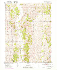
1951 Map of New Boston
USGS Topo · Published 1979About this map
Mussel Fork and its winding tributaries dominate this landscape on the border of Linn and Macon Counties. Compiled from 1930s aerial photography and surveyed in the late 1940s, the map illustrates a rural Missouri environment defined by small schoolhouses and country churches. Significant local landmarks include North Swede Ch, Union Chapel, and Helton Ch, alongside community education centers like Green Sch and Fairview Sch.
Find a feature on this map
24 named features on this map. Tap any name to fly to it.
Don’t see what you’re looking for? This feature index may not catch every label — zoom into the map to look around manually.
Map Details
Editions of this 1951 New Boston Map
2 editions found
Other maps of this area

1937 · Elmer
USGS Topo · 1:48,000

1938 · Kirksville
USGS Topo · 1:62,500

1940 · Kirksville
USGS Topo · 1:62,500

1942 · Elmer
USGS Topo · 1:62,500

1949 · Bucklin
USGS Topo · 1:24,000

1949 · Bucklin NW
USGS Topo · 1:24,000

1950 · Bucklin
USGS Topo · 1:24,000

1950 · New Cambria West
USGS Topo · 1:24,000

1950 · Bucklin NW
USGS Topo · 1:24,000

1951 · New Boston
USGS Topo · 1:24,000