
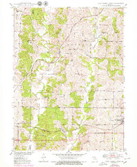
1950 Map of New Cambria West
USGS Topo · Published 1950About this map
Mussel Fork and Painter Creek dictate the topography of this rural landscape spanning the Linn and Macon County line. The mid-century settlement pattern is defined by a dense network of country schools such as Lundy Sch, Zion Sch, and Boone Sch, which served the farming communities surrounding Hart and Lingo. The southern portion of the map is dominated by the heavy rail infrastructure of the Chicago Burlington and Quincy railroad, which passes through Lingo toward the village of New Cambria. Further north, the Atchison Topeka and Santa Fe line cuts across the drainage of Dutch Creek. These competing rail lines provided vital connections for this agricultural region, while spiritual and social life centered on landmarks like Mission Covenant Ch and Mt Zion Ch.
Find a feature on this map
32 named features on this map. Tap any name to fly to it.
Don’t see what you’re looking for? This feature index may not catch every label — zoom into the map to look around manually.
Map Details
Editions of this 1950 New Cambria West Map
2 editions found
Other maps of this area

1937 · Elmer
USGS Topo · 1:48,000

1942 · Elmer
USGS Topo · 1:62,500

1949 · Bucklin
USGS Topo · 1:24,000

1949 · Bucklin NW
USGS Topo · 1:24,000

1950 · Bucklin
USGS Topo · 1:24,000

1950 · Bucklin NW
USGS Topo · 1:24,000

1951 · New Boston
USGS Topo · 1:24,000

1953 · Moberly
USGS Topo · 1:250,000

1953 · Marceline
USGS Topo · 1:24,000

1953 · Lagonda
USGS Topo · 1:24,000