
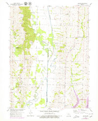
1953 Map of Lagonda
USGS Topo · Published 1955About this map
The Old Channel Chariton River winds through the borderlands of Macon and Chariton Counties, illustrating a landscape of shifting waterways and rural infrastructure in the early 1950s. This agricultural region is dotted with small community centers like Lagonda and Kaseyville, which were once anchored by numerous local schoolhouses and family cemeteries. The mapping of the Old Channel alongside newer river segments highlights significant topographical changes during this era of Missouri River Basin development.
Find a feature on this map
28 named features on this map. Tap any name to fly to it.
Don’t see what you’re looking for? This feature index may not catch every label — zoom into the map to look around manually.
Map Details
Editions of this 1953 Lagonda Map
2 editions found
Other maps of this area

1937 · Elmer
USGS Topo · 1:48,000

1942 · Elmer
USGS Topo · 1:62,500

1950 · New Cambria West
USGS Topo · 1:24,000

1953 · Moberly
USGS Topo · 1:250,000

1953 · Bevier South
USGS Topo · 1:24,000

1953 · College Mound
USGS Topo · 1:24,000

1953 · Prairie Hill
USGS Topo · 1:24,000

1953 · Wien
USGS Topo · 1:24,000

1953 · Bynumville
USGS Topo · 1:24,000

1954 · Moberly
USGS Topo · 1:250,000