
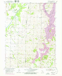
1953 Map of Prairie Hill
USGS Topo · Published 1955About this map
Prairie Hill and the surrounding rural townships of north-central Missouri appear here during the mid-1950s, a period defined by the meandering courses of the Chariton River and its multiple forks. The landscape is deeply tied to its water systems, notably the Old Channel Chariton River and the Middle Fork Chariton River, which together with Mussel Fork create a complex network of drainage across the Chariton and Wayland districts. The transition from prairie to river bottom is marked by agricultural activity and small-scale industry, evidenced by a Mine located near the town of Thomas Hill.
Find a feature on this map
33 named features on this map. Tap any name to fly to it.
Don’t see what you’re looking for? This feature index may not catch every label — zoom into the map to look around manually.
Map Details
Editions of this 1953 Prairie Hill Map
2 editions found
Other maps of this area

1890 · Glasgow
USGS Topo · 1:125,000

1953 · Moberly
USGS Topo · 1:250,000

1953 · Huntsville
USGS Topo · 1:24,000

1953 · Bevier South
USGS Topo · 1:24,000

1953 · College Mound
USGS Topo · 1:24,000

1953 · Clifton Hill
USGS Topo · 1:24,000

1953 · Lagonda
USGS Topo · 1:24,000

1953 · Wien
USGS Topo · 1:24,000

1953 · Bynumville
USGS Topo · 1:24,000

1954 · Moberly
USGS Topo · 1:250,000