
1953 Map of Clifton Hill
USGS Topo · Published 1955About this map
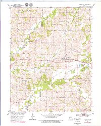
The town of Clifton Hill serves as the central hub of this mid-century survey, situated along the Wabash railroad line. The landscape is defined by the winding course of the Chariton River and its multiple branches, including the Middle Fork Chariton River and East Fork Chariton River. This period of Missouri history shows a rural education system in transition, as both the Washington Sch and Lee Sch are marked as abandoned, while the Vaughn Sch and Smith Sch remain active. Local genealogy is well-preserved through numerous family-named landmarks such as Richardson Cem, Finnell Cem, and Johnson Cem. The boundary between Chariton and Randolph Counties bisects the river bottomlands, illustrating how the meandering waterways historically shaped local political borders and agricultural property lines.
Find a feature on this map
27 named features on this map. Tap any name to fly to it.
Don’t see what you’re looking for? This feature index may not catch every label — zoom into the map to look around manually.
Map Details
Editions of this 1953 Clifton Hill Map
2 editions found
Other maps of this area

1890 · Glasgow
USGS Topo · 1:125,000

1953 · Moberly
USGS Topo · 1:250,000

1953 · Huntsville
USGS Topo · 1:24,000

1953 · Higbee
USGS Topo · 1:24,000

1953 · College Mound
USGS Topo · 1:24,000

1953 · Armstrong
USGS Topo · 1:24,000

1953 · Prairie Hill
USGS Topo · 1:24,000

1953 · Bynumville
USGS Topo · 1:24,000

1954 · Moberly
USGS Topo · 1:250,000
1956 · Salisbury
USGS Topo · 1:24,000