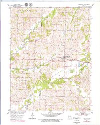
1953 Map of Clifton Hill
USGS Topo · Published 1979About this map
The Little Chariton River and its various forks define the topography of this Randolph and Chariton County boundary region. In the mid-century, the Clifton Hill settlement served as a central hub along the Wabash railroad line, surrounded by a landscape of small rural schools and family cemeteries. Significant local history is preserved in the locations of the Vaughn Sch and Smith Sch, alongside several named burial grounds like the Richardson Cem and Gross Cem. The map reveals a highly structured rural society, with township boundaries for Clifton, Salisbury, and Silver Creek delineating the landscape. Transport and water are inextricably linked here, with the East Fork Little Chariton River and Silver Creek feeding into the larger river system, supporting the agricultural life of the era before modern highway expansion dominated the corridor.
Find a feature on this map
24 named features on this map. Tap any name to fly to it.
Don’t see what you’re looking for? This feature index may not catch every label — zoom into the map to look around manually.
Map Details
Editions of this 1953 Clifton Hill Map
2 editions found
Other maps of this area

1890 · Glasgow
USGS Topo · 1:125,000

1953 · Moberly
USGS Topo · 1:250,000

1953 · Huntsville
USGS Topo · 1:24,000

1953 · Higbee
USGS Topo · 1:24,000

1953 · College Mound
USGS Topo · 1:24,000

1953 · Armstrong
USGS Topo · 1:24,000

1953 · Clifton Hill
USGS Topo · 1:24,000

1953 · Prairie Hill
USGS Topo · 1:24,000

1953 · Bynumville
USGS Topo · 1:24,000

1954 · Moberly
USGS Topo · 1:250,000