
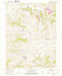
1953 Map of Armstrong
USGS Topo · Published 1955About this map
The town of Armstrong and the nearby village of Roanoke anchor this 1953 survey, which highlights the agrarian and industrial landscape of north-central Missouri. Situated at the junction of Chariton, Randolph, and Howard counties, the area is defined by the Gulf Mobile and Ohio RR, which cuts diagonally across the terrain through Prairie and Silver Creek townships. This rail corridor was the primary artery for the region's movement of goods, including materials from a Quarry located near Silver Creek.
Find a feature on this map
22 named features on this map. Tap any name to fly to it.
Don’t see what you’re looking for? This feature index may not catch every label — zoom into the map to look around manually.
Map Details
Editions of this 1953 Armstrong Map
2 editions found
Other maps of this area

1890 · Glasgow
USGS Topo · 1:125,000

1947 · Glasgow
USGS Topo · 1:62,500

1953 · Moberly
USGS Topo · 1:250,000

1953 · Fayette
USGS Topo · 1:24,000

1953 · Burton
USGS Topo · 1:24,000

1953 · Huntsville
USGS Topo · 1:24,000

1953 · Higbee
USGS Topo · 1:24,000

1953 · Clifton Hill
USGS Topo · 1:24,000

1954 · Moberly
USGS Topo · 1:250,000
1956 · Salisbury
USGS Topo · 1:24,000