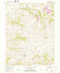
1953 Map of Armstrong
USGS Topo · Published 1979About this map
Armstrong and Roanoke anchor this central Missouri landscape at a time when small agricultural hubs were intricately connected by rail and rural institutions. The Gulf Mobile and Ohio railroad cuts diagonally across the terrain, passing through the heart of Armstrong and providing a vital link for the surrounding townships of Prairie, Silver Creek, and Burton. Local life is marked by the presence of the Butner Sch and the Wesley Chapel Cem, along with a Quarry that suggests local industrial activity.
Find a feature on this map
24 named features on this map. Tap any name to fly to it.
Don’t see what you’re looking for? This feature index may not catch every label — zoom into the map to look around manually.
Map Details
Editions of this 1953 Armstrong Map
2 editions found
Other maps of this area

1890 · Glasgow
USGS Topo · 1:125,000

1947 · Glasgow
USGS Topo · 1:62,500

1953 · Moberly
USGS Topo · 1:250,000

1953 · Fayette
USGS Topo · 1:24,000

1953 · Burton
USGS Topo · 1:24,000

1953 · Huntsville
USGS Topo · 1:24,000

1953 · Higbee
USGS Topo · 1:24,000

1953 · Armstrong
USGS Topo · 1:24,000

1953 · Clifton Hill
USGS Topo · 1:24,000

1954 · Moberly
USGS Topo · 1:250,000