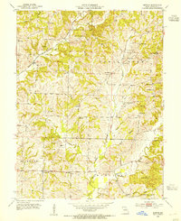
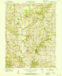
1953 Map of Burton
USGS Topo · Published 1954About this map
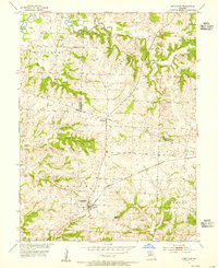
The Missouri Kansas and Texas railroad corridor bisects the township of Burton, serving as a central artery for this rural agricultural landscape in the mid-1950s. The terrain is deeply carved by the Texas Fork Salt Creek and the meandering Hungry Mother Creek, which define the boundaries of local life and movement. Settlement patterns follow these natural drainages and ridge lines, dotted with a dense network of country institutions such as Log Chapel, Bethel Ch, and the Myers High Sch. A significant number of family and institutional burial grounds, including the County Infirmary Cem and Marion Cem, are scattered across the quadrangle, reflecting generations of local family history. Small crossroads communities like Punkin Center and Sebree provide anchor points for the surrounding farmsteads and the various Inactive Mines located near the southern border.
Find a feature on this map
52 named features on this map. Tap any name to fly to it.
Don’t see what you’re looking for? This feature index may not catch every label — zoom into the map to look around manually.
Map Details
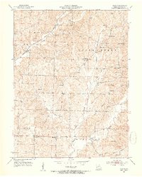
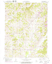
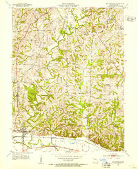
Editions of this 1953 Burton Map
3 editions found
Other maps of this area

1890 · Moberly
USGS Topo · 1:125,000

1890 · Glasgow
USGS Topo · 1:125,000

1917 · Sturgeon
USGS Topo · 1:62,500
1952 · New Franklin
USGS Topo · 1:24,000
1952 · Hilldale
USGS Topo · 1:24,000

1953 · Moberly
USGS Topo · 1:250,000
1953 · Fayette
USGS Topo · 1:24,000
1953 · Renick
USGS Topo · 1:24,000
1953 · Higbee
USGS Topo · 1:24,000
1953 · Armstrong
USGS Topo · 1:24,000