
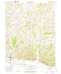
1952 Map of New Franklin
USGS Topo · Published 1953About this map
New Franklin anchors the southwestern corner of this mid-century Missouri landscape, where the Missouri Kansas Texas railroad parallels the modern Levee near the Missouri River. The area is characterized by a dense network of one-room schoolhouses that once served rural Howard County families, including Spanish Needles Sch, White Hall Sch, and Gray Sch. While the southern plains are managed by water control infrastructure, the northern uplands remain deeply dissected by Salt Creek and Bonne Femme Creek. This 1952 field-checked survey reveals the social geography of the era, marked by centers of community life like Mt Zion Ch and Mt Zion Sch. Further north, the settlement of Estill sits along the rail line, while local history is preserved in sites like Mt Pleasant Cem and the Robinson Cem.
Find a feature on this map
34 named features on this map. Tap any name to fly to it.
Don’t see what you’re looking for? This feature index may not catch every label — zoom into the map to look around manually.
Map Details
Editions of this 1952 New Franklin Map
2 editions found
Other maps of this area

1888 · Boonville
USGS Topo · 1:125,000

1890 · Glasgow
USGS Topo · 1:125,000

1947 · Glasgow
USGS Topo · 1:62,500

1947 · Jefferson City
USGS Topo · 1:250,000

1952 · Rocheport
USGS Topo · 1:24,000

1952 · Boonville
USGS Topo · 1:24,000

1952 · Hilldale
USGS Topo · 1:24,000

1953 · Moberly
USGS Topo · 1:250,000

1953 · Fayette
USGS Topo · 1:24,000

1953 · Billingsville
USGS Topo · 1:24,000