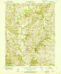
1952 Map of Hilldale
USGS Topo · Published 1953About this map
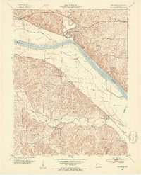
Moniteau Creek winds through a heavily dissected agricultural landscape along the boundary of Howard Co and Boone Co in the early 1950s. The region is characterized by a high density of rural schoolhouses and neighborhood churches, reflecting a tightly-knit mid-century farming community. Small rural hubs like Hilldale and Ashland serve as local anchors, while the land is shaped by the drainage patterns of Hunters Creek, Salt Creek, and Prairie Creek.
Find a feature on this map
25 named features on this map. Tap any name to fly to it.
Don’t see what you’re looking for? This feature index may not catch every label — zoom into the map to look around manually.
Map Details
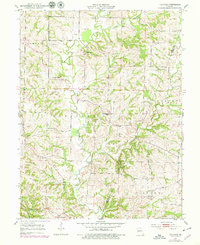
Editions of this 1952 Hilldale Map
2 editions found
Other maps of this area

1886 · Jefferson City
USGS Topo · 1:125,000

1888 · Boonville
USGS Topo · 1:125,000

1890 · Moberly
USGS Topo · 1:125,000

1890 · Glasgow
USGS Topo · 1:125,000

1894 · Jefferson City
USGS Topo · 1:125,000

1917 · Sturgeon
USGS Topo · 1:62,500

1947 · Jefferson City
USGS Topo · 1:250,000
1948 · Columbia
USGS Topo · 1:62,500
1950 · Columbia
USGS Topo · 1:62,500
1952 · Rocheport
USGS Topo · 1:24,000