
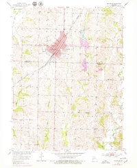
1953 Map of Marceline
USGS Topo · Published 1955About this map
The Atchison Topeka and Santa Fe railroad bisects the landscape on a southwest-to-northeast diagonal, anchoring the development of Marceline in the mid-1950s. This industrial corridor is marked by oil tanks and a network of urban streets including Chicago Ave and Graceland Ave. To the west, the topography is defined by the winding course of Yellow Creek, while the eastern portion of the quadrangle transitions into the drainage basins of Mussel Fork and Locust Creek.
Find a feature on this map
35 named features on this map. Tap any name to fly to it.
Don’t see what you’re looking for? This feature index may not catch every label — zoom into the map to look around manually.
Map Details
Editions of this 1953 Marceline Map
2 editions found
Other maps of this area

1946 · Brookfield
USGS Topo · 1:62,500

1948 · Brookfield
USGS Topo · 1:62,500

1949 · Indian Grove
USGS Topo · 1:24,000

1949 · Rothville
USGS Topo · 1:24,000

1949 · Bucklin
USGS Topo · 1:24,000

1950 · Bucklin
USGS Topo · 1:24,000

1950 · New Cambria West
USGS Topo · 1:24,000

1950 · Rothville
USGS Topo · 1:24,000

1953 · Moberly
USGS Topo · 1:250,000

1953 · Wien
USGS Topo · 1:24,000