2020s Maps of Mercer County, Missouri
Explore 15 historic maps of Mercer County from the 2020s. These maps offer a rare glimpse into what life looked like during the 2020s — showing old roads, neighborhoods, homes, and landmarks that have changed or disappeared over time.
Whether you're researching your family's past, planning a metal detecting trip, or studying how Mercer County's landscape evolved across the 2020s, these high-resolution maps are a powerful tool for exploring the history of this region.
- Focus on a specific era: All maps on this page are from the 2020s, giving you a focused view of this time period.
- See what’s changed: Compare century-old streets, trails, and buildings to today's modern landscape using overlays and satellite layers.
- Research with precision: Use these maps for genealogy, historical research, land use analysis, or educational projects.
- View, download, or print: Maps are fully viewable online in high resolution, and can be downloaded or printed for your own records.
Start exploring Mercer County's history through authentic maps from the 2020s. This is your window into the past.
Mercer County, MO maps
(15)- 2021 Map of Modena, 2021 Print
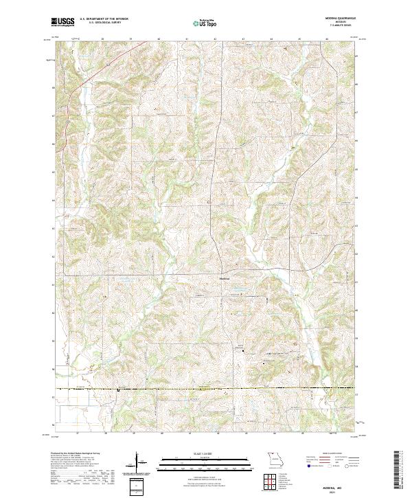 2021 Modena2021 Print · USGSThis rural Missouri landscape at the Mercer and Grundy county line illustrates a classic Midwestern pattern of small settlements and family-named roads. Researchers can trace local roots at Old Union Cem and Wild Cem or locate old water features like Dean Lake.
 - 2021 Map of Powersville, 2021 Print
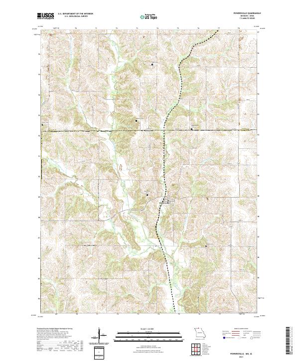 2021 Powersville2021 Print · USGSThe Missouri-Iowa borderlands near the start of the 2020s remain a landscape of quiet rural townships and winding creek forks. Local historians can trace family roots through numerous burial sites like Powersville Cemetery, Greer Cemetery, and the remote Wyreka Cemetery.
 - 2021 Map of Mill Grove, 2021 Print
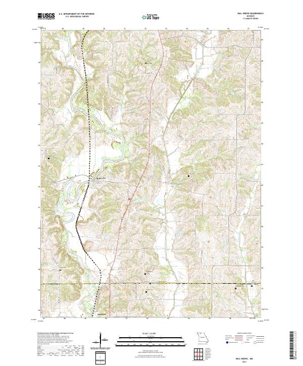 2021 Mill Grove2021 Print · USGSNorth-central Missouri farmlands are captured here in the early twenty-first century, spanning the border of Mercer and Grundy counties. Genealogists can trace family roots through numerous local burial sites like Middleberry Cem, Wyatt Cem, and Coon Cem near Mill Grove.
 - 2021 Map of Ravanna, 2021 Print
 2021 Ravanna2021 Print · USGSNorth Missouri agricultural life is well preserved in this recent survey of Mercer County. Genealogists and local historians can trace family locations through numerous sites like Ravanna Cem, Weesner Cem, and the community of Ravanna.
 - 2021 Map of Harris, 2021 Print
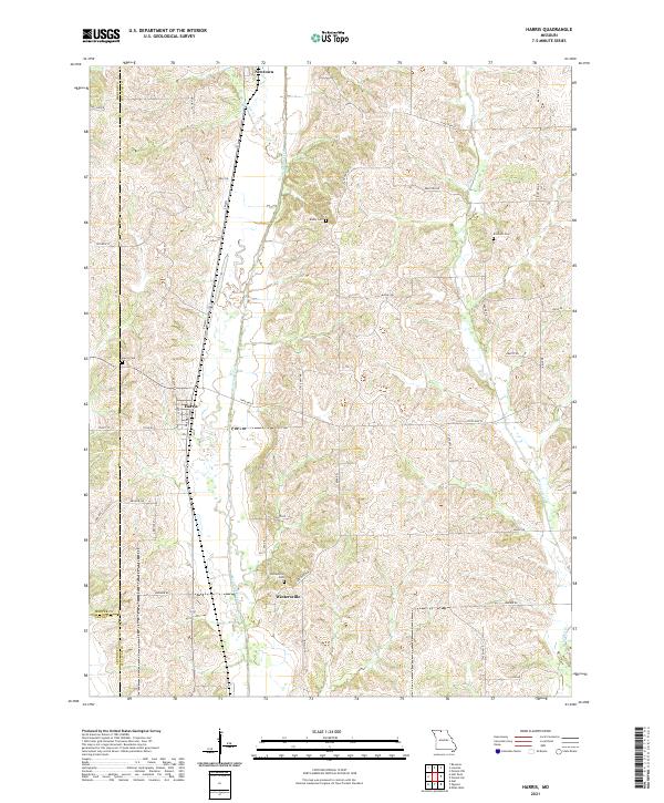 2021 Harris2021 Print · USGSSullivan and Mercer counties meet in this agricultural landscape as it appeared in the early 2020s. Genealogists and local researchers can locate family sites like Busby Cemetery and the settlements of Harris and Wintersville along the banks of Medicine Creek.
 - 2021 Map of Goshen, 2021 Print
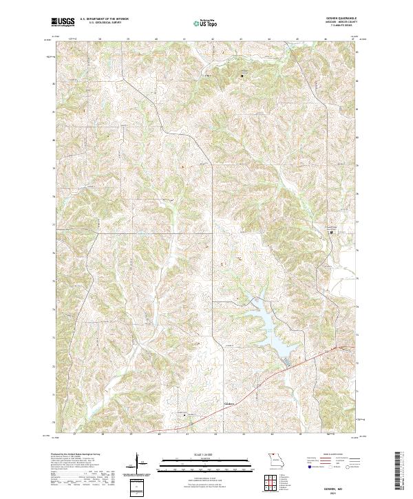 2021 Goshen2021 Print · USGSThe rural landscape of Mercer County comes to life in this survey of the northern Missouri countryside. Genealogists can trace family roots at Goshen Cem, Pleasant Hill Cem, and the historic Pleasant Ridge Church Cem.
 - 2021 Map of Akron, 2021 Print
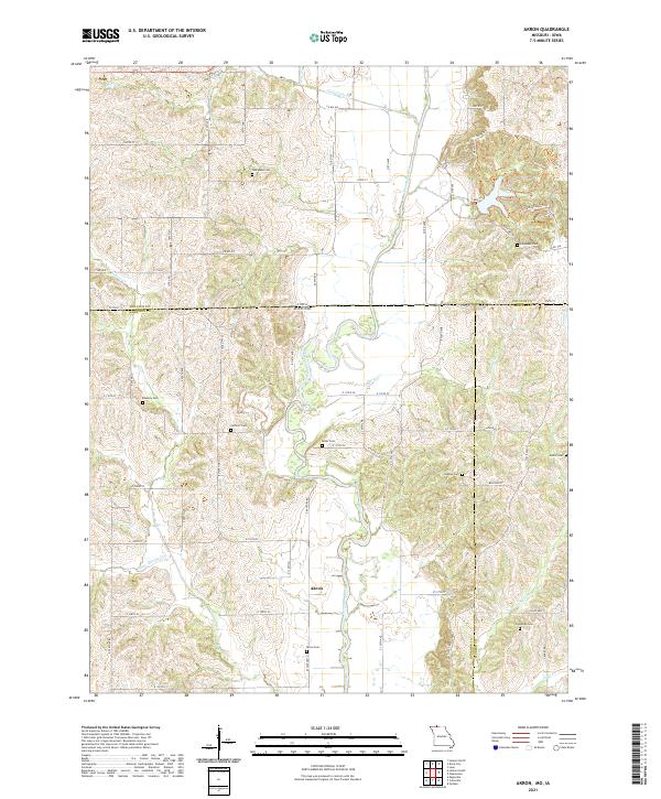 2021 Akron2021 Print · USGSThe Missouri-Iowa borderlands come to life in this survey of the northern reaches of the state. Genealogists and local historians can trace family roots through a dense network of burial sites, including New Buda Cem, Akron Cem, and Catholic Cem.
 - 2021 Map of Princeton, 2021 Print
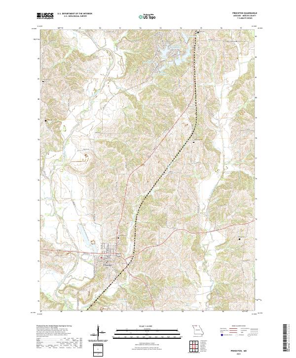 2021 Princeton2021 Print · USGSPrinceton and the surrounding Mercer County countryside are captured here in the early twenty-first century. Genealogists can trace family roots through several local landmarks like Princeton Cem, Underwood Cem, and the Mercer County Courthouse.
 - 2021 Map of Half Rock, 2021 Print
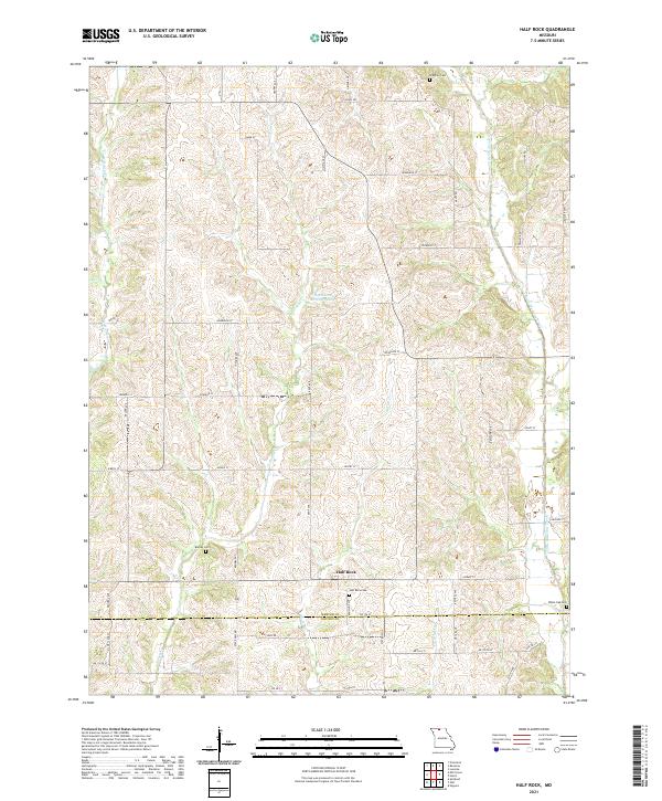 2021 Half Rock2021 Print · USGSNorth Missouri farmland near the Mercer and Grundy county line is captured here in the early 2020s. Researchers can locate family roots at Half Rock Cemetery or Brantley Cemetery and trace the winding paths of Little Medicine Creek.
 - 2021 Map of Mount Moriah, 2021 Print
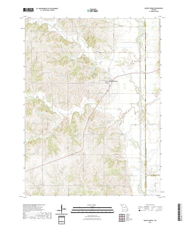 2021 Mount Moriah2021 Print · USGSHarrison County farmland and the Thompson River valley are captured in this recent survey of northern Missouri. Trace local family history at Mount Moriah Cem and Lloyd Cem, or explore the many small waters like Hamilton Lake and G Pitts Lake.
 - 2021 Map of Cainsville, 2021 Print
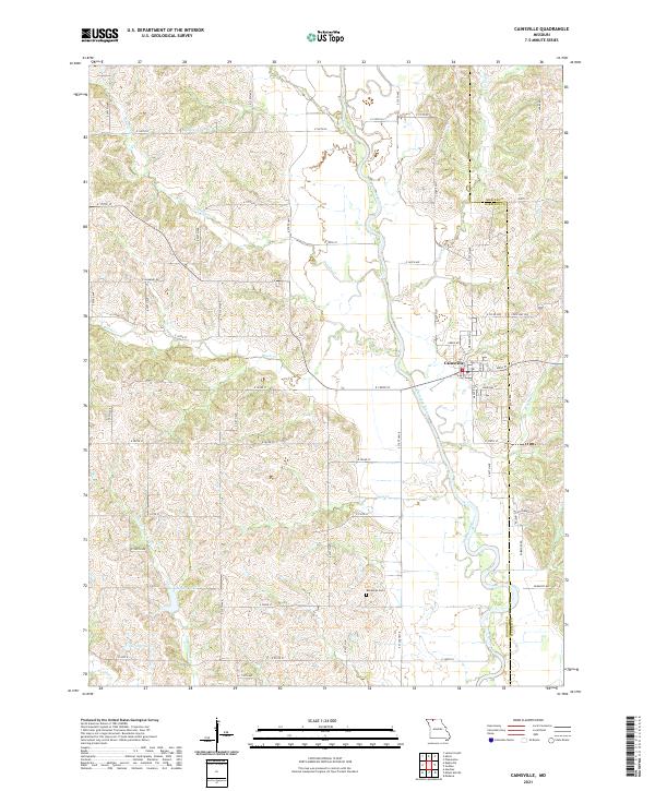 2021 Cainsville2021 Print · USGSCainsville and the surrounding farm country on the Harrison-Mercer county line are documented here in the early 2020s. Researchers can trace family ties and rural land use along the Thompson River valley, identifying landmarks like the Bohemian Cem and Grants Lake.
 - 2021 Map of Lucerne, 2021 Print
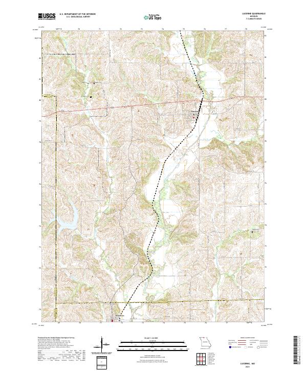 2021 Lucerne2021 Print · USGSNorth Missouri’s rolling creek valleys and rural crossroads are captured in this recent survey of the Putnam and Sullivan County border. Researchers can locate family sites and cemeteries like Old Busby Cemetery or trace the winding course of Medicine Creek.
 - 2021 Map of Cleopatra, 2021 Print
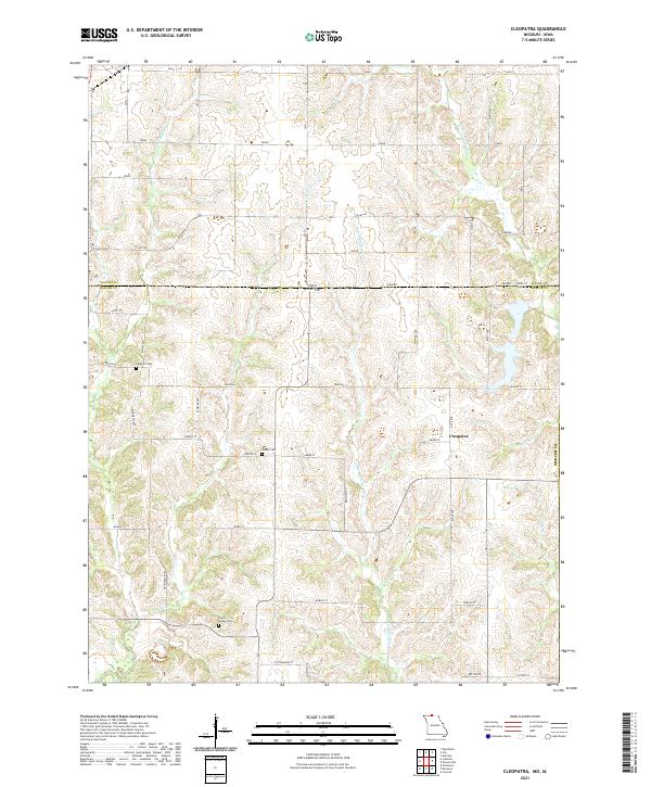 2021 Cleopatra2021 Print · USGSThe Missouri-Iowa border comes into focus in this recent survey of the rural landscape surrounding the settlement of Cleopatra. Genealogists and historians can locate family landmarks like Laughlin Cem and trace the winding course of Little Medicine Cr.
 - 2022 Map of Pleasanton, 2022 Print
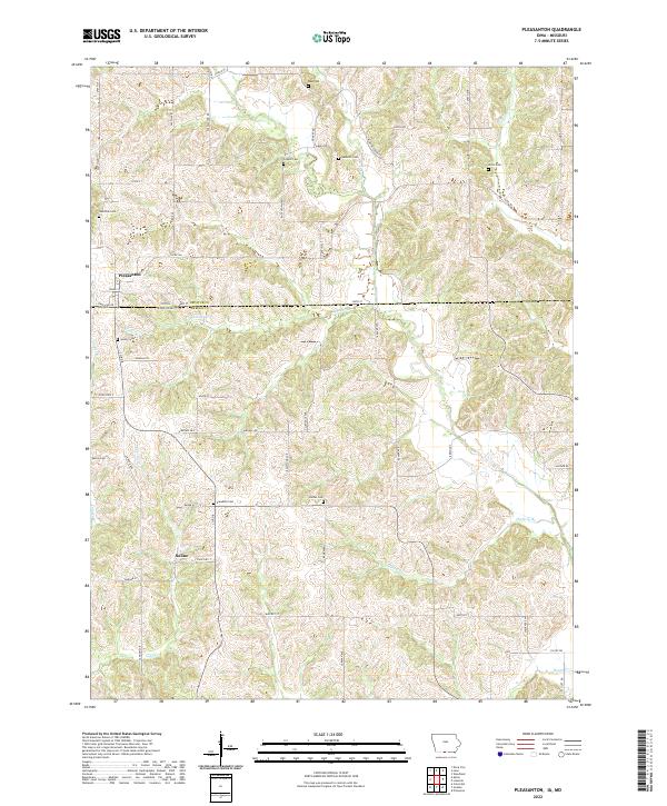 2022 Pleasanton2022 Print · USGSThe Iowa-Missouri borderlands come into focus in this contemporary survey of the rural landscape around Pleasanton. Genealogists and historians can trace numerous country burial grounds such as Hamilton Cem, Freedom Cem, and Union Cem.
 - 2022 Map of Lineville, 2022 Print
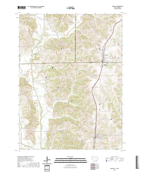 2022 Lineville2022 Print · USGSThe interstate border region of Iowa and Missouri comes to life in this survey of the area surrounding Lineville and Mercer. Genealogists can trace family heritage through over a dozen burial sites, including Evergreen Cem, Hollars Cem, and Middle Point Cem.
End of results
Showing maps 1-15 of 15
Top cities of Mercer County
- Princeton historical maps
- Mercer historical maps
- Ravanna historical maps
- South Lineville historical maps
Frequently asked questions
- What are the different types of historical maps available for Mercer County?
- What is the oldest map of Mercer County?
- Where can I purchase historical maps of Mercer County for my home or office?
- Where can I download high-res historical maps of Mercer County?
- Are there historical topographic maps available for Mercer County?
- Is there historical aerial imagery available for Mercer County?
- Where are historical maps of Mercer County sourced from?