Old Maps of Mercer County, Missouri for Hiking & Exploration
Hike through history with 90 historic maps of Mercer County. Explore old trails, ghost towns, and forgotten backroads — perfect for outdoor adventurers and local explorers.
- Rediscover forgotten places: Map out old mining camps, roads, and footpaths that no longer exist on modern maps.
- Layer with modern tools: Combine with LiDAR or satellite views to plan hikes through historical terrain.
- Made for exploration: Popular among hikers, overlanders, and local history lovers.
Use these maps to find adventure and explore the hidden past of Mercer County.
Mercer County, MO maps
(90)- 1945 Map of Lamoni, 1957 Print
 1945 Lamoni1957 Print · USGSThe Iowa and Missouri borderlands come to life in this mid-century survey of the rural corridor between Harrison and Decatur counties. Researchers can trace the tracks of the Chicago Burlington and Quincy railroad and find local landmarks like Andover, Riverview Ch, and Akron Cem.
 - 1946 Map of Princeton, 1976 Print
 1946 Princeton1976 Print · USGSMercer County during the mid-forties reveals a rural landscape anchored by the Princeton rail corridor and the Weldon River valley. Researchers can trace family history through dozens of country schools and churches, such as Early Sch, Coon Ch, and the Mercer Cem.
 - 1947 Map of Lamoni
 1947 Lamoni1947 Print · USGSThe rural borderlands of Iowa and Missouri are captured here just after the war, showing a dense network of country schools and churches. Genealogists can trace family roots through landmarks like Andover Cem, Lone Star Sch, and the Riverview Ch along the Thompson River.2 unique versions available
 - 1947 Map of Blythedale
 1947 Blythedale1947 Print · USGSNorthern Missouri's agricultural heartland is documented here in the late 1940s, showing a landscape densely dotted with local schoolhouses and family cemeteries. Genealogists can trace roots through the Chicago Burlington and Quincy rail line and sites like Yankee Ridge Cem or Green Castle Sch.2 unique versions available
 - 1948 Map of Princeton
 1948 Princeton1948 Print · USGSNorthern Missouri's agricultural heartland is documented here during the late 1940s, centered on the river valley and rail corridor. Researchers can trace the layout of Princeton and locate vanished rural landmarks like Modena, Hamblin School, and the Salem Cemetery.2 unique versions available
 - 1954 Map of Centerville, 1967 Print
 1954 Centerville1967 Print · USGSThe Iowa-Missouri borderlands at mid-century reveal a landscape shaped by river valleys and the height of the regional rail network. Genealogists and historians can trace the paths of the Wabash railroad and locate old townsites like Mystic, Moulton, and Greentop.3 unique versions available
 - 1957 Map of Centerville
 1957 Centerville1957 Print · USGSThe Iowa-Missouri borderlands in the mid-fifties reveal a landscape of river-valley agriculture and vital rail corridors. Genealogists and historians can trace family-named landmarks and small-town growth in Centerville, Kirksville, and along the Wabash railroad line.
 - 1958 Map of Centerville
 1958 Centerville1958 Print · USGSThe Iowa-Missouri borderlands come into focus during the mid-fifties, showing a landscape defined by river valleys and intersecting rail lines. Genealogists and local historians can trace family roots through dozens of rural hubs like Bloomfield, Unionville, and Corydon.
 - 1964 Map of Ravanna, 1965 Print
 1964 Ravanna1965 Print · USGSNorthern Missouri farmland in Mercer County is captured here in the mid-1960s, showing a landscape defined by creek drainages and rural townships. Genealogists can trace family footprints through sites like Otterbein Chapel, Ravanna Cem, and the local Quarry.
 - 1964 Map of Harris, 1965 Print
 1964 Harris1965 Print · USGSSullivan County's rural townships are documented in the mid-sixties, showing the agricultural landscape and rail corridors near the Mercer and Grundy borders. Researchers can trace family roots at Harris Cem and Center Grove Ch or follow the Chicago Milwaukee St Paul and Pacific rail line.2 unique versions available
 - 1964 Map of Half Rock, 1965 Print
 1964 Half Rock1965 Print · USGSNorthern Missouri farmland near the Mercer and Grundy county line comes into focus in the mid-1960s. Genealogists and local historians can trace family roots around Half Rock, Brantley Cem, and country churches like Hunter Ch.
 - 1964 Map of Pleasanton, 1965 Print
 1964 Pleasanton1965 Print · USGSThe borderlands of Iowa and Missouri come to life in the mid-sixties, centered on the village of Pleasanton. Genealogists can trace family roots through several rural landmarks, including Freedom Ch, South Cem, and the small settlement of Marks.
 - 1964 Map of Lucerne, 1965 Print
 1964 Lucerne1965 Print · USGSThe rural landscape of Putnam County comes into focus in the mid-1960s, showing a region defined by its rail connections and creek-bottom farms. Researchers can trace family history through the Old Busby Cem, West Putnam Sch, and the village of Lucerne.
 - 1964 Map of Cleopatra, 1966 Print
 1964 Cleopatra1966 Print · USGSThe Missouri-Iowa borderlands come to life in the mid-1960s, showing a rural landscape anchored by small settlements and family farms. Researchers can trace local genealogy and land use through landmarks like Cleopatra, Epworth Ch, and the Laughlin Cem.
 - 1964 Map of Powersville, 1966 Print
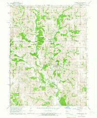 1964 Powersville1966 Print · USGSThe Missouri-Iowa borderlands come to life in the mid-sixties, centered on the railroad village of Powersville. Genealogists can trace local roots across numerous burial sites like Wyreka Cem, Edmond Cem, and the tracks of the Milwaukee Road.
 - 1964 Map of Lineville, 1966 Print
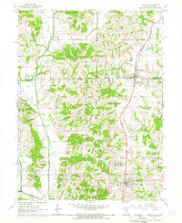 1964 Lineville1966 Print · USGSThe Iowa-Missouri border country comes to life in this mid-sixties survey of the Lineville and Mercer area. Trace family history through numerous rural cemeteries like Evergreen Cemetery and White Oak Cem, or follow the Chicago Rock Island and Pacific rail line.
 - 1981 Map of Akron
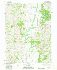 1981 Akron1981 Print · USGSThe Missouri-Iowa state line was a landscape of quiet river valleys and scattered farmsteads in the early eighties. Researchers can trace rural lineages through the many family-named burial grounds like Miller Cem or explore the Akron Townhall and the grounds of Nine Eagles State Park.
 - 1981 Map of Trenton
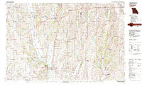 1981 Trenton1981 Print · USGSNorthern Missouri in the early eighties remains a landscape defined by its river valleys and intersecting rail lines. Genealogists and local historians can trace the development of riverside towns like Trenton and Princeton or locate smaller rural junctions such as Humphreys and Brimson.
 - 1981 Map of Leon, 1982 Print
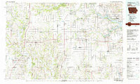 1981 Leon1982 Print · USGSSouthern Iowa and northern Missouri are captured here in the early eighties as the rural landscape balances traditional agriculture with large-scale water management. Researchers can trace the path of the Burlington Northern through Leon or locate early settlements like Decatur City and New Buda.
 - 1984 Map of Princeton
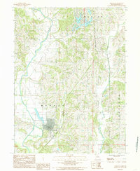 1984 Princeton1984 Print · USGSPrinceton and the surrounding Mercer County townships are captured here in the early 1980s as the regional rail and water networks converged. Genealogists can trace the town grid near the Chicago and North Western line or explore the rural landscape around Lake Marie and the Little Weldon River.
 - 1984 Map of Goshen, 1985 Print
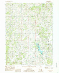 1984 Goshen1985 Print · USGSMercer and Harrison counties appear in the mid-1980s as a quiet patchwork of rural townships and winding creek beds. Researchers can trace family-named lands near Goshen or explore the drainage of Sandy Creek and the waters of Lake Paho.
 - 1984 Map of Mill Grove, 1985 Print
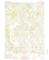 1984 Mill Grove1985 Print · USGSNorth central Missouri is captured here in the mid-eighties as a landscape of river bends and rural townships. Researchers can trace family roots near Mill Grove or locate several local Cemeteries tucked between Muddy Creek and the Weldon River.
 - 1984 Map of Modena, 1985 Print
 1984 Modena1985 Print · USGSNorth-central Missouri farming country is documented here in the early 1980s, centered on the community of Modena. Genealogists and local historians can trace property lines across the Mercer and Grundy County border near Sandy Creek and Peleet Creek.
 - 1984 Map of Cainsville, 1985 Print
 1984 Cainsville1985 Print · USGSCainsville and the river valleys of northern Missouri are captured here in the early 1980s. Researchers can trace the path of the Thompson River, locate a local Cem, and explore the rural townships of Madison and Trail Creek.
 - 1984 Map of Mount Moriah, 1985 Print
 1984 Mount Moriah1985 Print · USGSHarrison County in the early eighties is captured here in a moment of rural continuity and conservation. Researchers can trace property lines near Mount Moriah or locate the Wayne Helton Memorial State Wildlife Area and the winding Thompson River.
Showing maps 1-25 of 90
Top cities of Mercer County
- Princeton historical maps
- Mercer historical maps
- Ravanna historical maps
- South Lineville historical maps
Frequently asked questions
- What are the different types of historical maps available for Mercer County?
- What is the oldest map of Mercer County?
- Where can I purchase historical maps of Mercer County for my home or office?
- Where can I download high-res historical maps of Mercer County?
- Are there historical topographic maps available for Mercer County?
- Is there historical aerial imagery available for Mercer County?
- Where are historical maps of Mercer County sourced from?