Old Maps of Mercer County, Missouri for Genealogy
Trace your family roots with 40 historic maps of Mercer County. These high-res maps reveal old neighborhoods, homesites, landmarks, and streets — helping you uncover where your ancestors lived and how the area evolved over time.
- Explore historic neighborhoods: Identify where your relatives may have lived in the 1800s or 1900s.
- Compare maps over time: Trace the changes in streets, buildings, and landmarks for multi-generational research.
- Perfect for genealogy & ancestry research: Used by family historians and researchers to map out lineage and migration.
These maps are an incredible resource for exploring your personal connection to Mercer County's past.
Mercer County, MO maps
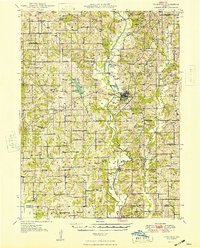
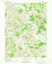
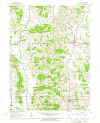
(40)- 1945 Map of Lamoni, 1957 Print
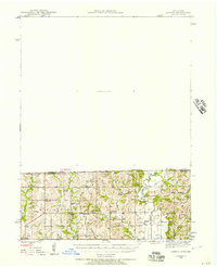 1945 Lamoni1957 Print · USGSCovers Mercer County, including Lamoni, Leon, and other nearby areas
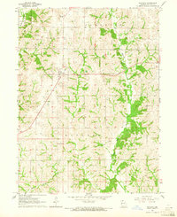
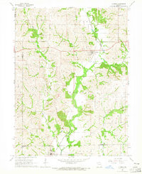
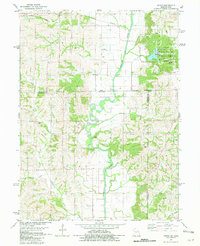
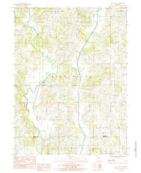
 - 1946 Map of Princeton, 1976 Print
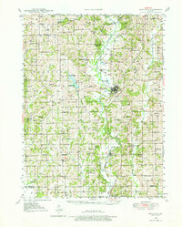 1946 Princeton1976 Print · USGSCovers Mercer County, including Princeton, Spickard, and other nearby areas
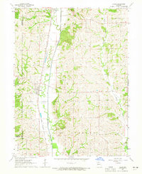
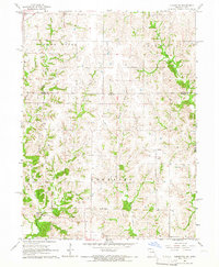
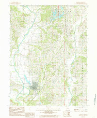
 - 1947 Map of Lamoni
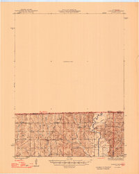 1947 Lamoni1947 Print · USGSCovers Mercer County, including Lamoni, Leon, and other nearby areas2 unique versions available
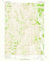
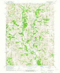
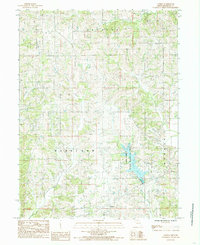
 - 1947 Map of Blythedale
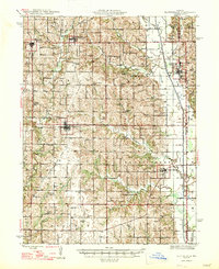 1947 Blythedale1947 Print · USGSCovers Mercer County, including Ridgeway, Cainsville, and other nearby areas2 unique versions available
 - 1948 Map of Princeton
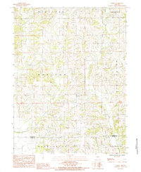
 1948 Princeton1948 Print · USGSCovers Mercer County, including Princeton, Spickard, and other nearby areas2 unique versions available
 - 1954 Map of Centerville, 1967 Print
 1954 Centerville1967 Print · USGSCovers Mercer County, including Ottumwa, Kirksville, and other nearby areas3 unique versions available
 - 1957 Map of Centerville
 1957 Centerville1957 Print · USGSCovers Mercer County, including Ottumwa, Kirksville, and other nearby areas
 - 1958 Map of Centerville
 1958 Centerville1958 Print · USGSCovers Mercer County, including Ottumwa, Kirksville, and other nearby areas
 - 1964 Map of Ravanna, 1965 Print
 1964 Ravanna1965 Print · USGSCovers Mercer County, including Ravanna, United States, and other nearby areas
 - 1964 Map of Harris, 1965 Print
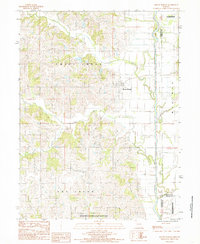
 1964 Harris1965 Print · USGSCovers Mercer County, including Newtown, Harris, and other nearby areas2 unique versions available
 - 1964 Map of Half Rock, 1965 Print
 1964 Half Rock1965 Print · USGSCovers Mercer County, including Topsy, Half Rock, and other nearby areas
 - 1964 Map of Pleasanton, 1965 Print
 1964 Pleasanton1965 Print · USGSCovers Mercer County, including Pleasanton, Saline, and other nearby areas
 - 1964 Map of Lucerne, 1965 Print
 1964 Lucerne1965 Print · USGSCovers Mercer County, including Newtown, Lucerne, and other nearby areas
 - 1964 Map of Cleopatra, 1966 Print
 1964 Cleopatra1966 Print · USGSCovers Mercer County, including Cleopatra, Clinton Center, and other nearby areas
 - 1964 Map of Powersville, 1966 Print
 1964 Powersville1966 Print · USGSCovers Mercer County, including Powersville, Galesburg, and other nearby areas
 - 1964 Map of Lineville, 1966 Print
 1964 Lineville1966 Print · USGSCovers Mercer County, including Mercer, Lineville, and other nearby areas
 - 1981 Map of Akron
 1981 Akron1981 Print · USGSCovers Mercer County, including Akron, New Buda, and other nearby areas
 - 1981 Map of Trenton
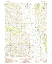
 1981 Trenton1981 Print · USGSCovers Mercer County, including Trenton, Unionville, and other nearby areas
 - 1981 Map of Leon, 1982 Print
 1981 Leon1982 Print · USGSCovers Mercer County, including Osceola, Chariton, and other nearby areas
 - 1984 Map of Princeton
 1984 Princeton1984 Print · USGSCovers Mercer County, including Princeton, United States, and other nearby areas
 - 1984 Map of Goshen, 1985 Print
 1984 Goshen1985 Print · USGSCovers Mercer County, including Goshen, United States, and other nearby areas
 - 1984 Map of Mill Grove, 1985 Print
 1984 Mill Grove1985 Print · USGSCovers Mercer County, including Spickard, Mill Grove, and other nearby areas
 - 1984 Map of Modena, 1985 Print
 1984 Modena1985 Print · USGSCovers Mercer County, including Dinsmore, Modena, and other nearby areas
 - 1984 Map of Cainsville, 1985 Print
 1984 Cainsville1985 Print · USGSCovers Mercer County, including Cainsville, Harrison County, and other nearby areas
 - 1984 Map of Mount Moriah, 1985 Print
 1984 Mount Moriah1985 Print · USGSCovers Mercer County, including Mount Moriah, Grundy County, and other nearby areas
Showing maps 1-25 of 40
Top cities of Mercer County
- Princeton historical maps
- Mercer historical maps
- Ravanna historical maps
- South Lineville historical maps
Frequently asked questions
- What are the different types of historical maps available for Mercer County?
- What is the oldest map of Mercer County?
- Where can I purchase historical maps of Mercer County for my home or office?
- Where can I download high-res historical maps of Mercer County?
- Are there historical topographic maps available for Mercer County?
- Is there historical aerial imagery available for Mercer County?
- Where are historical maps of Mercer County sourced from?