2020s Maps of California, Missouri
Explore 2 historic maps of California from the 2020s. These maps offer a rare glimpse into what life looked like during the 2020s — showing old roads, neighborhoods, homes, and landmarks that have changed or disappeared over time.
Whether you're researching your family's past, planning a metal detecting trip, or studying how California's landscape evolved across the 2020s, these high-resolution maps are a powerful tool for exploring the history of this region.
- Focus on a specific era: All maps on this page are from the 2020s, giving you a focused view of this time period.
- See what’s changed: Compare century-old streets, trails, and buildings to today's modern landscape using overlays and satellite layers.
- Research with precision: Use these maps for genealogy, historical research, land use analysis, or educational projects.
- View, download, or print: Maps are fully viewable online in high resolution, and can be downloaded or printed for your own records.
Start exploring California's history through authentic maps from the 2020s. This is your window into the past.
California, MO maps
(2)- 2021 Map of California South, 2021 Print
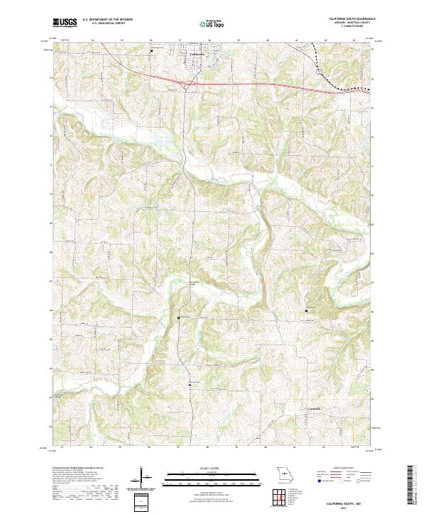 2021 California South2021 Print · USGSMoniteau County at the start of the 2020s shows a landscape of winding creeks and rural settlements south of the county seat. Researchers can trace family history at Boeckhaus Cem or Gamble Cem and locate crossings at Burris Fork Bridge.
 - 2021 Map of California North, 2021 Print
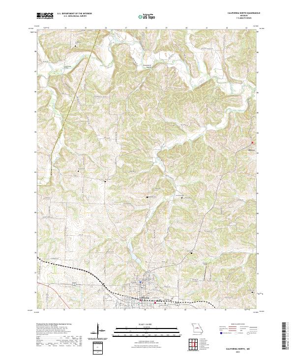 2021 California North2021 Print · USGSMoniteau County in the early 2020s remains centered on the city of California, where the local seat and courthouse anchor the region. Genealogists can trace family lines across several small burial grounds, including Schmutz Cem, Howard Cem, and Strickfaden Cem.
End of results
Showing maps 1-2 of 2
Top cities near California
- Tipton historical maps
- Russellville historical maps
- Jamestown historical maps
- Clarksburg historical maps
- Centertown historical maps
- Prairie Home historical maps
See more
Frequently asked questions
- What are the different types of historical maps available for California?
- What is the oldest map of California?
- Where can I purchase historical maps of California for my home or office?
- Where can I download high-res historical maps of California?
- Are there historical topographic maps available for California?
- Is there historical aerial imagery available for California?
- Where are historical maps of California sourced from?