Old Maps of California, Missouri for Hiking & Exploration
Hike through history with 17 historic maps of California. Explore old trails, ghost towns, and forgotten backroads — perfect for outdoor adventurers and local explorers.
- Rediscover forgotten places: Map out old mining camps, roads, and footpaths that no longer exist on modern maps.
- Layer with modern tools: Combine with LiDAR or satellite views to plan hikes through historical terrain.
- Made for exploration: Popular among hikers, overlanders, and local history lovers.
Use these maps to find adventure and explore the hidden past of California.
California, MO maps
(17)- 1888 Map of Boonville
 1888 Boonville1888 Print · USGSCentral Missouri comes to life in the late nineteenth century as the river economy of Boonville meets the iron rails of the Missouri Pacific Railroad. Genealogists and historians can trace old community centers like Latham Store, Chouteau Springs, and the townships of Richland and Saline.5 unique versions available
 - 1947 Map of Jefferson City, 1949 Print
 1947 Jefferson City1949 Print · USGSCentral Missouri and the northern Ozarks come into focus in this late 1940s survey of the river-and-rail landscape. Genealogists and historians can trace the growth of Jefferson City and Sedalia or locate family roots near Bagnell Dam and the Lake of the Ozarks.
 - 1951 Map of California South, 1953 Print
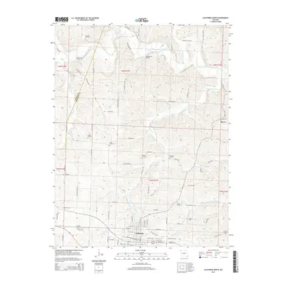
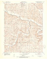 1951 California South1953 Print · USGSMoniteau County's rural townships are captured here in the early 1950s, showing a landscape of small family farms and local parish life. Researchers can trace ancestral roots through numerous family cemeteries and old school sites like Gamble Cem, Pluck Sch, and Corticelli Ch.3 unique versions available
 - 1952 Map of California North, 1953 Print
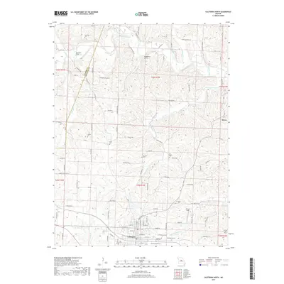
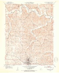 1952 California North1953 Print · USGSIn the early 1950s, the area north of California, Missouri, was a landscape of small family farms and rural schoolhouses. Genealogists can trace family roots through several private burial grounds like Strickfaden Cem and identify local landmarks like the Old Salem Ch.4 unique versions available
 - 1954 Map of Jefferson City
 1954 Jefferson City1954 Print · USGSCentral Missouri in the early postwar years showcases a landscape defined by the winding Lake of the Ozarks and the state capital at Jefferson City. Researchers can trace the mid-century rail networks of the Missouri Pacific RR and locate rural communities like Tuscumbia, St Elizabeth, and St Anthony.2 unique versions available
 - 1955 Map of Jefferson City, 1967 Print
 1955 Jefferson City1967 Print · USGSCentral Missouri in the mid-fifties is defined by the winding Missouri River and the expanding reach of Lake of the Ozarks. Researchers can trace the rail corridors of the Missouri Pacific or locate the early footprint of Whiteman AFB and Jefferson City.4 unique versions available
 - 1958 Map of Jefferson City
 1958 Jefferson City1958 Print · USGSCentral Missouri in the late fifties shows a region transforming through the growth of Whiteman Air Force Base and the Lake of the Ozarks. Researchers can trace rail lines like the Missouri Pacific or find family roots at Enloe Cemetery and Mount Pleasant Cem.
 - 1959 Map of Jefferson City
 1959 Jefferson City1959 Print · USGSCentral Missouri is captured during the mid-fifties as the river economy and rail networks like the Missouri Pacific met the rise of the automobile. Local researchers can trace family landmarks and rural infrastructure from the Lake of the Ozarks up to Providence Cemetery and Knob Noster State Park.
 - 1982 Map of Jefferson City, 1983 Print
 1982 Jefferson City1983 Print · USGSMid-Missouri in the early eighties shows the corridor between Columbia and Jefferson City during a period of modern growth. Genealogists and historians can trace the Missouri Pacific Railroad route, family plots at Memorial Park Cem, and landmarks like Osage City and Lupus.
 - 2011 Map of California North, 2011 Print
 2011 California North2011 Print · USGSCovers California, including Kliever, Cooper County, and other nearby areas
 - 2011 Map of California South, 2011 Print
 2011 California South2011 Print · USGSCovers California, including Corticelli, Moniteau County, and other nearby areas
 - 2015 Map of California North, 2015 Print
 2015 California North2015 Print · USGSCovers California, including Kliever, Cooper County, and other nearby areas
 - 2015 Map of California South, 2015 Print
 2015 California South2015 Print · USGSCovers California, including Corticelli, Moniteau County, and other nearby areas
 - 2017 Map of California North, 2017 Print
 2017 California North2017 Print · USGSCovers California, including Kliever, Cooper County, and other nearby areas
 - 2017 Map of California South, 2017 Print
 2017 California South2017 Print · USGSCovers California, including Corticelli, Moniteau County, and other nearby areas
 - 2021 Map of California South, 2021 Print
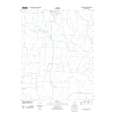
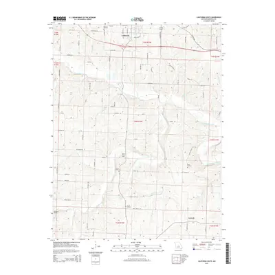
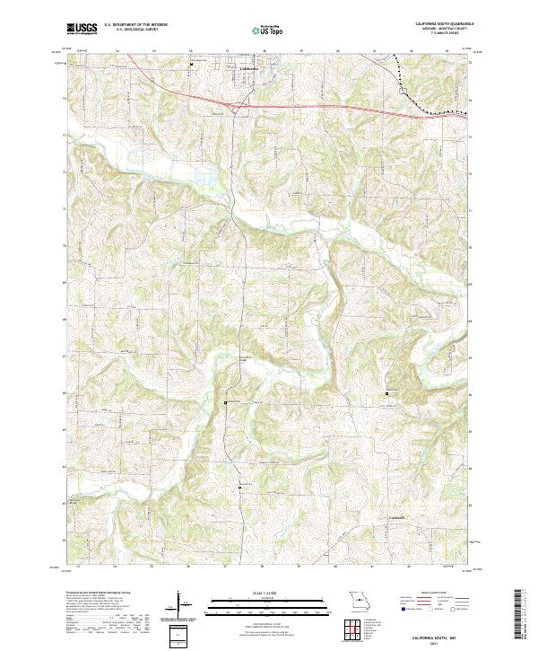 2021 California South2021 Print · USGSMoniteau County at the start of the 2020s shows a landscape of winding creeks and rural settlements south of the county seat. Researchers can trace family history at Boeckhaus Cem or Gamble Cem and locate crossings at Burris Fork Bridge.
 - 2021 Map of California North, 2021 Print
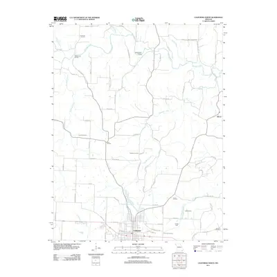
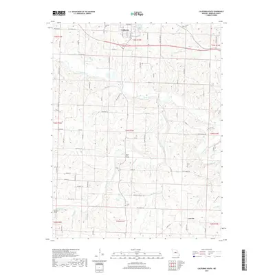
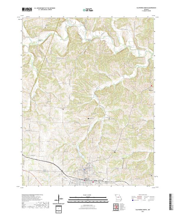 2021 California North2021 Print · USGSMoniteau County in the early 2020s remains centered on the city of California, where the local seat and courthouse anchor the region. Genealogists can trace family lines across several small burial grounds, including Schmutz Cem, Howard Cem, and Strickfaden Cem.
End of results
Showing maps 1-17 of 17
Top cities near California
- Tipton historical maps
- Russellville historical maps
- Jamestown historical maps
- Clarksburg historical maps
- Centertown historical maps
- Prairie Home historical maps
See more
Frequently asked questions
- What are the different types of historical maps available for California?
- What is the oldest map of California?
- Where can I purchase historical maps of California for my home or office?
- Where can I download high-res historical maps of California?
- Are there historical topographic maps available for California?
- Is there historical aerial imagery available for California?
- Where are historical maps of California sourced from?