1900s (20th Century) Maps of Monroe County, Missouri
Explore 39 historic maps of Monroe County from the 1900s (20th Century). These maps offer a rare glimpse into what life looked like during the 1900s — showing old roads, neighborhoods, homes, and landmarks that have changed or disappeared over time.
Whether you're researching your family's past, planning a metal detecting trip, or studying how Monroe County's landscape evolved across the 1900s, these high-resolution maps are a powerful tool for exploring the history of this region.
- Focus on a specific era: All maps on this page are from the 1900s, giving you a focused view of this time period.
- See what’s changed: Compare century-old streets, trails, and buildings to today's modern landscape using overlays and satellite layers.
- Research with precision: Use these maps for genealogy, historical research, land use analysis, or educational projects.
- View, download, or print: Maps are fully viewable online in high resolution, and can be downloaded or printed for your own records.
Start exploring Monroe County's history through authentic maps from the 1900s. This is your window into the past.
Monroe County, MO maps
(39)- 1903 Map of Palmyra
 1903 Palmyra1903 Print · USGSNortheast Missouri at the start of the twentieth century was a landscape of river-valley farming and critical rail junctions. Researchers can trace early rural life through features like Sharp Mills, St. Pauls Ch., and the crossing of the Hannibal and St. Joseph R. R.2 unique versions available
 - 1908 Map of Macon, 1965 Print
 1908 Macon1965 Print · USGSMacon County and its neighbors are seen here in the early twentieth century, as rail lines and river forks defined the local economy. Genealogists can locate family landmarks among dozens of rural schoolhouses and churches like Bethlehem Church and Prairie Dale School.
 - 1910 Map of Macon
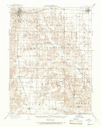
 1910 Macon1910 Print · USGSMacon County's rural landscape is captured here in the decade before the Great War, showing a territory defined by railroad towns and isolated river mills. Genealogists can trace family roots through numerous country landmarks like Blees Military Academy, Levick Mill, and the Bear Thicket School.
 - 1945 Map of Florida
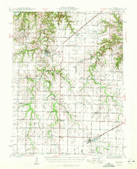
 1945 Florida1945 Print · USGSThe Salt River forks in Monroe and Audrain counties defined local life in the 1940s before modern reservoirs changed the landscape. Genealogists can trace family footprints through dozens of rural landmarks like Walnut Grove Cem, Cedar Grove Ch, and Dye Sch.3 unique versions available
 - 1945 Map of Perry
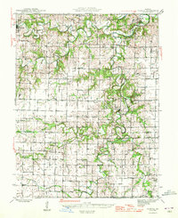
 1945 Perry1945 Print · USGSNortheast Missouri’s agricultural heartland is documented here in the mid-1940s as the rail era began to fade. Researchers can trace dozens of vanished country schoolhouses like Oakdale Sch and early rural churches including Corinth Ch and Prairie View Ch.3 unique versions available
 - 1948 Map of Quincy
 1948 Quincy1948 Print · USGSThe Mississippi and Illinois River valleys are captured at a post-war crossroads as rail and river travel met the expanding highway system. Genealogists can trace family settlements from Quincy to Hannibal and smaller towns like Vandalia and Jerseyville.2 unique versions available
 - 1952 Map of Middle Grove, 1955 Print
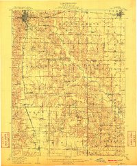
 1952 Middle Grove1955 Print · USGSMid-century rural life in central Missouri is meticulously documented here just as the post-war era reshaped the countryside. Researchers can trace family history through numerous country landmarks like Number Six Sch, Enon Ch, and Meals Cem.
 - 1953 Map of Moberly
 1953 Moberly1953 Print · USGSMid-century north-central Missouri is documented here as a bustling intersection of river commerce and heavy rail. Researchers can trace historic family-named landmarks and transport hubs from the Missouri River corridor to the rail yards of Moberly, Chillicothe, and Macon.
 - 1953 Map of Clark, 1955 Print
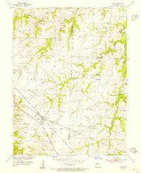 1953 Clark1955 Print · USGSNear the intersection of Randolph, Monroe, and Audrain counties in the 1950s, this area centers on the rail hub of Clark. Genealogists can trace rural family sites near Chapel Grove Cem, Macedonia Ch, and the Mt Pisgah Sch.3 unique versions available
 - 1954 Map of Moberly, 1969 Print
 1954 Moberly1969 Print · USGSMid-century Missouri is captured here during a period of transition for its river towns and rail hubs. Genealogists and historians can trace the paths of the Wabash railroad through Moberly or explore the riverside layout of Lexington and Brunswick.3 unique versions available
 - 1956 Map of Quincy, 1967 Print
 1956 Quincy1967 Print · USGSThe river and rail corridors of the Illinois-Missouri border are documented here during the mid-1950s. Researchers can trace historic river landings and regional transit hubs from Quincy and Hannibal to smaller settlements like Meredosia and Roodhouse.3 unique versions available
 - 1957 Map of Moberly
 1957 Moberly1957 Print · USGSNorth-central Missouri in the late nineteen-forties and fifties remains a landscape defined by its great rivers and a dense network of steam and diesel rail lines. Genealogists and historians can trace the paths of the Wabash RR and Santa Fe RR through historic junctions like Moberly, Brookfield, and Macon.
 - 1958 Map of Tulip, 1960 Print
 1958 Tulip1960 Print · USGSAudrain and Monroe counties appear in the late fifties as a rural landscape of branching creeks and country schoolhouses. Genealogists and local historians can trace the locations of Appleman Ch, Friendship Sch, and the rail corridor of the G M & O.2 unique versions available
 - 1958 Map of Lentner, 1960 Print
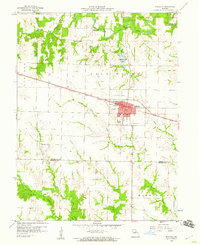
 1958 Lentner1960 Print · USGSShelby and Monroe counties are captured here in the late fifties, centered on the railroad hub of Lentner. Genealogists and researchers can trace the locations of the Oak Ridge Sch, the Fairview Sch, and the rural community of Maud.2 unique versions available
 - 1959 Map of Monroe City, 1960 Print
 1959 Monroe City1960 Print · USGSMid-century Northeast Missouri comes into focus here at the tri-county junction of Marion, Ralls, and Monroe. Genealogists and rail historians can trace the paths of the Chicago Burlington and Quincy railroad, locate the St Judes Cem, or find rural schoolhouses like Stone Sch.2 unique versions available
 - 1959 Map of Shelbina, 1960 Print
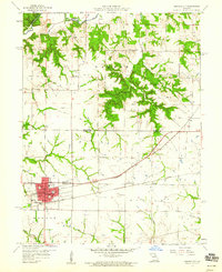
 1959 Shelbina1960 Print · USGSShelby County in the late fifties is defined by the busy rail corridor of the Chicago Burlington and Quincy and the growth of Shelbina. Genealogists and local historians can locate rural landmarks like Lowman Chapel, Moreman Sch, and several old burial grounds.2 unique versions available
 - 1959 Map of Lakenan, 1960 Print
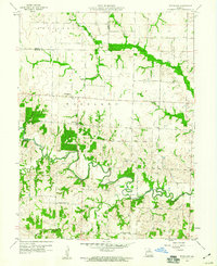
 1959 Lakenan1960 Print · USGSShelby and Monroe counties appear here in the late fifties, showcasing a rural Missouri landscape defined by meandering river forks and early school districts. Genealogists can trace family connections through sites like Beatley Sch, Givan Sch, and Hunnewell Cem.3 unique versions available
 - 1959 Map of Woodlawn, 1960 Print
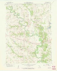
 1959 Woodlawn1960 Print · USGSMonroe and Shelby Counties are captured here in the late fifties, showing a rural landscape defined by the winding Middle Fork Salt River. Genealogists can locate family-named sites like Atterberry Cem, Milner Cem, and Oak Grove Ch.
 - 1959 Map of Madison, 1960 Print
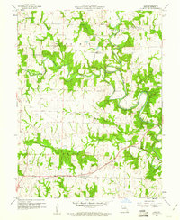
 1959 Madison1960 Print · USGSMonroe County was a network of rail and river in the late fifties, centered on the Wabash line. Local researchers can locate family burial plots at Sunset Hill Cemetery or Old Prairie Cem and trace the winding course of the Elk Fork Salt River.
 - 1959 Map of Joanna, 1960 Print
 1959 Joanna1960 Print · USGSThe rural borderlands of Monroe and Ralls Counties are captured here in the late fifties, just before significant hydrological changes. Genealogists can locate family landmarks like Utterback Cem, Shaver Ford, and the old Nolen Sch.2 unique versions available
 - 1959 Map of Hunnewell, 1961 Print
 1959 Hunnewell1961 Print · USGSThe Hunnewell area at the end of the fifties reveals a landscape shaped by the Chicago Burlington and Quincy railroad and the newly established Hunnewell Lake. Genealogists can locate family landmarks like the How Cem, Union Chapel, and several local schoolhouses including Buckman Sch.2 unique versions available
 - 1960 Map of Moberly
 1960 Moberly1960 Print · USGSCentral Missouri comes alive in the mid-twentieth century as a bustling network of river towns and significant rail corridors. Genealogists and historians can trace the paths of the Wabash RR through Moberly or explore the riverfronts of Lexington and Brunswick.
 - 1960 Map of Goss, 1961 Print
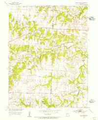
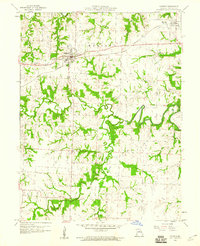
 1960 Goss1961 Print · USGSMonroe County was a landscape of winding river bends and small rural hubs in the early sixties. Genealogists can trace family names through sites like Crutcher Cem and Marr Sch, or follow the WABASH rail line through Goss.2 unique versions available
 - 1960 Map of Granville, 1961 Print
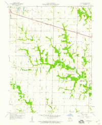
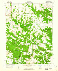
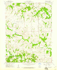 1960 Granville1961 Print · USGSMonroe County was a mosaic of quiet townships and creek-side farms in the early sixties. Genealogists and local historians can trace rural roots at Spencer Chapel Cem, Granville Sch, and the community of Granville.2 unique versions available
 - 1960 Map of Rowena, 1961 Print
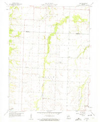
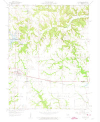
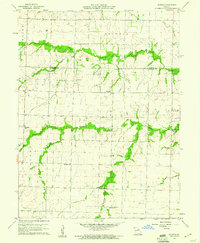 1960 Rowena1961 Print · USGSThe rural borders of Monroe and Audrain counties are captured here at the start of the 1960s, showing a landscape defined by traditional farming communities. Genealogists can locate several named country schoolhouses and churches, including Goodwater Sch, Strother Sch, and Bethlehem Ch.2 unique versions available
Showing maps 1-25 of 39
Top cities of Monroe County
- Paris historical maps
- Madison historical maps
- Holliday historical maps
- Stoutsville historical maps
- Goss historical maps
- Goss historical maps
Frequently asked questions
- What are the different types of historical maps available for Monroe County?
- What is the oldest map of Monroe County?
- Where can I purchase historical maps of Monroe County for my home or office?
- Where can I download high-res historical maps of Monroe County?
- Are there historical topographic maps available for Monroe County?
- Is there historical aerial imagery available for Monroe County?
- Where are historical maps of Monroe County sourced from?