1960s Maps of Monroe County, Missouri
Explore 6 historic maps of Monroe County from the 1960s. These maps offer a rare glimpse into what life looked like during the 1960s — showing old roads, neighborhoods, homes, and landmarks that have changed or disappeared over time.
Whether you're researching your family's past, planning a metal detecting trip, or studying how Monroe County's landscape evolved across the 1960s, these high-resolution maps are a powerful tool for exploring the history of this region.
- Focus on a specific era: All maps on this page are from the 1960s, giving you a focused view of this time period.
- See what’s changed: Compare century-old streets, trails, and buildings to today's modern landscape using overlays and satellite layers.
- Research with precision: Use these maps for genealogy, historical research, land use analysis, or educational projects.
- View, download, or print: Maps are fully viewable online in high resolution, and can be downloaded or printed for your own records.
Start exploring Monroe County's history through authentic maps from the 1960s. This is your window into the past.
Monroe County, MO maps
(6)- 1960 Map of Moberly
 1960 Moberly1960 Print · USGSCentral Missouri comes alive in the mid-twentieth century as a bustling network of river towns and significant rail corridors. Genealogists and historians can trace the paths of the Wabash RR through Moberly or explore the riverfronts of Lexington and Brunswick.
 - 1960 Map of Goss, 1961 Print
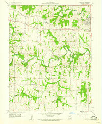
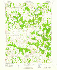 1960 Goss1961 Print · USGSMonroe County was a landscape of winding river bends and small rural hubs in the early sixties. Genealogists can trace family names through sites like Crutcher Cem and Marr Sch, or follow the WABASH rail line through Goss.2 unique versions available
 - 1960 Map of Granville, 1961 Print
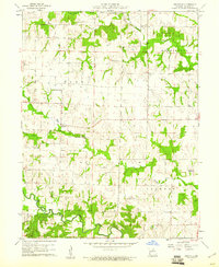 1960 Granville1961 Print · USGSMonroe County was a mosaic of quiet townships and creek-side farms in the early sixties. Genealogists and local historians can trace rural roots at Spencer Chapel Cem, Granville Sch, and the community of Granville.2 unique versions available
 - 1960 Map of Rowena, 1961 Print
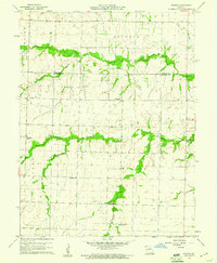 1960 Rowena1961 Print · USGSThe rural borders of Monroe and Audrain counties are captured here at the start of the 1960s, showing a landscape defined by traditional farming communities. Genealogists can locate several named country schoolhouses and churches, including Goodwater Sch, Strother Sch, and Bethlehem Ch.2 unique versions available
 - 1960 Map of Stoutsville, 1961 Print
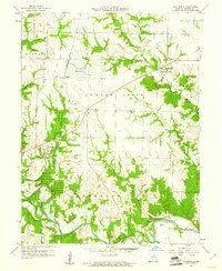 1960 Stoutsville1961 Print · USGSMonroe County was a landscape of river fords and rail lines in the early sixties, centered on the river convergence at Stoutsville. Genealogists and local historians can trace the Wabash line, locate St Andrews Cem, and identify old river crossings like Kitty Wheel Ford.2 unique versions available
 - 1960 Map of Paris West, 1961 Print
 1960 Paris West1961 Print · USGSMonroe County was a network of river forks and rail lines in the early sixties, centered around the community of Paris. Researchers can trace local heritage through numerous family landmarks like McKinney Cem, the Sanford Sch, and the old Wabash railroad corridor.4 unique versions available
End of results
Showing maps 1-6 of 6
Top cities of Monroe County
- Paris historical maps
- Madison historical maps
- Holliday historical maps
- Stoutsville historical maps
- Goss historical maps
- Goss historical maps
Frequently asked questions
- What are the different types of historical maps available for Monroe County?
- What is the oldest map of Monroe County?
- Where can I purchase historical maps of Monroe County for my home or office?
- Where can I download high-res historical maps of Monroe County?
- Are there historical topographic maps available for Monroe County?
- Is there historical aerial imagery available for Monroe County?
- Where are historical maps of Monroe County sourced from?