1900s (20th Century) Maps of Bellflower, Missouri
Explore 14 historic maps of Bellflower from the 1900s (20th Century). These maps offer a rare glimpse into what life looked like during the 1900s — showing old roads, neighborhoods, homes, and landmarks that have changed or disappeared over time.
Whether you're researching your family's past, planning a metal detecting trip, or studying how Bellflower's landscape evolved across the 1900s, these high-resolution maps are a powerful tool for exploring the history of this region.
- Focus on a specific era: All maps on this page are from the 1900s, giving you a focused view of this time period.
- See what’s changed: Compare century-old streets, trails, and buildings to today's modern landscape using overlays and satellite layers.
- Research with precision: Use these maps for genealogy, historical research, land use analysis, or educational projects.
- View, download, or print: Maps are fully viewable online in high resolution, and can be downloaded or printed for your own records.
Start exploring Bellflower's history through authentic maps from the 1900s. This is your window into the past.
Bellflower, MO maps
(14)- 1942 Map of New Florence, 1963 Print
 1942 New Florence1963 Print · USGSMontgomery County in the early 1940s reveals a landscape of dispersed farmsteads and rail-dependent towns like New Florence and High Hill. You can trace rural education through vanished schoolhouses like Orange Blossom Sch or locate family sites near Wright Cem.2 unique versions available
 - 1942 Map of Bellflower, 1966 Print
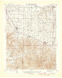
 1942 Bellflower1966 Print · USGSEastern Missouri farm country is captured here during the early years of the war, revealing a landscape defined by the Cuivre River and the Chicago Burlington and Quincy rail line. Genealogists can locate family-named landmarks and rural hubs like Middletown, Smyrna Ch, and the Prairie Flower Sch.
 - 1945 Map of Bellflower
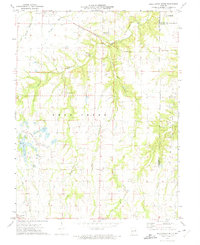
 1945 Bellflower1945 Print · USGSThe rural borderlands of Montgomery, Audrain, and Pike counties are captured here in the mid-1940s as a network of tightly-knit farming communities. Genealogists can trace family footprints through dozens of local landmarks, including Payne Cem, Smyrna Ch, and the many namesake schoolhouses like Mudd Sch.2 unique versions available
 - 1946 Map of New Florence
 1946 New Florence1946 Print · USGSMid-century Montgomery and Warren counties are captured here just as the rural school system and steam-era rail lines remained central to life. Genealogists can locate family landmarks like Wright Cem and dozens of vanished schoolhouses including Crabapple Sch and Me Kittrick Sch.2 unique versions available
 - 1948 Map of Quincy
 1948 Quincy1948 Print · USGSThe Mississippi and Illinois River valleys are captured at a post-war crossroads as rail and river travel met the expanding highway system. Genealogists can trace family settlements from Quincy to Hannibal and smaller towns like Vandalia and Jerseyville.2 unique versions available
 - 1949 Map of Saint Louis
 1949 Saint Louis1949 Print · USGSGreater St. Louis and its surrounding river valleys are captured here just after the war, showing the metropolitan core and the rural Ozark fringe. Researchers can trace the sprawling rail network of the Wabash RR or locate landmarks like Meramec Caverns Airport and Scott Air Force Base.2 unique versions available
 - 1956 Map of Quincy, 1967 Print
 1956 Quincy1967 Print · USGSThe river and rail corridors of the Illinois-Missouri border are documented here during the mid-1950s. Researchers can trace historic river landings and regional transit hubs from Quincy and Hannibal to smaller settlements like Meredosia and Roodhouse.3 unique versions available
 - 1962 Map of St. Louis
 1962 St. Louis1962 Print · USGSThe mid-century gateway to the west shows the metropolitan expansion of St Louis alongside its critical river confluences. Genealogists and historians can trace the rail corridors of the Missouri Pacific RR and settlements from Fulton to De Soto.
 - 1963 Map of St. Louis, 1970 Print
 1963 St. Louis1970 Print · USGSSt. Louis and its surrounding river valleys are captured here during the peak of mid-century suburban expansion and industrial activity. Trace the historic rail routes of the Norfolk and Western Ry or locate the St Louis Ordnance Plant and early stretches of US Highway 66.4 unique versions available
 - 1966 Map of St. Louis
 1966 St. Louis1966 Print · USGSThe St. Louis metropolitan area and its surrounding river valleys are captured here during the mid-sixties era of suburban growth and industrial strength. Genealogists and historians can trace the foundations of local communities through sites like Old Pioneer Cem, Parks College, and the Jefferson Barracks Military Reservation.
 - 1973 Map of Bellflower South, 1975 Print
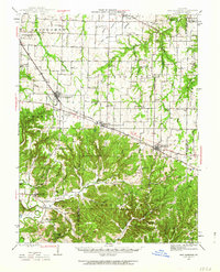
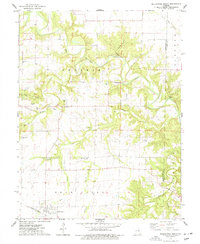
 1973 Bellflower South1975 Print · USGSEastern Missouri's rural landscape is captured here in the early seventies, showing a network of small settlements and creek-bottom farms. Researchers can trace family history through sites like St Paul Cem, the Baptist Cem of Bellflower, and the old rail line of the Burlington Northern.
 - 1973 Map of Bellflower North, 1977 Print
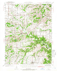
 1973 Bellflower North1977 Print · USGSMontgomery County was a landscape of small rural settlements and river-valley farms in the early 1970s. Researchers can trace family history through numerous landmarks like Union Chapel, Mabry Cem, and the old crossing at Stillhouse Ford.
 - 1985 Map of Fulton
 1985 Fulton1985 Print · USGSMid-Missouri was a hub of river commerce and rail travel in the mid-1980s, where towns like Fulton and Hermann anchored the river valley. Researchers can trace historic river islands like Rush Island or follow the path of the Missouri - Kansas - Texas Railroad.2 unique versions available
 - 1986 Map of Mexico
 1986 Mexico1986 Print · USGSEast Central Missouri in the mid-eighties shows a landscape of steady agricultural towns and the expansive waters of Mark Twain Lake. Genealogists and historians can trace rail-side communities like Laddonia and Wellsville or locate family markers at Elwood Cem.2 unique versions available
End of results
Showing maps 1-14 of 14
Top cities near Bellflower
- Warrenton historical maps
- Montgomery City historical maps
- Wellsville historical maps
- New Florence historical maps
- Jonesburg historical maps
- Truesdale historical maps
See more
Frequently asked questions
- What are the different types of historical maps available for Bellflower?
- What is the oldest map of Bellflower?
- Where can I purchase historical maps of Bellflower for my home or office?
- Where can I download high-res historical maps of Bellflower?
- Are there historical topographic maps available for Bellflower?
- Is there historical aerial imagery available for Bellflower?
- Where are historical maps of Bellflower sourced from?