1980s Maps of Morgan County, Missouri
Explore 12 historic maps of Morgan County from the 1980s. These maps offer a rare glimpse into what life looked like during the 1980s — showing old roads, neighborhoods, homes, and landmarks that have changed or disappeared over time.
Whether you're researching your family's past, planning a metal detecting trip, or studying how Morgan County's landscape evolved across the 1980s, these high-resolution maps are a powerful tool for exploring the history of this region.
- Focus on a specific era: All maps on this page are from the 1980s, giving you a focused view of this time period.
- See what’s changed: Compare century-old streets, trails, and buildings to today's modern landscape using overlays and satellite layers.
- Research with precision: Use these maps for genealogy, historical research, land use analysis, or educational projects.
- View, download, or print: Maps are fully viewable online in high resolution, and can be downloaded or printed for your own records.
Start exploring Morgan County's history through authentic maps from the 1980s. This is your window into the past.
Morgan County, MO maps
(12)- 1982 Map of Jefferson City, 1983 Print
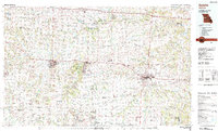
 1982 Jefferson City1983 Print · USGSMid-Missouri in the early eighties shows the corridor between Columbia and Jefferson City during a period of modern growth. Genealogists and historians can trace the Missouri Pacific Railroad route, family plots at Memorial Park Cem, and landmarks like Osage City and Lupus.
 - 1983 Map of Sunrise Beach
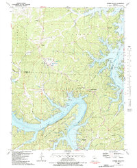 1983 Sunrise Beach1983 Print · USGSThe northern reaches of the Lake of the Ozarks are captured here in the early eighties, showcasing a landscape of winding coves and growing shoreline communities. Researchers can locate numerous family burial sites like Garber Memorial Cem or trace landmarks such as the Hurricane Deck Lookout Tower and Purvis.2 unique versions available
 - 1983 Map of Lake Ozark
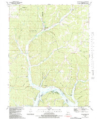
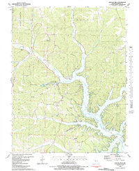
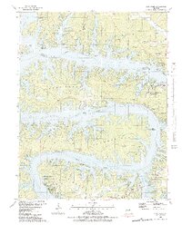 1983 Lake Ozark1983 Print · USGSThe Lake of the Ozarks shoreline is shown in intricate detail in the early eighties, highlighting the intersection of Miller, Morgan, and Camden counties. Genealogists and historians can trace family landmarks like Houston Cem, Millstone Ch, and the submerged history of Kinchlow Hol Cove.3 unique versions available
 - 1983 Map of Bollinger Creek
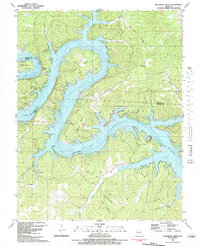 1983 Bollinger Creek1983 Print · USGSThe Lake of the Ozarks shoreline and the Osage River valley are shown here in the early eighties as the area developed into a recreational hub. Researchers can locate family burial grounds like Parish Cem and Woolery Cem or the remote Ivy Bend Landing Strip.
 - 1983 Map of Rocky Mount
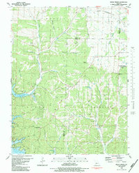 1983 Rocky Mount1983 Print · USGSThe Morgan and Miller County borderlands are shown here in the early 1980s as recreation and rural life converge near the Lake of the Ozarks. Genealogists can trace local roots through the Sidebottom Cem, Taylor Cem, and Dooley Chapel.
 - 1983 Map of Proctor Creek
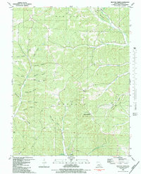 1983 Proctor Creek1983 Print · USGSMorgan County's dissected landscape is shown here in the early 1980s, where the northern reaches of the Lake of the Ozarks meet the rugged BUFFALO hills. Genealogists can trace family landmarks like the Ard-Menteer Cem, Richie Ch, and the settlement at Proctor.
 - 1983 Map of Knobby
 1983 Knobby1983 Print · USGSThe northern Ozarks landscape is captured here in the early 1980s, where the winding Lake of the Ozarks meets rugged Missouri ridges. Genealogists and hikers can trace old family landmarks like Dority Cemetery, Adkins Cave, and the small settlement of Knobby.
 - 1983 Map of Sedalia
 1983 Sedalia1983 Print · USGSWest Central Missouri's landscape in the early eighties shows a dense network of rail towns and riverside communities along the Blackwater River. Genealogists and historians can trace the development of Warrensburg and Sedalia near Whiteman Air Force Base and Knob Noster State Park.
 - 1983 Map of Boylers Mill
 1983 Boylers Mill1983 Print · USGSThe northern reaches of the Lake of the Ozarks meet the Missouri Ozarks in the early 1980s, documenting a landscape of steep hollows and family cemeteries. Locate local landmarks like Boylers Mill, the Mt Hulda Lookout Tower, and Shiloh Cem.
 - 1983 Map of Harry S Truman Reservoir, 1984 Print
 1983 Harry S Truman Reservoir1984 Print · USGSBenton and Henry counties center on the vast Harry S Truman Reservoir in the early 1980s as the landscape adapted to its new shoreline. Genealogists and historians can trace old river crossings like Bledsoe Ferry, local landmarks like Mt Zion Ch, and unique settlements such as Tightwad.
 - 1983 Map of Lake Of The Ozarks, 1984 Print
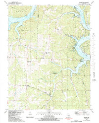
 1983 Lake Of The Ozarks1984 Print · USGSThe Lake of the Ozarks region in the early eighties shows a landscape of deep river bends and growing recreation. Genealogists can trace family names and small settlements from Versailles to Meta and locate old mining sites like Tiff Mine.
 - 1983 Map of Gravois Mills, 1984 Print
 1983 Gravois Mills1984 Print · USGSThe northern reaches of the Lake of the Ozarks come into focus in this early 1980s Missouri survey. Genealogists and local historians can trace family burial sites like Rastorfer Cem and explore landmarks including Jacobs Cave and St Patricks Ch.
End of results
Showing maps 1-12 of 12
Top cities of Morgan County
- Versailles historical maps
- Stover historical maps
- Laurie historical maps
- Barnett historical maps
- Gravois Mills historical maps
- Syracuse historical maps
Frequently asked questions
- What are the different types of historical maps available for Morgan County?
- What is the oldest map of Morgan County?
- Where can I purchase historical maps of Morgan County for my home or office?
- Where can I download high-res historical maps of Morgan County?
- Are there historical topographic maps available for Morgan County?
- Is there historical aerial imagery available for Morgan County?
- Where are historical maps of Morgan County sourced from?