Old Maps of Morgan County, Missouri for Genealogy
Trace your family roots with 139 historic maps of Morgan County. These high-res maps reveal old neighborhoods, homesites, landmarks, and streets — helping you uncover where your ancestors lived and how the area evolved over time.
- Explore historic neighborhoods: Identify where your relatives may have lived in the 1800s or 1900s.
- Compare maps over time: Trace the changes in streets, buildings, and landmarks for multi-generational research.
- Perfect for genealogy & ancestry research: Used by family historians and researchers to map out lineage and migration.
These maps are an incredible resource for exploring your personal connection to Morgan County's past.
Morgan County, MO maps
(139)- 1887 Map of Sedalia
 1887 Sedalia1887 Print · USGSIn the late nineteenth century, the rail corridors of central Missouri radiated from the bustling hub of Sedalia. Researchers can trace the development of early settlements like Georgetown and Houstonia along the Missouri Pacific Railroad.
 - 1887 Map of Warsaw
 1887 Warsaw1887 Print · USGSBenton County was a land of river junctions and railheads in the late 1880s. Local historians can trace the early footprints of Warsaw, the winding Missouri Pacific Railroad, and riverside settlements like Fairfield and Duroc.
 - 1888 Map of Versailles
 1888 Versailles1888 Print · USGSCentral Missouri in the late 1880s shows the winding Osage River valley long before the creation of the Lake of the Ozarks. Researchers can trace the original locations of Linn Creek, find the Osage Iron Works, and follow the Missouri Pacific Railroad to its end in Versailles.
 - 1888 Map of Boonville
 1888 Boonville1888 Print · USGSCentral Missouri comes to life in the late nineteenth century as the river economy of Boonville meets the iron rails of the Missouri Pacific Railroad. Genealogists and historians can trace old community centers like Latham Store, Chouteau Springs, and the townships of Richland and Saline.5 unique versions available
 - 1893 Map of Versailles
 1893 Versailles1893 Print · USGSCentral Missouri's river-and-rail landscape is captured here in the late nineteenth century, decades before the valley was transformed by dams. Genealogists can trace family roots in early settlements like Versailles, Bagnell, and the original site of Linn Creek.4 unique versions available
 - 1894 Map of Warsaw
 1894 Warsaw1894 Print · USGSBenton County and its neighbors are shown here in the mid-1880s, centered on the river junctions that shaped early Missouri commerce. Genealogists can trace family roots through old rural centers like Fairfield, Boylers Mills, and Cross Timbers before the river valleys were transformed.4 unique versions available
 - 1894 Map of Sedalia
 1894 Sedalia1894 Print · USGSCentral Missouri's rail-and-river network is frozen in time during the late 19th century, centered on the growing hub of Sedalia. Researchers can trace the path of the Sedalia Warsaw And Southwestern RR and find vanished points like Dumpville and Mc Allister Springs.5 unique versions available
 - 1904 Map of Eldon
 1904 Eldon1904 Print · USGSMiller and Morgan counties thrived at the turn of the century as the new railroad network connected agricultural hills to outside markets. Genealogists can trace family roots through early settlements like Barnett Sta. and Olean or locate the historic Simpson Coalmine.
 - 1904 Map of Gravois Mills
 1904 Gravois Mills1904 Print · USGSMorgan County is shown at a pivotal moment in the early twentieth century as railroads began to transform the local economy. Researchers can locate the historic rail junction at Versailles or trace early lead and zinc prospects like the Juliette Mine and Wolfoen Mine.2 unique versions available
 - 1932 Map of Versailles No 4
 1932 Versailles No 41932 Print · USGSThe Missouri Ozarks are captured here in the early 1930s, showing the early transformation of the landscape following the creation of Lake of the Ozarks. Researchers can trace the roots of Osage Beach or locate rural landmarks like Popplewell Cem and Watson Sch.
 - 1934 Map of Purvis
 1934 Purvis1934 Print · USGSThe Lake of the Ozarks shoreline was still finding its shape in the mid-1930s as tourism began to reshape the Missouri hills. Researchers can locate early recreational spots like Lakewood Club alongside rural landmarks like Stevens Cem and St Patricks Ch.2 unique versions available
 - 1934 Map of Irontown Ferry
 1934 Irontown Ferry1934 Print · USGSThe Lake of the Ozarks had only recently reached its full capacity when this 1930s survey was conducted along the Camden County line. Genealogists and researchers can trace the locations of the Irontown Ferry, the Old Iron Smelter, and early schools like Clark Sch.2 unique versions available
 - 1934 Map of Lake Ozark
 1934 Lake Ozark1934 Print · USGSThe new reservoir era in Central Missouri comes to life in this survey, showing the shoreline just after the completion of Bagnell Dam. Researchers can trace the early developments at Lakeview Beach and locate rural landmarks like Harpers Chapel and Zebra PO.3 unique versions available
 - 1935 Map of Gravois Mills
 1935 Gravois Mills1935 Print · USGSThe northern reaches of the Lake of the Ozarks are captured here in the mid-1930s as tourism begins to reshape Morgan County. Researchers can trace early resort life at YMCA Camp and Navaho Beach or locate family home sites near Jacobs Sch and Gravois Mills.
 - 1935 Map of Proctor Creek
 1935 Proctor Creek1935 Print · USGSMorgan County is documented here during the mid-1930s, showing the rural uplands just as the Lake of the Ozarks was reshaping the southern landscape. Genealogists can locate family landmarks such as Richey Church and several community schools like Lindoff School and Saw Mill School.
 - 1935 Map of Rocky Mount
 1935 Rocky Mount1935 Print · USGSThe Morgan and Miller County borderlands are shown here in the mid-1930s as the northern arms of the Lake of the Ozarks began to shape the terrain. Researchers can locate rural landmarks like the Stover Coal Bank, the Rocky Mount PO, and several family cemeteries.
 - 1935 Map of Boylers Mill
 1935 Boylers Mill1935 Print · USGSThe Morgan and Benton county lines meet here in the 1930s, showing the early impact of the newly formed Lake of the Ozarks. Genealogists can trace family landmarks like the Shiloh Church, Boylers Mill, and several rural one-room schoolhouses.
 - 1935 Map of Knobby Creek
 1935 Knobby Creek1935 Print · USGSThe northern Lake of the Ozarks shoreline and its surrounding uplands appear here in the mid-1930s as the reservoir era began. Genealogists can trace rural school districts like Olive Branch School and Nickel Hill School or locate family sites near Dority Cem and Sagrada.2 unique versions available
 - 1947 Map of Jefferson City, 1949 Print
 1947 Jefferson City1949 Print · USGSCentral Missouri and the northern Ozarks come into focus in this late 1940s survey of the river-and-rail landscape. Genealogists and historians can trace the growth of Jefferson City and Sedalia or locate family roots near Bagnell Dam and the Lake of the Ozarks.
 - 1949 Map of Gravois Mills, 1956 Print
 1949 Gravois Mills1956 Print · USGSMorgan County in the late 1940s shows a landscape of deep valleys and rising waters where the Lake of the Ozarks meets the Missouri hills. Researchers can trace old rail corridors and find early mining sites like Juliette Mine or the small settlement of Lodema.
 - 1951 Map of Latham, 1954 Print
 1951 Latham1954 Print · USGSMid-Missouri farming life in the early fifties is preserved here, centered on the village of Latham. Genealogists and historians can trace family roots through numerous rural landmarks like Latham Cem, Pilot Grove Ch, and the many namesake schools like Pilot Sch.2 unique versions available
 - 1952 Map of Tipton, 1953 Print
 1952 Tipton1953 Print · USGSTipton and Syracuse sit at the junction of Cooper, Morgan, and Moniteau counties during the early fifties rail era. Researchers can trace the sprawling campus of the State Industrial Home for Girls or locate several decommissioned schools like Glendale Sch.3 unique versions available
 - 1952 Map of Fortuna, 1953 Print
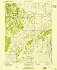 1952 Fortuna1953 Print · USGSMoniteau and Morgan counties are shown in the early fifties, capturing a network of rural schools and family cemeteries. Trace the locations of historic local institutions like St Martins Sch, Hickory Grove Sch, and the Prairie View Ch.3 unique versions available
 - 1953 Map of Florence, 1954 Print
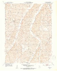 1953 Florence1954 Print · USGSMorgan County, Missouri, is captured here in the early fifties during a period of rural consolidation. Researchers can trace ancestral locations through numerous country schools and cemeteries like Bluhm Sch, Lone Star Sch, and Bethlehem Cem.3 unique versions available
 - 1953 Map of Otterville East, 1954 Print
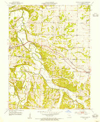 1953 Otterville East1954 Print · USGSMid-century Morgan and Cooper counties appear here as a landscape of rural townships and river valleys. Researchers can trace family history at Antioch Cem and Mt Olive Ch or follow the Missouri Pacific rail line through Otterville.3 unique versions available
Showing maps 1-25 of 139
Top cities of Morgan County
- Versailles historical maps
- Stover historical maps
- Laurie historical maps
- Barnett historical maps
- Gravois Mills historical maps
- Syracuse historical maps
Frequently asked questions
- What are the different types of historical maps available for Morgan County?
- What is the oldest map of Morgan County?
- Where can I purchase historical maps of Morgan County for my home or office?
- Where can I download high-res historical maps of Morgan County?
- Are there historical topographic maps available for Morgan County?
- Is there historical aerial imagery available for Morgan County?
- Where are historical maps of Morgan County sourced from?