Old Maps of Neosho, Missouri for Genealogy
Trace your family roots with 25 historic maps of Neosho. These high-res maps reveal old neighborhoods, homesites, landmarks, and streets — helping you uncover where your ancestors lived and how the area evolved over time.
- Explore historic neighborhoods: Identify where your relatives may have lived in the 1800s or 1900s.
- Compare maps over time: Trace the changes in streets, buildings, and landmarks for multi-generational research.
- Perfect for genealogy & ancestry research: Used by family historians and researchers to map out lineage and migration.
These maps are an incredible resource for exploring your personal connection to Neosho's past.
Neosho, MO maps
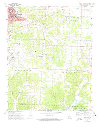
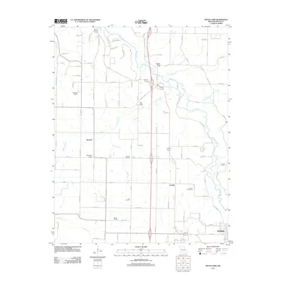
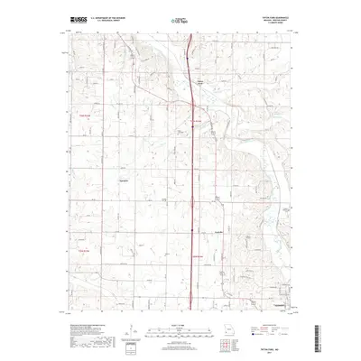
(25)- 1916 Map of Neosho
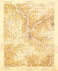 1916 Neosho1916 Print · USGSNewton County's rail and mining heart beat strong during the years before the Great War. Genealogists and local historians can trace forgotten rural schoolhouses like Possumtrot School and Jaybird School, or locate early lead workings such as the Tiger Mine near Granby.5 unique versions available
 - 1954 Map of Tulsa
 1954 Tulsa1954 Print · USGSNortheast Oklahoma and the Ozark border are shown here during a period of massive industrial and infrastructure growth. Researchers can trace the legacy of the Tri-State Mining District and the development of major reservoirs like Grand Lake O' The Cherokees.2 unique versions available
 - 1958 Map of Tulsa, 1968 Print
 1958 Tulsa1968 Print · USGSNortheast Oklahoma and the Ozark borderlands are captured here during a massive era of reservoir construction and highway expansion. Researchers can trace the mid-century footprints of Tulsa, the sprawling Lake O' the Cherokees, and historical sites like Pea Ridge National Military Park.3 unique versions available
 - 1963 Map of Tulsa
 1963 Tulsa1963 Print · USGSThe Oklahoma and Arkansas borderlands are shown here in the early sixties, a time of massive reservoir construction and heavy mining. Genealogists can trace family roots through settlements like Nowata, Pryor, and Jay, or locate historical zinc and lead mines and coal mines.
 - 1972 Map of Granby, 1973 Print
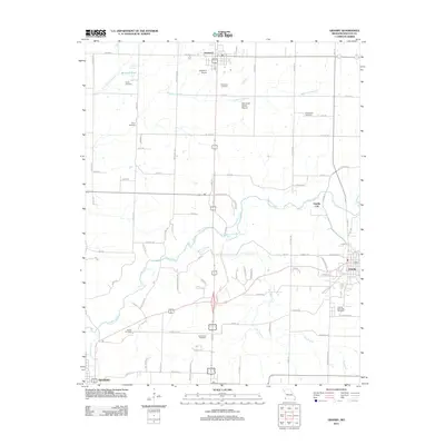
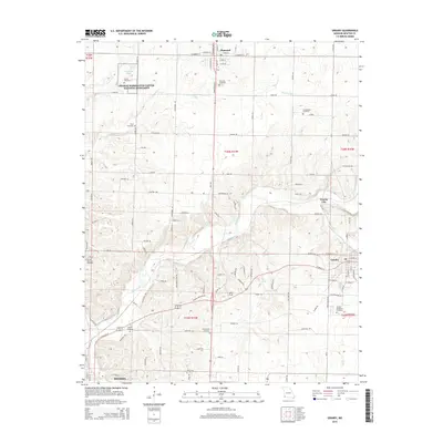
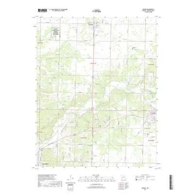
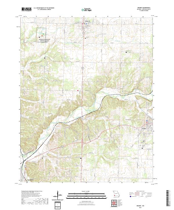
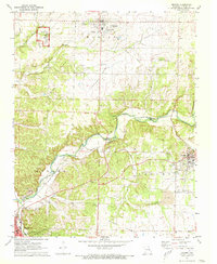 1972 Granby1973 Print · USGSNewton County in the early seventies shows a landscape defined by prairie agriculture, the legacy of lead mining, and the St Louis-San Francisco rail line. Genealogists can trace local roots at Granby Memorial Cem, Hazelwood Cem, and the childhood home of a famed scientist at George Washington Carver National Monument.
 - 1972 Map of Tipton Ford, 1973 Print
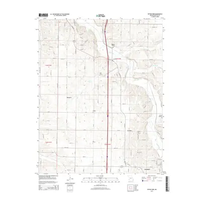
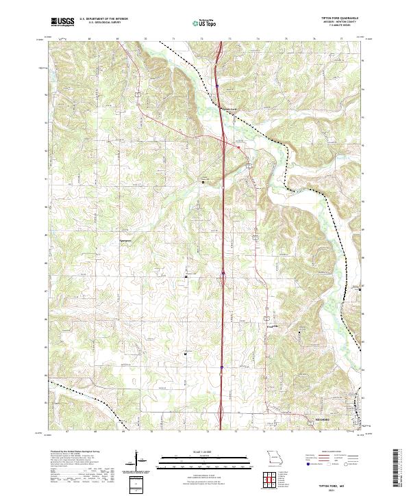
 1972 Tipton Ford1973 Print · USGSNewton County in the early seventies shows a landscape defined by prairie farming and the legacies of lead and zinc mining. Genealogists and local historians can trace family roots through sites like Spurgeon, Thrasher Cem, and Oak Grove Chapel.
 - 1972 Map of Neosho West, 1973 Print
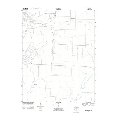
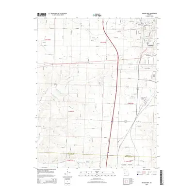
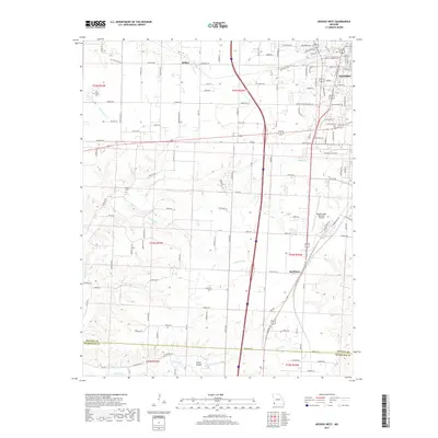
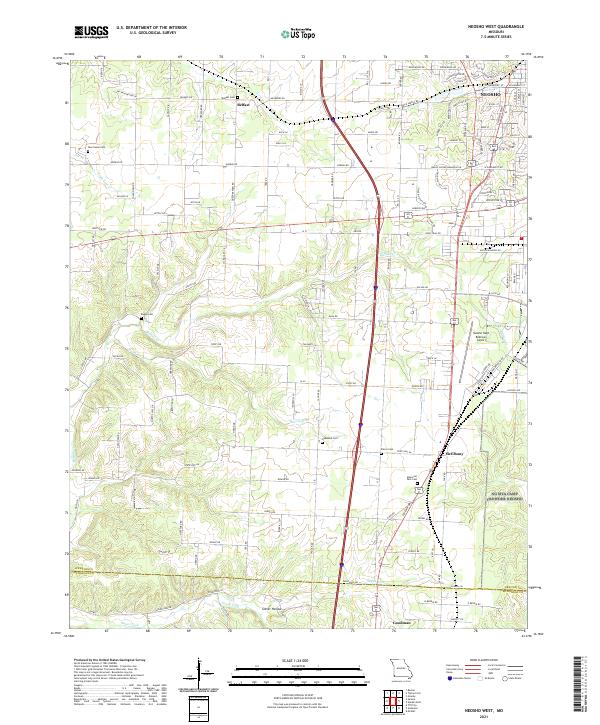
 1972 Neosho West1973 Print · USGSThe western outskirts of Neosho and the rural prairies of Newton County are documented here in the early seventies as the city grew. Researchers can trace family history through sites like New Salem Cem, find the location of the Drive-in Theater, or follow the path of the St Louis San Francisco railroad.2 unique versions available
 - 1972 Map of Neosho East, 1973 Print
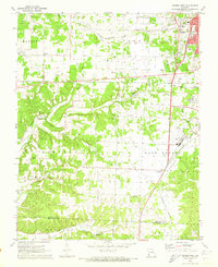
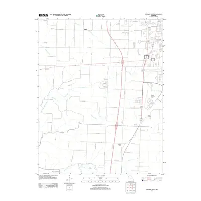
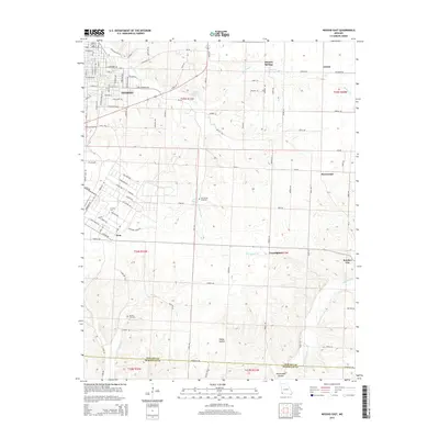
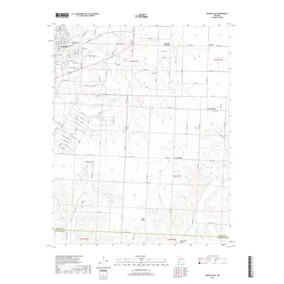
 1972 Neosho East1973 Print · USGSThe Newton County landscape in the early seventies shows the city of Neosho expanding toward Pools Prairie. Researchers can trace local history through the IOOF Cem, the National Fish Hatchery, and the rural community at Monark Springs.3 unique versions available
 - 1986 Map of Neosho
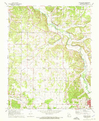
 1986 Neosho1986 Print · USGSThe tri-state border region comes alive in the mid-eighties as a landscape of mining heritage and river valleys. Researchers can trace the rail lines of the Kansas City Southern Ry and locate rural landmarks like Gibson Cem and Peoria.2 unique versions available
 - 2012 Map of Neosho East, 2012 Print
 2012 Neosho East2012 Print · USGSCovers Neosho, including Monark Springs, Christopher, and other nearby areas
 - 2012 Map of Neosho West, 2012 Print
 2012 Neosho West2012 Print · USGSCovers Neosho, including Belfast, McElhany, and other nearby areas
 - 2012 Map of Granby, 2012 Print
 2012 Granby2012 Print · USGSCovers Neosho, including Granby, Diamond, and other nearby areas
 - 2012 Map of Tipton Ford, 2012 Print
 2012 Tipton Ford2012 Print · USGSCovers Neosho, including Fredville, Spurgeon, and other nearby areas
 - 2015 Map of Tipton Ford, 2015 Print
 2015 Tipton Ford2015 Print · USGSCovers Neosho, including Fredville, Spurgeon, and other nearby areas
 - 2015 Map of Neosho West, 2015 Print
 2015 Neosho West2015 Print · USGSCovers Neosho, including Belfast, McElhany, and other nearby areas
 - 2015 Map of Granby, 2015 Print
 2015 Granby2015 Print · USGSCovers Neosho, including Granby, Diamond, and other nearby areas
 - 2015 Map of Neosho East, 2015 Print
 2015 Neosho East2015 Print · USGSCovers Neosho, including Monark Springs, Christopher, and other nearby areas
 - 2017 Map of Neosho West, 2017 Print
 2017 Neosho West2017 Print · USGSCovers Neosho, including Belfast, McElhany, and other nearby areas
 - 2017 Map of Granby, 2017 Print
 2017 Granby2017 Print · USGSCovers Neosho, including Granby, Diamond, and other nearby areas
 - 2017 Map of Neosho East, 2017 Print
 2017 Neosho East2017 Print · USGSCovers Neosho, including Monark Springs, Christopher, and other nearby areas
 - 2017 Map of Tipton Ford, 2017 Print
 2017 Tipton Ford2017 Print · USGSCovers Neosho, including Fredville, Spurgeon, and other nearby areas
 - 2021 Map of Granby, 2021 Print
 2021 Granby2021 Print · USGSMissouri's Newton County is captured here in the early twenty-first century, showing the rural corridor between Diamond and Granby. Researchers can pinpoint numerous burial grounds like Hazelwood Cem and Boyd Cem, or explore the grounds of the George Washington Carver National Monument.
 - 2021 Map of Neosho West, 2021 Print
 2021 Neosho West2021 Print · USGSNewton County in the early twenty-first century reveals a landscape where traditional Ozark settlements meet modern aviation and transit. Genealogists can trace family connections through sites like Belfast Cem, New Salem Cem, and the rural crossroads of McElhany.
 - 2021 Map of Tipton Ford, 2021 Print
 2021 Tipton Ford2021 Print · USGSNewton County's rural corridors and creek valleys are documented here in the early 2020s as the area maintains its quiet, small-town character. Genealogists can locate several local burial sites including Pleasant Hill Cem and Thrasher Cem near Spurgeon.
 - 2021 Map of Neosho East, 2021 Print
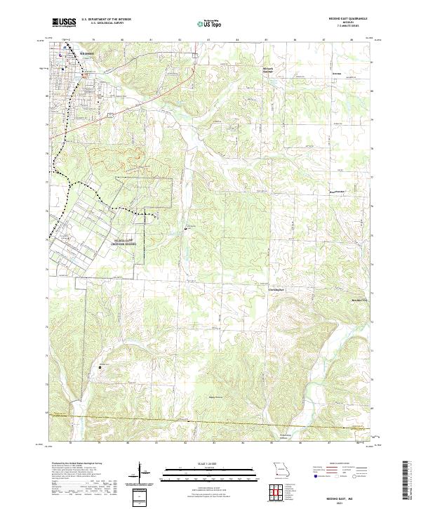 2021 Neosho East2021 Print · USGSNewton County's eastern townships are shown here in the early 2020s, centered on the civic activity of Neosho and its surrounding rural communities. Genealogists can locate family landmarks like Elm Spring Cem and Maness Cem, or trace the springs that gave rise to places like Monark Springs.
End of results
Showing maps 1-25 of 25
Top cities near Neosho
- Joplin historical maps
- Seneca historical maps
- Granby historical maps
- Anderson historical maps
- Duquesne historical maps
- Goodman historical maps
See more
Frequently asked questions
- What are the different types of historical maps available for Neosho?
- What is the oldest map of Neosho?
- Where can I purchase historical maps of Neosho for my home or office?
- Where can I download high-res historical maps of Neosho?
- Are there historical topographic maps available for Neosho?
- Is there historical aerial imagery available for Neosho?
- Where are historical maps of Neosho sourced from?