Old Maps of Washington Township, Missouri for Academic Research
Study the evolution of Washington Township with 24 high-resolution historic maps. Whether you're teaching, researching, or modeling changes in land use, these maps provide essential visual documentation of urban, environmental, and geographic change.
- Analyze long-term change: Track patterns in development, transportation, and natural features.
- Ideal for environmental or urban studies: Support academic projects with primary historical map data.
- Use in the classroom or lab: Educators and researchers rely on these maps to bring historical context to life.
These maps are a powerful tool for teaching, research, and visualizing how Washington Township has changed over the decades.
Washington Township, MO maps
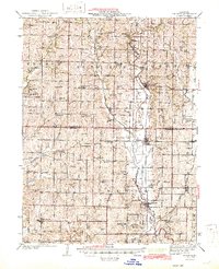
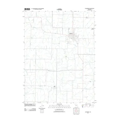
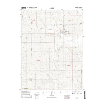
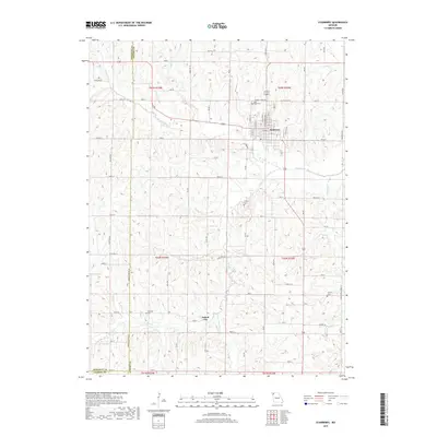
(24)- 1925 Map of Stanberry
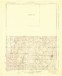 1925 Stanberry1925 Print · USGSNorthwest Missouri in the mid-1920s is captured here at a height of rural community life before the consolidation of rural districts. Genealogists can locate dozens of localized landmarks like Bachelor Hall School, Flag Springs, and the Chicago Burlington and Quincy railroad line.3 unique versions available
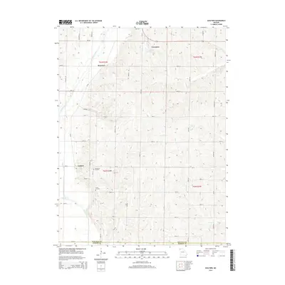
 - 1927 Map of Bolckow
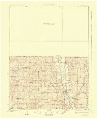 1927 Bolckow1927 Print · USGSNorthwest Missouri thrived as a rail-centered farming region in the years before the Great Depression. Researchers can trace rural lineages through numerous country schools like Radical School and Gravel Wall School, or locate the Stone Church Cem.2 unique versions available
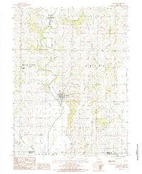
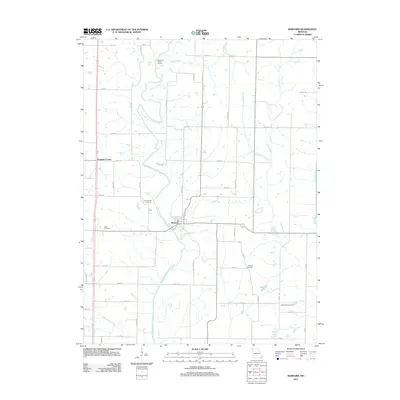
 - 1939 Map of Stanberry, 1954 Print
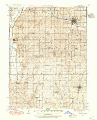 1939 Stanberry1954 Print · USGSNorthwest Missouri thrived as a rail and agricultural hub in the late thirties, with three major lines intersecting the fertile prairie. Genealogists can trace family roots through dozens of local landmarks like Conception College, Stanberry, and the Meekers Cem.
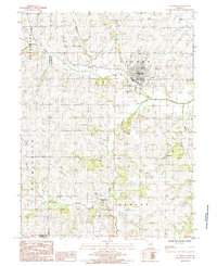
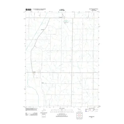
 - 1943 Map of Stanberry
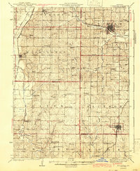 1943 Stanberry1943 Print · USGSNorthwest Missouri thrived as a rail and farming hub during the mid-twentieth century, centered on the junctions at Stanberry and King City. Genealogists can trace hundreds of farmsteads and dozens of local landmarks like Conception College and the Prairie Flower School.
 - 1945 Map of Bolckow
 1945 Bolckow1945 Print · USGSNorthwest Missouri in the 1940s is defined here by its rail-connected towns and a dense network of one-room schoolhouses. Genealogists can trace family footprints across dozens of local landmarks like Shambaugh Cem, Common Sense Sch, and Pumpkin Center.2 unique versions available
 - 1955 Map of Nebraska City, 1967 Print
 1955 Nebraska City1967 Print · USGSThe four-state region surrounding the Missouri River valley appears here in the mid-1950s, a landscape of rail-dependent market towns and rural school districts. Genealogists can locate family landmarks like the Rock Bluff School, St Oswald Church, and the Clarinda State Hospital.3 unique versions available
 - 1957 Map of Nebraska City
 1957 Nebraska City1957 Print · USGSThe four-state junction of Nebraska, Iowa, Missouri, and Kansas comes alive in this mid-fifties survey of the Missouri River valley. Genealogists and historians can trace the rail-and-road networks connecting Nebraska City, Maryville, and the Squaw Creek National Wildlife Refuge.
 - 1958 Map of Nebraska City
 1958 Nebraska City1958 Print · USGSThe Missouri River Valley and its fertile four-state borderlands are captured here during the mid-century expansion of the regional highway and rail networks. Genealogists can trace family roots through numerous rural landmarks like Moulton School, Shady Grove Church, and the Clarinda State Hospital.
 - 1984 Map of Barnard, 1985 Print
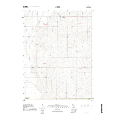
 1984 Barnard1985 Print · USGSBarnard and the surrounding Nodaway County countryside are captured here in the early eighties as the regional rail lines had given way to an Old Railroad Grade. Researchers can trace the path of the One Hundred and Two River and locate local landmarks like Pumpkin Center and several area Quarries.
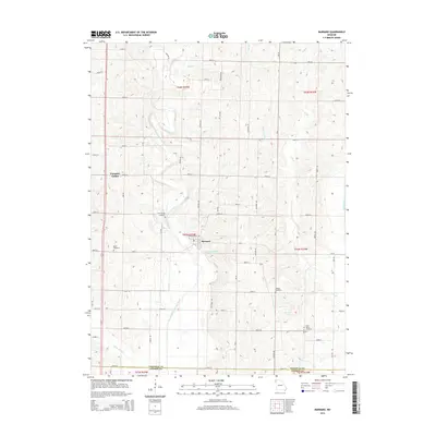
 - 1985 Map of Stanberry
 1985 Stanberry1985 Print · USGSGentry County farmland in the mid-eighties shows a landscape of quiet rural settlements and established utility corridors. Genealogists and local historians can trace family locations near Island City, identify the Stanberry town limits, or locate landmarks like the Roadside Pk.
 - 1985 Map of Guilford
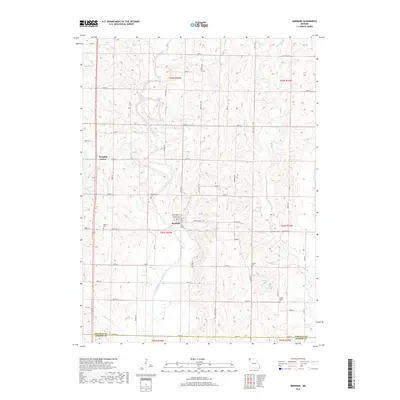
 1985 Guilford1985 Print · USGSThe rural landscape of Nodaway County comes to life in the early 1980s as the Platte River winds through the borderlands of Andrew County. Researchers can trace the local river-and-rail era through landmarks like Guilford, the Cem near Conception, and the site of Wederholt.
 - 1986 Map of Maryville
 1986 Maryville1986 Print · USGSNorthwest Missouri's agricultural heartland is documented here in the mid-1980s, from the campus at Northwest Missouri State University to the Grand River valley. Genealogists can trace family footprints across dozens of local burial grounds like Alanthus Grove Cem and Brooklyn Cem.2 unique versions available
 - 2011 Map of Stanberry, 2011 Print
 2011 Stanberry2011 Print · USGSCovers Washington Township, including Stanberry, Cooper Township, and other nearby areas
 - 2011 Map of Barnard, 2011 Print
 2011 Barnard2011 Print · USGSCovers Washington Township, including Barnard, Grant Township, and other nearby areas
 - 2011 Map of Guilford, 2011 Print
 2011 Guilford2011 Print · USGSCovers Washington Township, including Guilford, Grant Township, and other nearby areas
 - 2014 Map of Barnard, 2014 Print
 2014 Barnard2014 Print · USGSCovers Washington Township, including Barnard, Grant Township, and other nearby areas
 - 2014 Map of Stanberry, 2014 Print
 2014 Stanberry2014 Print · USGSCovers Washington Township, including Stanberry, Cooper Township, and other nearby areas
 - 2014 Map of Guilford, 2014 Print
 2014 Guilford2014 Print · USGSCovers Washington Township, including Guilford, Grant Township, and other nearby areas
 - 2017 Map of Guilford, 2017 Print
 2017 Guilford2017 Print · USGSCovers Washington Township, including Guilford, Grant Township, and other nearby areas
 - 2017 Map of Barnard, 2017 Print
 2017 Barnard2017 Print · USGSCovers Washington Township, including Barnard, Grant Township, and other nearby areas
 - 2017 Map of Stanberry, 2017 Print
 2017 Stanberry2017 Print · USGSCovers Washington Township, including Stanberry, Cooper Township, and other nearby areas
 - 2021 Map of Stanberry, 2021 Print
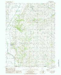
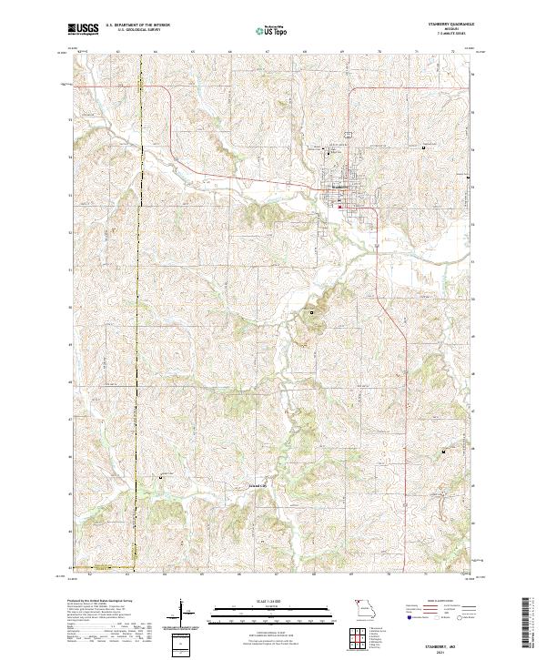 2021 Stanberry2021 Print · USGSGentry County farmland and the community of Stanberry are detailed here in the early 2020s. Researchers can locate numerous family burial grounds and small settlements, including Island City, High Ridge Cem, and Meeker Cem.
 - 2021 Map of Barnard, 2021 Print
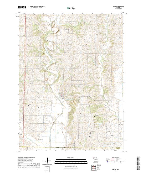 2021 Barnard2021 Print · USGSNodaway County farming country and the river valleys of northwest Missouri are documented here in recent detail. Researchers can trace the courses of the One Hundred and Two River and Platte River or locate family sites like Baker Cem and Alumbaugh Cem.
 - 2021 Map of Guilford, 2021 Print
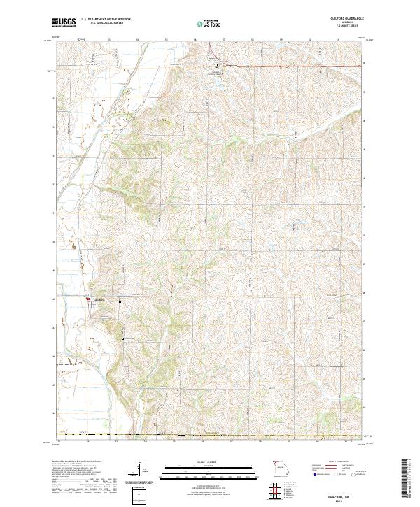 2021 Guilford2021 Print · USGSNodaway County agricultural life and religious centers are captured here in the early twenty-first century. Researchers can locate family heritage sites at Saint Columba Cem or trace the lands surrounding Conception Seminary College and Guilford.
End of results
Showing maps 1-24 of 24
Top cities near Washington Township
- Maryville historical maps
- Savannah historical maps
- Stanberry historical maps
- King City historical maps
- Ravenwood historical maps
- Union Star historical maps
See more
Top neighborhoods of Washington Township
Frequently asked questions
- What are the different types of historical maps available for Washington Township?
- What is the oldest map of Washington Township?
- Where can I purchase historical maps of Washington Township for my home or office?
- Where can I download high-res historical maps of Washington Township?
- Are there historical topographic maps available for Washington Township?
- Is there historical aerial imagery available for Washington Township?
- Where are historical maps of Washington Township sourced from?