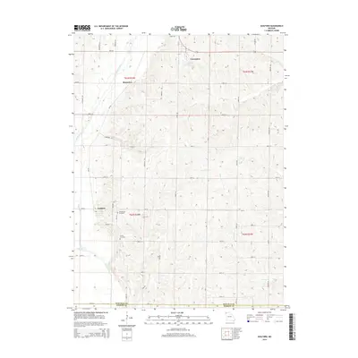
2014 Map of Guilford
USGS Topo · Published 2014About this map
The Platte River meanders through the western portion of this landscape, anchoring the village of Guilford and its surrounding agricultural terrain. Further north, the settlement of Conception sits near the Conception Abbey Reservoir, a notable water feature that supports the historic Monastery nearby. The map reveals a highly structured grid of section lines and rural roads, such as Noble Rd and Navy Rd, which define the movement through this corner of Missouri. Genealogists and local historians can pinpoint family heritage sites including Weathermon Cemetery and Groves Cemetery, both situated south of the principal settlements. The drainage patterns of Clear Creek, Turkey Creek, and King Branch further illustrate how the geography influenced the placement of original homesteads and the eventual township boundaries of T63N and T62N.
Find a feature on this map
39 named features on this map. Tap any name to fly to it.
Don’t see what you’re looking for? This feature index may not catch every label — zoom into the map to look around manually.
Map Details
Editions of this 2014 Guilford Map
This is the sole edition of this map. No revisions or reprints were ever made.
Other maps of this area

1925 · Stanberry
USGS Topo · 1:62,500

1927 · Bolckow
USGS Topo · 1:62,500

1939 · Stanberry
USGS Topo · 1:62,500

1940 · Parnell
USGS Topo · 1:62,500

1943 · Parnell
USGS Topo · 1:62,500

1943 · Maryville
USGS Topo · 1:62,500

1943 · Stanberry
USGS Topo · 1:62,500

1945 · Bolckow
USGS Topo · 1:62,500

1955 · Nebraska City
USGS Topo · 1:250,000

1957 · Nebraska City
USGS Topo · 1:250,000