2020s Maps of Perryville, Missouri
Explore 4 historic maps of Perryville from the 2020s. These maps offer a rare glimpse into what life looked like during the 2020s — showing old roads, neighborhoods, homes, and landmarks that have changed or disappeared over time.
Whether you're researching your family's past, planning a metal detecting trip, or studying how Perryville's landscape evolved across the 2020s, these high-resolution maps are a powerful tool for exploring the history of this region.
- Focus on a specific era: All maps on this page are from the 2020s, giving you a focused view of this time period.
- See what’s changed: Compare century-old streets, trails, and buildings to today's modern landscape using overlays and satellite layers.
- Research with precision: Use these maps for genealogy, historical research, land use analysis, or educational projects.
- View, download, or print: Maps are fully viewable online in high resolution, and can be downloaded or printed for your own records.
Start exploring Perryville's history through authentic maps from the 2020s. This is your window into the past.
Perryville, MO maps
(4)- 2021 Map of Perryville East, 2021 Print
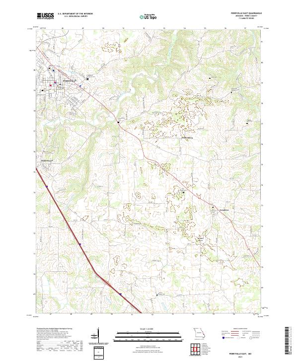 2021 Perryville East2021 Print · USGSPerry County at the start of the 2020s shows the growth of Perryville alongside its deep-rooted rural church communities. Genealogists can locate family landmarks like the Perry County Courthouse, York Chapel Cem, and Friedenberg.
 - 2021 Map of Perryville West, 2021 Print
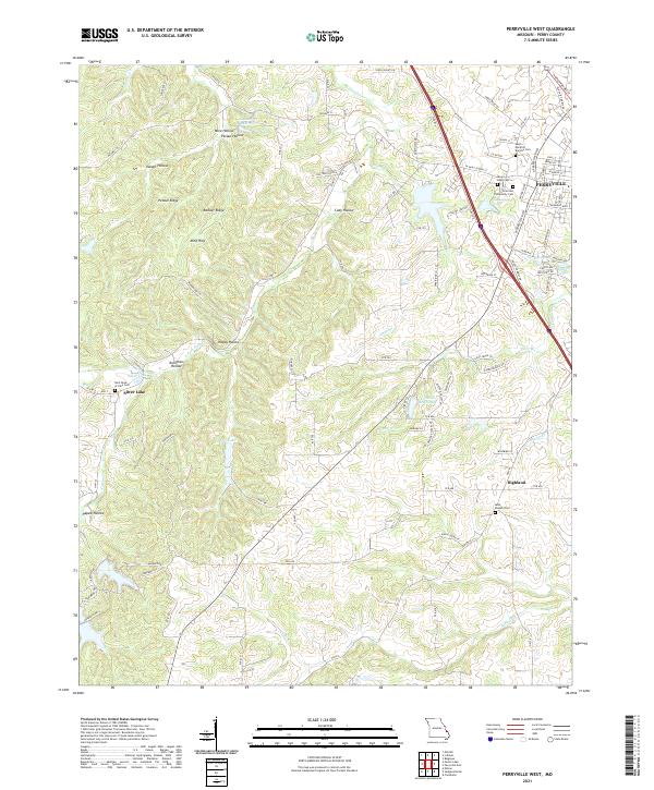 2021 Perryville West2021 Print · USGSPerry County's western outskirts and the growing city of Perryville are shown here during the early twenty-first century. Genealogists and local historians can trace family locations and church sites like Saint Joseph Cem in Highland or the Saint-Rose-of-Lima Cem near Silver Lake.
 - 2021 Map of Lithium, 2021 Print
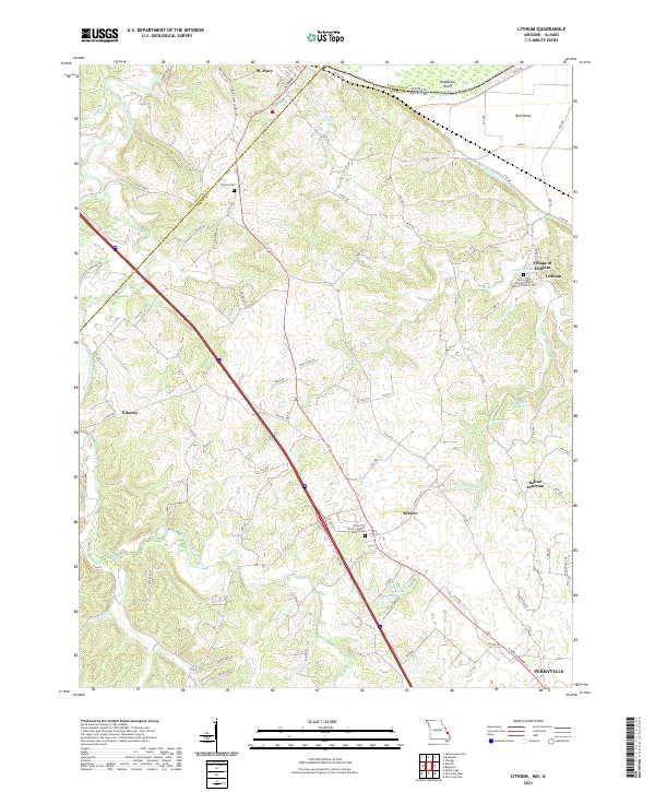 2021 Lithium2021 Print · USGSSoutheast Missouri's river borderlands come alive in this recent survey of the Lithium and Perryville areas. Genealogists and local historians can trace family roots at Brown Cem, locate the Village of Lithium, or study the Ball Mill Resurgence and Old River.
 - 2021 Map of Belgique, 2021 Print
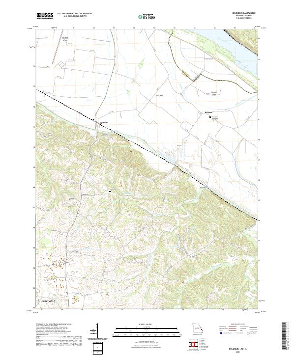 2021 Belgique2021 Print · USGSThe Missouri-Illinois borderlands come into focus in this contemporary survey, showing the shifting course of the Mississippi River and its backwaters. Genealogists can locate Preston Cem and the community of Belgique, while tracing the rural road network connecting Sereno and McBride.
End of results
Showing maps 1-4 of 4
Top cities near Perryville
- Chester historical maps
- Sainte Genevieve historical maps
- Saint Mary historical maps
- St. Mary historical maps
- Oak Ridge historical maps
- Sedgewickville historical maps
See more
Frequently asked questions
- What are the different types of historical maps available for Perryville?
- What is the oldest map of Perryville?
- Where can I purchase historical maps of Perryville for my home or office?
- Where can I download high-res historical maps of Perryville?
- Are there historical topographic maps available for Perryville?
- Is there historical aerial imagery available for Perryville?
- Where are historical maps of Perryville sourced from?