Old Maps of Stokley, Missouri for Academic Research
Study the evolution of Stokley with 17 high-resolution historic maps. Whether you're teaching, researching, or modeling changes in land use, these maps provide essential visual documentation of urban, environmental, and geographic change.
- Analyze long-term change: Track patterns in development, transportation, and natural features.
- Ideal for environmental or urban studies: Support academic projects with primary historical map data.
- Use in the classroom or lab: Educators and researchers rely on these maps to bring historical context to life.
These maps are a powerful tool for teaching, research, and visualizing how Stokley has changed over the decades.
Stokley, MO maps
(17)- 1887 Map of Sedalia
 1887 Sedalia1887 Print · USGSIn the late nineteenth century, the rail corridors of central Missouri radiated from the bustling hub of Sedalia. Researchers can trace the development of early settlements like Georgetown and Houstonia along the Missouri Pacific Railroad.
 - 1894 Map of Sedalia
 1894 Sedalia1894 Print · USGSCentral Missouri's rail-and-river network is frozen in time during the late 19th century, centered on the growing hub of Sedalia. Researchers can trace the path of the Sedalia Warsaw And Southwestern RR and find vanished points like Dumpville and Mc Allister Springs.5 unique versions available
 - 1939 Map of Sweet Springs
 1939 Sweet Springs1939 Print · USGSThe rural borderlands of Saline and Pettis Counties are captured here at the end of the 1930s as the rail and highway systems began to modernize the landscape. Genealogists can locate numerous country schoolhouses and churches like Sunny Dell Sch, Oak Grove Cem, and Houstonia.
 - 1940 Map of Sweet Springs
 1940 Sweet Springs1940 Print · USGSWestern Missouri in the late thirties is revealed here as a landscape of interconnected river valleys and tightly knit rural communities. Genealogists and historians can trace family roots through numerous country schools and landmarks like High Hill Cem, Bleak Mound, and the Missouri Pacific rail line.
 - 1941 Map of Sweet Springs
 1941 Sweet Springs1941 Print · USGSCentral Missouri farmland at the end of the Depression is defined here by the winding Blackwater River and the critical Missouri Pacific rail line. Genealogists and local historians can locate dozens of country schools and churches, such as Holy Cross Sch, Dunksburg, and the High Hill Cem.2 unique versions available
 - 1945 Map of Sweet Springs
 1945 Sweet Springs1945 Print · USGSCentral Missouri farmland at the end of the 1930s is revealed here, spanning the intersection of four counties. Genealogists can trace family roots through numerous rural landmarks like Holy Cross Ch, Weber Sch, and the isolated High Hill Cem.2 unique versions available
 - 1947 Map of Jefferson City, 1949 Print
 1947 Jefferson City1949 Print · USGSCentral Missouri and the northern Ozarks come into focus in this late 1940s survey of the river-and-rail landscape. Genealogists and historians can trace the growth of Jefferson City and Sedalia or locate family roots near Bagnell Dam and the Lake of the Ozarks.
 - 1954 Map of Jefferson City
 1954 Jefferson City1954 Print · USGSCentral Missouri in the early postwar years showcases a landscape defined by the winding Lake of the Ozarks and the state capital at Jefferson City. Researchers can trace the mid-century rail networks of the Missouri Pacific RR and locate rural communities like Tuscumbia, St Elizabeth, and St Anthony.2 unique versions available
 - 1955 Map of Jefferson City, 1967 Print
 1955 Jefferson City1967 Print · USGSCentral Missouri in the mid-fifties is defined by the winding Missouri River and the expanding reach of Lake of the Ozarks. Researchers can trace the rail corridors of the Missouri Pacific or locate the early footprint of Whiteman AFB and Jefferson City.4 unique versions available
 - 1958 Map of Jefferson City
 1958 Jefferson City1958 Print · USGSCentral Missouri in the late fifties shows a region transforming through the growth of Whiteman Air Force Base and the Lake of the Ozarks. Researchers can trace rail lines like the Missouri Pacific or find family roots at Enloe Cemetery and Mount Pleasant Cem.
 - 1959 Map of Jefferson City
 1959 Jefferson City1959 Print · USGSCentral Missouri is captured during the mid-fifties as the river economy and rail networks like the Missouri Pacific met the rise of the automobile. Local researchers can trace family landmarks and rural infrastructure from the Lake of the Ozarks up to Providence Cemetery and Knob Noster State Park.
 - 1973 Map of La Monte, 1975 Print
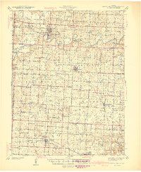
 1973 La Monte1975 Print · USGSMid-Missouri prairie and creek bottoms define this area in the early seventies as the local economy centered on the rail line. Researchers can trace the layout of La Monte, the La Monte Cem, and the rural settlement at Stokley.
 - 1983 Map of Sedalia
 1983 Sedalia1983 Print · USGSWest Central Missouri's landscape in the early eighties shows a dense network of rail towns and riverside communities along the Blackwater River. Genealogists and historians can trace the development of Warrensburg and Sedalia near Whiteman Air Force Base and Knob Noster State Park.
 - 2011 Map of La Monte, 2011 Print
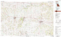
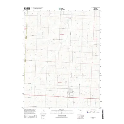
 2011 La Monte2011 Print · USGSCovers Stokley, including La Monte, Johnson County, and other nearby areas
 - 2015 Map of La Monte, 2015 Print
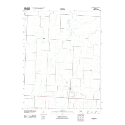
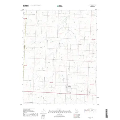
 2015 La Monte2015 Print · USGSCovers Stokley, including La Monte, Johnson County, and other nearby areas
 - 2017 Map of La Monte, 2017 Print
 2017 La Monte2017 Print · USGSCovers Stokley, including La Monte, Johnson County, and other nearby areas
 - 2021 Map of La Monte, 2021 Print
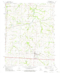
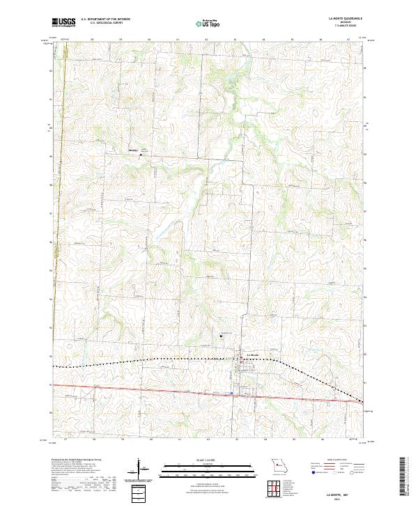 2021 La Monte2021 Print · USGSThe Pettis County countryside near the Johnson County line comes into focus in this recent survey. Local historians can trace family ties at the La Monte Cem and County Line Cem or explore the drainage of the South Fork Blackwater River.
End of results
Showing maps 1-17 of 17
Top cities near Stokley
- Sedalia historical maps
- Warrensburg historical maps
- Knob Noster historical maps
- Concordia historical maps
- Sweet Springs historical maps
- La Monte historical maps
See more
Frequently asked questions
- What are the different types of historical maps available for Stokley?
- What is the oldest map of Stokley?
- Where can I purchase historical maps of Stokley for my home or office?
- Where can I download high-res historical maps of Stokley?
- Are there historical topographic maps available for Stokley?
- Is there historical aerial imagery available for Stokley?
- Where are historical maps of Stokley sourced from?